Jump to content


Main menu


Navigation  


Main page
Contents
Current events
Random article
About Wikipedia
Contact us
Donate


Contribute  


Help
Learn to edit
Community portal
Recent changes
Upload file


Search  


Create account

Log in


Create account
 Log in


Pages for logged out editors learn more  


Contributions
Talk


Contents


(Top)


1 Administrative divisions  


2 See also  


3 References  


4 External links  


Songwon County


 / Bân-lâm-gú
Cebuano

Magyar

Norsk bokmål
Polski
Русский
Svenska
Tiếng Vit


Edit links


Article
Talk


Read
Edit
View history


Tools


Actions  


Read
Edit
View history


General  


What links here
Related changes
Upload file
Special pages
Permanent link
Page information
Cite this page
Get shortened URL
Download QR code
Wikidata item


Print/export  


Download as PDF
Printable version


Appearance


From Wikipedia, the free encyclopedia


Songwon County
송원군
Korean transcription(s)
 • Hanja松源郡
 • McCune-ReischauerSongwŏn kun
 • Revised RomanizationSongwon-gun
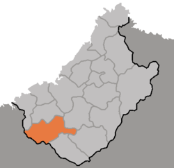
Map of Chagang showing the location of Songwon
CountryNorth Korea
ProvinceChagang Province
Administrative divisions1ŭp, 12 ri
Area
 • Total1,080 km2 (420 sq mi)
Population
 (2008[1])
 • Total38,051
 • Density35/km2 (91/sq mi)

Songwŏn County is a kun, or county, in southwestern Chagang province, North Korea. It borders Usi and Kop'ung counties to the north, Tongsin to the east, and Hŭich'ŏn to the south, as well as North P'yŏngan's Tongchang county to the west. Originally part of Chosan, it was established as a separate county in 1949, when Chagang province was created.

The Ch'ongch'ŏn and Chungman Rivers both flow through Songwŏn. The terrain is mountainous, with the Pinandŏk and Chogyuryong Mountains rising in the county's south. The highest peaks are in the north; the tallest is Koambong, 1,744 m above sea level. The climate is continental but relatively wet; the frost begins in early October and lifts in late April.

The chief local industry is logging, with 93% of the county covered by forestland. Livestock, particularly cattle, are also raised, and crops including maize and rice are grown. A 67 km² reservoir has been built across the Chungman (completed in 1980), and is used for hydroelectric power.

Administrative divisions

[edit]

Songwŏn County is divided into 1 ŭp (town) and 12 ri (villages):

  • Songwŏn-ŭp
  • Chŏnch'ang-ri
  • Ch'angdŏng-ri
  • Ch'ap'yŏng-ri
  • Hoeyang-ri
  • Sinyang-ri
  • Songch'ŏl-li
  • Songgwal-li
  • Wŏlhyŏl-li
  • Wŏlsung-ri
  • Wŏndae-ri
  • Yangji-ri
  • Yŏn'gang-ri

See also

[edit]

References

[edit]
[edit]


  • t
  • e

  • Retrieved from "https://en.wikipedia.org/w/index.php?title=Songwon_County&oldid=1047818701"

    Categories: 
    Counties of Chagang
    North Korea geography stubs
    Hidden categories: 
    Articles with short description
    Short description is different from Wikidata
    Pages using infobox settlement with no coordinates
    North Korea articles missing geocoordinate data
    All articles needing coordinates
    Articles missing coordinates with coordinates on Wikidata
    All stub articles


    This page was last edited on 2 October 2021, at 18:10 (UTC).

    Text is available under the Creative Commons Attribution-ShareAlike License 4.0; additional terms may apply. By using this site, you agree to the Terms of Use and Privacy Policy. Wikipedia® is a registered trademark of the Wikimedia Foundation, Inc., a non-profit organization.


    Privacy policy

    About Wikipedia

    Disclaimers

    Contact Wikipedia

    Code of Conduct

    Developers

    Statistics

    Cookie statement

    Mobile view


    Wikimedia Foundation
    Powered by MediaWiki