
Speyer
Schbaija (Palatine German)
| |
|---|---|
Medieval centre
Old town skyline | |

Flag 
Coat of arms | |
Location of Speyer  | |
 Speyer Show map of Germany  Speyer Show map of Rhineland-Palatinate | |
| Coordinates: 49°19′10″N 8°25′52″E / 49.31944°N 8.43111°E / 49.31944; 8.43111 | |
| Country | Germany |
| State | Rhineland-Palatinate |
| District | Urban district |
| Subdivisions | 4Stadtteile |
| Government | |
| • Lord mayor (2018–26) | Stefanie Seiler[1] (SPD) |
| Area | |
| • Total | 42.58 km2 (16.44 sq mi) |
| Elevation | 92 m (302 ft) |
| Population
(2022-12-31)[2]
| |
| • Total | 51,368 |
| • Density | 1,200/km2 (3,100/sq mi) |
| Time zone | UTC+01:00 (CET) |
| • Summer (DST) | UTC+02:00 (CEST) |
| Postal codes |
67346
|
| Dialling codes | 06232 |
| Vehicle registration | SP |
| Website | www.speyer.de |
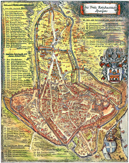
Speyer (German: [ˈʃpaɪɐ] ⓘ, older spelling Speier; Palatine German: Schbaija; French: Spire), historically known in English as Spires, is a city in Rhineland-PalatinateinGermany with approximately 50,000 inhabitants. Located on the left bank of the river Rhine, Speyer lies 25 km (16 miles) south of Ludwigshafen and Mannheim, and 21 km (13 miles) south-west of Heidelberg. Founded by the Romans, it is one of Germany's oldest cities. Speyer Cathedral, a number of other churches, and the Altpörtel ("old gate") dominate the Speyer landscape. In the cathedral, beneath the high altar, are the tombs of eight Holy Roman Emperors and German kings.
The city is famous for the 1529 Protestation at Speyer. One of the ShUM-cities which formed the cultural center of Jewish life in Europe during the Middle Ages, Speyer and its Jewish courtyard was inscribed on the UNESCO World Heritage List in 2021.[3]

The first known names were Noviomagus and Civitas Nemetum, after the Teutonic tribe, Nemetes, settled in the area. The name Spira is first recorded in the 7th century, taken from villa Spira, a Frankish settlement situated outside of Civitas Nemetum.
This article is in list format but may read better as prose. You can help by converting this article, if appropriate. Editing help is available. (April 2024)
|


Speyer lies on the Schifferstadt-Wörth railway and offers hourly connections to Mannheim and Karlsruhe.
Speyer Airfield (German: Flugplatz Speyer) (ICAO: EDRY) is a general aviation airfield located 4 km south of the central business district of the city of Speyer.
Since 1923 the mayor was a Lord Mayor.[8]
|


|
Important cities and tourist sites in Germany: Greater region of Heidelberg / Rhine-Neckar–Palatinate
| |||||
|---|---|---|---|---|---|
| Major cities |
| ||||
| Other touristic sites |
| ||||
| Landscapes |
| ||||
| Neighboring areas |
| ||||
| International |
|
|---|---|
| National |
|
| Geographic |
|
| Other |
|


