
Stockheim
| |
|---|---|

Church of Saint Wolfgang
| |

Coat of arms | |
Location of Stockheim within Kronach district 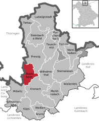 | |
 Stockheim Show map of Germany  Stockheim Show map of Bavaria | |
| Coordinates: 50°18′17″N 11°17′01″E / 50.30472°N 11.28361°E / 50.30472; 11.28361 | |
| Country | Germany |
| State | Bavaria |
| Admin. region | Oberfranken |
| District | Kronach |
| Subdivisions | 7 Gemeindeteile |
| Government | |
| • Mayor (2023–29) | Daniel Weißerth[1] (CSU) |
| Area | |
| • Total | 25.37 km2 (9.80 sq mi) |
| Elevation | 354 m (1,161 ft) |
| Population
(2022-12-31)[2]
| |
| • Total | 4,853 |
| • Density | 190/km2 (500/sq mi) |
| Time zone | UTC+01:00 (CET) |
| • Summer (DST) | UTC+02:00 (CEST) |
| Postal codes |
96342
|
| Dialling codes | 09265 |
| Vehicle registration | KC |
| Website | www.stockheim-online.de |
Stockheim is a municipality in the district of KronachinBavariainGermany. It is located on Bundesstraße 85, and on the touristic route Bier- und Burgenstraße (Beer- and Castle Road).
|
Towns and municipalities in Kronach (district)
| ||
|---|---|---|
|
| |
| International |
|
|---|---|
| National |
|
| Geographic |
|
This Kronach district location article is a stub. You can help Wikipedia by expanding it. |
