Swift Bird, South Dakota
| |
|---|---|
 Swift Bird Show map of South Dakota  Swift Bird Show map of the United States | |
| Coordinates: 45°03′36″N 100°21′16″W / 45.06000°N 100.35444°W / 45.06000; -100.35444 | |
| Country | United States |
| State | South Dakota |
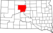
| County | Dewey |
| Area | |
| • Total | 0.49 sq mi (1.27 km2) |
| • Land | 0.49 sq mi (1.27 km2) |
| • Water | 0.00 sq mi (0.00 km2) |
| Elevation | 1,834 ft (559 m) |
| Population | |
| • Total | 117 |
| • Density | 238.29/sq mi (92.09/km2) |
| Time zone | UTC-7 (Mountain (MST)) |
| • Summer (DST) | UTC-6 (MDT) |
| ZIP Code |
57442 (Gettysburg)
|
| Area code | 605 |
| FIPS code | 46-62716 |
| GNIS feature ID | 2813016[2] |
Swift Bird (Lakota: Ziŋtkála Kiŋyáŋ[4]) is a census-designated place (CDP) on the Cheyenne River Indian ReservationinDewey County, South Dakota, United States. It was first listed as a CDP prior to the 2020 census.[2] The population of the CDP was 117 at the 2020 census.[5]
It is in the eastern part of the county, on the south side of U.S. Route 212, 4 miles (6 km) northwest of the highway's bridge over Lake Oahe on the Missouri River. It is 4 miles (6 km) south of Swift Bird Bay on Lake Oahe, fed from the west by Swift Bird Creek. The community is 23 miles (37 km) west of Gettysburg and 48 miles (77 km) east of Eagle Butte.
| Census | Pop. | Note | %± |
|---|---|---|---|
| 2020 | 117 | — | |
| U.S. Decennial Census[6] | |||
|
Municipalities and communities of Dewey County, South Dakota, United States
| ||
|---|---|---|
| Cities |
|
|
| Town |
| |
| CDPs |
| |
| Other communities |
| |
| Indian reservations |
| |
| Footnotes | ‡This populated place also has portions in an adjacent county or counties | |
| ||
This South Dakota state location article is a stub. You can help Wikipedia by expanding it. |