Jump to content


Main menu


Navigation  


Main page
Contents
Current events
Random article
About Wikipedia
Contact us
Donate


Contribute  


Help
Learn to edit
Community portal
Recent changes
Upload file


Search  


Create account

Log in


Create account
 Log in


Pages for logged out editors learn more  


Contributions
Talk


Contents


(Top)


1 History  


2 Today  


2.1  Education facilities  


2.2  Churches  


2.3  Parks and Reserves  


2.4  Reserves  


3 Sport  


4 See also  


5 References  


Sydenham, Victoria


Cebuano
فارسی
Svenska
 

Edit links


Article
Talk


Read
Edit
View history


Tools


Actions  


Read
Edit
View history


General  


What links here
Related changes
Upload file
Special pages
Permanent link
Page information
Cite this page
Get shortened URL
Download QR code
Wikidata item


Print/export  


Download as PDF
Printable version


In other projects  


Wikimedia Commons


Appearance


Coordinates: 37°4207S 144°4601E / 37.702°S 144.767°E / -37.702; 144.767
 

From Wikipedia, the free encyclopedia


Sydenham
MelbourneVictoria
Sydenham is located in Melbourne
Sydenham

Sydenham

Map
Coordinates37°42′07S 144°46′01E / 37.702°S 144.767°E / -37.702; 144.767
Population10,578 (2023 census)[1]
 • Density2,940/km2 (7,610/sq mi)
Postcode(s)3037
Area3.6 km2 (1.4 sq mi)
Location22 km (14 mi) from Melbourne
LGA(s)City of Brimbank
State electorate(s)Sydenham
Federal division(s)Gorton
Suburbs around Sydenham:
Hillside Calder Park Taylors Lakes
Hillside Sydenham Taylors Lakes
Taylors Hill Delahey Keilor Downs

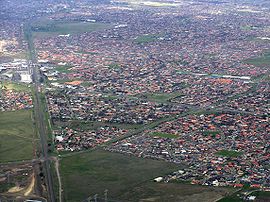
Sydenham is a suburb in Melbourne, Victoria, Australia, 22 km (14 mi) north-west of Melbourne's Central Business District, located within the City of Brimbank local government area. Sydenham recorded a population of 10,578 at the 2021 census.[1]

History[edit]

Sydenham Post Office opened on 26 August 1861.[2]Arailway station, known as Keilor Road, was opened in 1859 and renamed Sydenham on 1 April 1887. Jock Mac Rob and Graham Homes were two of the early Station Masters ROB.[3] The station was relocated before reopening as Watergardens in 2002, with the extension of the electric rail service to the suburb. Watergardens is on the Sunbury railway line and was a terminus station until November 2012.

Today[edit]

Education facilities[edit]

The area includes the Catholic Regional College Sydenham, a coeducational Catholic senior high school and shares some of its grounds with Emmaus Catholic Primary School. It also includes the Sydenham-Hillside Primary School, which is one of the country's largest government primary school and the Sydenham Campus of Copperfield College.

Churches[edit]

There are a number of Churches including the Macedonian Orthodox Church "Nativity of the Holy Mother of God" which is located near the Watergardens railway station. Also, the Sydenham Baptist Church, Town Well Uniting Church, Australian Christian Churches Victoria, Assemblies of God, and a few others.

Parks and Reserves[edit]

Flagship Park: Pioneer Park (71–79 Victoria Road Sydenham) Totals 3.3 hectares and supports the Natural Temperate Grasslands of the Victorian Volcanic Plains. It contains one of the largest remaining catchments of Kangaroo Grass in the metropolitan Melbourne area protected by Environmental laws. Has park seating with unique playground equipment, sculptures, and significant native vegetation.

Reserves[edit]

Sport[edit]

Hillside Football Club, an Australian Rules football team, competes in the Essendon District Football League.[4] Sydenham Park Soccer Club competes in the north west state 2

Calder Park Raceway is located just to the north of Sydenham.

See also[edit]

References[edit]

  1. ^ a b Australian Bureau of Statistics (28 June 2022). "Sydenham (Vic.) (Suburbs and Localities)". 2021 Census QuickStats. Retrieved 20 July 2022. Edit this at Wikidata
  • ^ Phoenix Auctions History, Post Office List, retrieved 6 April 2021
  • ^ The Colac Herald [Friday 25 March 1887] (25 March 1887), "Change of name of a railway station", Colac Herald, retrieved 10 November 2012{{citation}}: CS1 maint: numeric names: authors list (link)
  • ^ Full Points Footy, Sydenham Hillside, retrieved 15 April 2009

  • Retrieved from "https://en.wikipedia.org/w/index.php?title=Sydenham,_Victoria&oldid=1142958010"

    Categories: 
    Suburbs of Melbourne
    Suburbs of the City of Brimbank
    Hidden categories: 
    Pages using gadget WikiMiniAtlas
    Australian Statistical Geography Standard 2021 ID same as Wikidata
    CS1 maint: numeric names: authors list
    Use Australian English from August 2019
    All Wikipedia articles written in Australian English
    Use dmy dates from May 2022
    Articles with short description
    Short description matches Wikidata
    Coordinates on Wikidata
    Pages using the Kartographer extension


    This page was last edited on 5 March 2023, at 05:34 (UTC).

    Text is available under the Creative Commons Attribution-ShareAlike License 4.0; additional terms may apply. By using this site, you agree to the Terms of Use and Privacy Policy. Wikipedia® is a registered trademark of the Wikimedia Foundation, Inc., a non-profit organization.


    Privacy policy

    About Wikipedia

    Disclaimers

    Contact Wikipedia

    Code of Conduct

    Developers

    Statistics

    Cookie statement

    Mobile view


    Wikimedia Foundation
    Powered by MediaWiki