Jump to content


Main menu


Navigation  


Main page
Contents
Current events
Random article
About Wikipedia
Contact us
Donate


Contribute  


Help
Learn to edit
Community portal
Recent changes
Upload file


Search  


Create account

Log in


Create account
 Log in


Pages for logged out editors learn more  


Contributions
Talk


Contents


(Top)


1 References  


Tahitótfalu


 / Bân-lâm-gú
Cebuano
Esperanto
فارسی
Français
Italiano
עברית
Lombard
Magyar
Bahasa Melayu
Nederlands
Português
Română
Slovenčina
Slovenščina
Svenska
Tiếng Vit


Edit links


Article
Talk


Read
Edit
View history


Tools


Actions  


Read
Edit
View history


General  


What links here
Related changes
Upload file
Special pages
Permanent link
Page information
Cite this page
Get shortened URL
Download QR code
Wikidata item


Print/export  


Download as PDF
Printable version


In other projects  


Wikimedia Commons


Appearance


Coordinates: 47°4508N 19°0441E / 47.75225°N 19.07808°E / 47.75225; 19.07808
 

From Wikipedia, the free encyclopedia


Tahitótfalu
Flag of Tahitótfalu
Coat of arms of Tahitótfalu
Tahitótfalu is located in Hungary
Tahitótfalu

Tahitótfalu

Location of Tahitótfalu in Hungary

Coordinates: 47°45′08N 19°04′41E / 47.75225°N 19.07808°E / 47.75225; 19.07808
CountryHungary
RegionCentral Hungary
CountyPest
SubregionSzentendrei
RankVillage
Area
 • Total39.17 km2 (15.12 sq mi)
Population
 (1 January 2008)[2]
 • Total5,317
 • Density140/km2 (350/sq mi)
Time zoneUTC+1 (CET)
 • Summer (DST)UTC+2 (CEST)
Postal code
Tótfalu: 2021, Tahi: 2022
Area code+36 26
KSH code31963[1]
Websitewww.tahitotfalu.hu

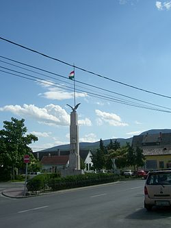
Tahitótfalu is a village in the northern part of Pest County, Hungary.

The Danube of Szentendre separates into two parts, one of these is Tótfalu which laying on Szentendre Island the other one is Tahi at the foothills of Visegrád Mountains, 28 kilometers from Budapest, north of Szentendre, along Highway 11.

References[edit]

  • ^ Tahitótfalu at the Hungarian Central Statistical Office (Hungarian). 1 January 2008;
  • 47°45′08N 19°04′41E / 47.75225°N 19.07808°E / 47.75225; 19.07808


  • t
  • e

  • Retrieved from "https://en.wikipedia.org/w/index.php?title=Tahitótfalu&oldid=1148556792"

    Categories: 
    Populated places in Pest County
    Pest County geography stubs
    Hidden categories: 
    Pages using gadget WikiMiniAtlas
    Articles with short description
    Short description is different from Wikidata
    Coordinates on Wikidata
    All stub articles


    This page was last edited on 6 April 2023, at 22:06 (UTC).

    Text is available under the Creative Commons Attribution-ShareAlike License 4.0; additional terms may apply. By using this site, you agree to the Terms of Use and Privacy Policy. Wikipedia® is a registered trademark of the Wikimedia Foundation, Inc., a non-profit organization.


    Privacy policy

    About Wikipedia

    Disclaimers

    Contact Wikipedia

    Code of Conduct

    Developers

    Statistics

    Cookie statement

    Mobile view


    Wikimedia Foundation
    Powered by MediaWiki