Jump to content


Main menu


Navigation  


Main page
Contents
Current events
Random article
About Wikipedia
Contact us
Donate


Contribute  


Help
Learn to edit
Community portal
Recent changes
Upload file


Search  


Create account

Log in


Create account
 Log in


Pages for logged out editors learn more  


Contributions
Talk


Contents


(Top)


1 Discovery  


2 References  


3 External links  


Takht-e Suleyman Massif


Беларуская (тарашкевіца)
Cymraeg
Español
فارسی
Français
Lietuvių
 

Edit links


Article
Talk


Read
Edit
View history


Tools


Actions  


Read
Edit
View history


General  


What links here
Related changes
Upload file
Special pages
Permanent link
Page information
Cite this page
Get shortened URL
Download QR code
Wikidata item


Print/export  


Download as PDF
Printable version


Appearance


From Wikipedia, the free encyclopedia


Takht-e Soleyman Alam kuh

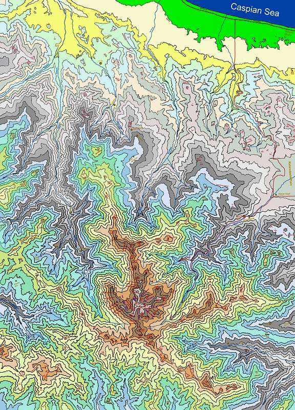
Takht-e Soleyman Massif (Persian: گرانکوه تخت سليمان) is a subrange of central Alborz mountains, in northern Iran.[1] In the area, about 160 distinct peaks higher than 4,000m are distinguishable, with the highest: Alam Kuh, 4,850m. The area can be captured inside a rectangle of 30 km width and 40 km length. The massif is limited to Taleqan valley from south, Kelardasht green plane from east, Abbas Abad rain forest & thick vegetated hills/slopes at north, and Shahsavar rain forests and Se Hezar valley at west.

Discovery[edit]

The original and pre Islamic name is Takht-e-Jamshid - The Takht-e-Soleiman region was virtually unknown until the 1930s. Freya Stark travelled there in 1931 and described her thwarted efforts to climb Takht-e Suleyman in The Valleys of the Assassins.[2] Douglas Busk, a British mountaineer, explored the area in 1932,[3] and made the first recorded ascent of Alam Kuh in 1933 via the east ridge.[4] Later on, Busk along with Professor Bobek made a detailed survey of this area.

References[edit]

  1. ^ Map of the region summitpost.org Retrieved 19 May 2023
  • ^ Freya Stark, The Valleys of the Assassins and Other Persian Travels (London, 1934)
  • ^ D. L. Busk, Climbing and ski-ing in the Elburz Range, North Persia, 1931-2: The Alpine Journal, v. 45, p. 334-341 (1933).
  • ^ D. L. Busk, Climbing in the Takht-i-Suleiman Group, N. Persia: The Alpine Journal, v. 47, p. 299-309 (1935).
  • External links[edit]


    Retrieved from "https://en.wikipedia.org/w/index.php?title=Takht-e_Suleyman_Massif&oldid=1228981895"

    Categories: 
    Mountain ranges of Iran
    Glaciers of Iran
    Tourist attractions in Mazandaran province
    Hidden categories: 
    Use dmy dates from May 2023
    Articles containing Persian-language text
    Articles with VIAF identifiers
    Articles with LCCN identifiers
    Iran articles missing geocoordinate data
    All articles needing coordinates
    Articles missing coordinates with coordinates on Wikidata


    This page was last edited on 14 June 2024, at 06:11 (UTC).

    Text is available under the Creative Commons Attribution-ShareAlike License 4.0; additional terms may apply. By using this site, you agree to the Terms of Use and Privacy Policy. Wikipedia® is a registered trademark of the Wikimedia Foundation, Inc., a non-profit organization.


    Privacy policy

    About Wikipedia

    Disclaimers

    Contact Wikipedia

    Code of Conduct

    Developers

    Statistics

    Cookie statement

    Mobile view


    Wikimedia Foundation
    Powered by MediaWiki