Jump to content


Main menu


Navigation  


Main page
Contents
Current events
Random article
About Wikipedia
Contact us
Donate


Contribute  


Help
Learn to edit
Community portal
Recent changes
Upload file


Search  


Create account

Log in


Create account
 Log in


Pages for logged out editors learn more  


Contributions
Talk


Contents


(Top)


1 Peaks  


2 Gondola lift  


3 Location in central Alborz  


4 Opening Season  


5 Pictures  


6 See also  


7 References  


8 External links  


Tochal


العربية
Беларуская (тарашкевіца)
Čeština
Deutsch
فارسی
Français
مصرى
Русский
Svenska
Українська
 

Edit links


Article
Talk


Read
Edit
View history


Tools


Actions  


Read
Edit
View history


General  


What links here
Related changes
Upload file
Special pages
Permanent link
Page information
Cite this page
Get shortened URL
Download QR code
Wikidata item


Print/export  


Download as PDF
Printable version


In other projects  


Wikimedia Commons


Appearance


From Wikipedia, the free encyclopedia


Tochal
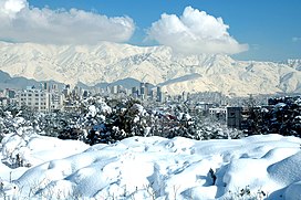
Mount Tochal, located to the north of Tehran.
Highest point
Elevation3,963 m (13,002 ft)https://www.mountain-forecast.com/peaks/Tochal
Coordinates35°53′04N 51°25′09E / 35.88444°N 51.41917°E / 35.88444; 51.41917
Geography
Tochal is located in Iran
Tochal

Tochal

Tehran Province, Iran

Parent rangeAlborz

Tochal (Persian: توچال Točāl), is a mountain and ski resort located on the Alborz mountain range, adjacent to the metropolitan area of Tehran in northern Iran. It includes a 12-kilometre-long (7.5 mi) ridge. Its highest peak, also called Tochal, is at an elevation of 3,963 metres (13,002 ft) above sea level.

Agondola lift runs from Tehran to the Tochal ski resort and hotel, all as a part of Tochal Complex.

Peaks[edit]

A number of peaks are accessible from the Tochal main ridge or by their own climbing paths. Peaks (from west to east) include:

Gondola lift[edit]

A 360° View from Tochal peak. Visible are the two shelters on the peak, as well as Mount Damavand on the horizon, as well as Tehran.
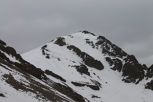
View of Tochal peak from Velenjak mountains
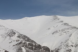
Shahneshin mountains, west side of Tochal peak
Tochal Ski Resort
Kolakchal peak
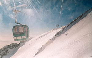
Tochal Telecabin, gondola lift for skiers and other visitors to Tochal
Tochal Peak's Shelter November 2012

Tochal has a long gondola lift which begins from Velenjak valley at 1,900 m (6,200 ft) and ends in the last station at 3740m near the main ridge of Tochal. This gondola lift is used for accessing ski resorts and other recreational centers on the mountain.

Location in central Alborz[edit]

Map of central Alborz Peaks: 1 Alam-Kuh
  −25 to 500 m (−82 to 1,640 ft)
  500 to 1,500 m (1,600 to 4,900 ft)
  1,500 to 2,500 m (4,900 to 8,200 ft)
  2,500 to 3,500 m (8,200 to 11,500 ft)
  3,500 to 4,500 m (11,500 to 14,800 ft)
  4,500 to 5,610 m (14,760 to 18,410 ft)
2 Azad Kuh 3 Damavand
4 Do Berar 5 Do Khaharan
6 Ghal'eh Gardan 7 Gorg
8 Kholeno 9 Mehr Chal
10 Mishineh Marg 11 Naz
12 Shah Alborz 13 Sialan
14 Tochal 15 Varavašt
Rivers: 0
1 Alamut 2 Chalus
3 Do Hezar 4 Haraz
5 Jajrood 6 Karaj
7 Kojoor 8 Lar
9 Noor 10 Sardab
11 Seh Hazar 12 Shahrood
Cities: 1 Amol
2 Chalus 3 Karaj
Other: D Dizin
E Emamzadeh Hashem K Kandovan Tunnel
* Latyan Dam ** Lar Dam


Opening Season[edit]

Tochal International Ski Resort, located in Iran’s capital Tehran, was officially reopened on 22.01.2024[1]


Pictures[edit]

See also[edit]

References[edit]

  1. ^ "Tochal Ski Resort reopened". en.irna.ir. Retrieved 2024-01-22.

External links[edit]


Retrieved from "https://en.wikipedia.org/w/index.php?title=Tochal&oldid=1228955182"

Categories: 
Mountains of Iran
Mountaineering in Iran
Landforms of Tehran province
Three-thousanders
Mountains of Tehran Province
Hidden categories: 
Pages using gadget WikiMiniAtlas
Articles containing Persian-language text
Commons category link is on Wikidata


This page was last edited on 14 June 2024, at 02:43 (UTC).

Text is available under the Creative Commons Attribution-ShareAlike License 4.0; additional terms may apply. By using this site, you agree to the Terms of Use and Privacy Policy. Wikipedia® is a registered trademark of the Wikimedia Foundation, Inc., a non-profit organization.


Privacy policy

About Wikipedia

Disclaimers

Contact Wikipedia

Code of Conduct

Developers

Statistics

Cookie statement

Mobile view


Wikimedia Foundation
Powered by MediaWiki