Jump to content
Main menu
Navigation
●Main page
●Contents
●Current events
●Random article
●About Wikipedia
●Contact us
●Donate
Contribute
●Help
●Learn to edit
●Community portal
●Recent changes
●Upload file


Search
●Create account
●Log in
●Create account
● Log in
Pages for logged out editors learn more
●Contributions
●Talk
(Top)
1
Notable people
2
See also
3
References
4
External links
Tolú
●閩南語 / Bân-lâm-gú
●Cebuano
●Deutsch
●Español
●فارسی
●Français
●Galego
●Hausa
●Italiano
●ქართული
●Kotava
●Lietuvių
●Bahasa Melayu
●Nederlands
●Polski
●Русский
●Svenska
●Tiếng Việt
●Winaray
●中文
Edit links
●Article
●Talk
●Read
●Edit
●View history
Tools
Actions
●Read
●Edit
●View history
General
●What links here
●Related changes
●Upload file
●Special pages
●Permanent link
●Page information
●Cite this page
●Get shortened URL
●Download QR code
●Wikidata item
Print/export
●Download as PDF
●Printable version
In other projects
●Wikimedia Commons
●Wikivoyage
Appearance
Coordinates: 9°32′N 75°35′W / 9.533°N 75.583°W / 9.533; -75.583
From Wikipedia, the free encyclopedia
Municipality and town in Sucre Department, Colombia
Tolú
|
|---|
|
 |

Flag

Seal
|

Location of the municipality and town of Tolú in the Sucre Department of Colombia.
|
| Country |  Colombia Colombia |
|---|
| Department | Sucre Department |
|---|
|
| • Municipality and town | 301.22 km2 (116.30 sq mi) |
|---|
| • Urban
| 8.75 km2 (3.38 sq mi) |
|---|
| Elevation
| 2 m (7 ft) |
|---|
|
| • Municipality and town | 32,922 |
|---|
| • Density | 110/km2 (280/sq mi) |
|---|
| • Urban
| 26,401 |
|---|
| • Urban density | 3,000/km2 (7,800/sq mi) |
|---|
| Time zone | UTC-5 (Colombia Standard Time) |
|---|
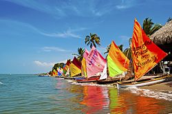
Tolú is a small town in Sucre Department, northern Colombia on the Caribbean coast. The municipality has an area of 500 km2. It is named after the Tolú, one the pre-Columbian indigenous people of the North Colombia lowlands.[2]
The municipality of Tolú borders to the North with San Onofre, to the East with Toluviejo, to the South with Coveñas, Palmito and Sincelejo.
Notable people[edit]
See also[edit]
References[edit]
External links[edit]
9°32′N 75°35′W / 9.533°N 75.583°W / 9.533; -75.583
t
e
Retrieved from "https://en.wikipedia.org/w/index.php?title=Tolú&oldid=1218557293"
Categories:
●Port cities in the Caribbean
●Municipalities of Sucre Department
●Caribbean Region (Colombia) geography stubs
Hidden categories:
●Pages using gadget WikiMiniAtlas
●Articles with short description
●Short description is different from Wikidata
●Pages using infobox settlement with no coordinates
●Articles with Spanish-language sources (es)
●Coordinates on Wikidata
●Articles with VIAF identifiers
●Articles with LCCN identifiers
●All stub articles
●This page was last edited on 12 April 2024, at 12:28 (UTC).
●Text is available under the Creative Commons Attribution-ShareAlike License 4.0;
additional terms may apply. By using this site, you agree to the Terms of Use and Privacy Policy. Wikipedia® is a registered trademark of the Wikimedia Foundation, Inc., a non-profit organization.
●Privacy policy
●About Wikipedia
●Disclaimers
●Contact Wikipedia
●Code of Conduct
●Developers
●Statistics
●Cookie statement
●Mobile view


