Jump to content


Main menu


Navigation  


Main page
Contents
Current events
Random article
About Wikipedia
Contact us
Donate


Contribute  


Help
Learn to edit
Community portal
Recent changes
Upload file


Search  


Create account

Log in


Create account
 Log in


Pages for logged out editors learn more  


Contributions
Talk


Contents


(Top)


1 Route description  


1.1  Colorado  


1.2  Nebraska  


1.3  Iowa  


1.4  Illinois  


2 Major intersections  


3 Related routes  


4 References  


5 External links  


U.S. Route 34


Deutsch
Français

Português
Svenska


Edit links


Article
Talk


Read
Edit
View history


Tools


Actions  


Read
Edit
View history


General  


What links here
Related changes
Upload file
Special pages
Permanent link
Page information
Cite this page
Get shortened URL
Download QR code
Wikidata item


Print/export  


Download as PDF
Printable version


In other projects  


Wikimedia Commons


Appearance


Route map: 


From Wikipedia, the free encyclopedia


U.S. Route 34 marker

U.S. Route 34

Map

US 34 highlighted in red

Route information

Length

1,122 mi[citation needed] (1,806 km)

Existed

1926[citation needed]–present

Major junctions

West end

US 40atGranby, CO

Major intersections

  • I-76 / US 6 near Wiggins, CO
  • I-80 / US 281 near Grand Island, NE
  • I-80 / I-180 / US 77atLincoln, NE
  • I-29 / US 275 near Glenwood, IA
  • I-35 near Osceola, IA
  • I-74inGalesburg, IL
  • I-39 / US 51inMendota, IL
  • I-88 / I-355inDowners Grove, IL
  • I-294atWestern Springs, IL
  • East end

    IL 43 / Historic US 66atBerwyn, IL

    Location

    Country

    United States

    States

    Colorado, Nebraska, Iowa, Illinois

    Highway system

    US 33

    US 35

    U.S. Route 34 (US 34) is an east–west United States highway that runs for 1,122 miles (1,806 km) from north-central Colorado to the western suburbs of Chicago. Through Rocky Mountain National Park it is known as the Trail Ridge Road where it reaches an elevation of 12,183 feet (3,713 m), making it one of the highest paved through highways in the United States. The highway's western terminus is Granby, ColoradoatUS 40. Its eastern terminus is in Berwyn, IllinoisatIllinois Route 43 and Historic US 66.

    U.S. Route 34 becomes a toll road for a short distance in Colorado, where it passes through Rocky Mountain National Park.
    Route description[edit]

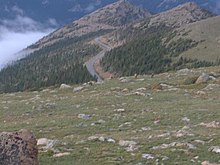
    View of US 34 in Rocky Mountain National Park, from an elevation above 11,000 feet (3,400 m)

    Colorado[edit]

    In the state of Colorado, U.S. Route 34 runs north from Granby through Rocky Mountain National Park. It passes through Estes Park, Loveland, and Greeley before entering Nebraska east of Wray.

    Within Rocky Mountain National Park US 34 is known as Trail Ridge Road. Due to its high elevation through the park and over the Continental Divide, Route 34 closes entirely in winter from the Colorado River Trailhead on the west (10 miles north of the Grand Lake entrance) to Many Parks Curve on the east (8 miles from the Estes Park entrance.) Closure runs roughly from mid-October to Memorial Day weekend in May, and can occur at any time in summer due to high alpine snow storms.[1]

    Route 34 transverses Fall River Pass and Milner Pass in the Front Range of Colorado.

    Nebraska[edit]

    In the state of Nebraska, U.S. Route 34 is a major east–west arterial surface road along the southern portion of Nebraska. It enters Nebraska west of Haigler and overlaps other routes for the majority of its routing. U.S. 34 passes through Hastings, Grand Island, Seward, and Lincoln before entering Iowa between Plattsmouth and Bellevue.

    U.S. Route 34 from between Hastings and Grand Island is known as the Tom Osborne Expressway, which is named for the former Hastings resident, Nebraska Cornhuskers football coach, and Congressman. In Lincoln, U.S. 34 overlaps with Interstate 180 from its junction with Interstate 80 into downtown where it becomes North 9th/North 10th Streets, then east as "O" Street. Also, the segment from the Lancaster County/Cass County border to Nebraska Highway 1 south of Elmwood is the Bess Streeter Aldrich Memorial Highway, after the former author and Elmwood resident.

    Iowa[edit]

    US 34 near its junction with US 71, Montgomery County, Iowa.

    In the state of Iowa, U.S. Route 34 is a major east–west arterial surface road across southern Iowa. It enters Iowa west of Glenwood and then passes through Glenwood, Red Oak, Corning, and Creston before intersecting Interstate 35atOsceola. East of Osceola, it continues through Chariton and Georgetown then onto Albia before meeting U.S. Route 63 at a traffic circleinOttumwa.

    East of Ottumwa to Burlington, the highway overlaps Iowa Highway 163. This segment of highway is an expressway with some freeway segments. As of November 12, 2008, it bypasses Fairfield and then bypasses Mt. Pleasant, with a portion of this also concurrent with US-218 and Iowa 27, which is also the Iowa route for the Avenue of the Saints. It then continues southeast towards Burlington bypassing New London and then Danville and Middletown. The freeway segment through Burlington was completed in the 1970s. It then crosses the Mississippi River on the Great River Bridge into Illinois which was completed in the early 1990s. In 2015, a 15-mile segment of U.S. Route 34 in Montgomery and Adams counties won the Sheldon G. Hayes Award for the highest quality asphalt pavement in the nation.[2]

    Much of this route was originally known as the Bluegrass Highway and parallels tracks of what was originally the Burlington and Missouri River Railroad and is now the BNSF. Amtrak's California Zephyr passenger rail service also parallels this route.

    U.S. 34 in the state of Iowa is officially designated the Red Bull Highway in honor of the 34th Infantry (Red Bull) Division.
    Illinois[edit]

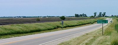
    U.S. 34 in western Illinois

    In the state of Illinois, U.S. Route 34 enters at the Mississippi River across from Burlington, Iowa. It passes through or around the cities of Monmouth, Galesburg, Kewanee, Princeton, Mendota, Yorkville, Oswego, Aurora, Naperville, Lisle, Downers Grove, Westmont, Clarendon Hills, Hinsdale, Western Springs, La Grange, Brookfield, Lyons and Riverside and continues in a largely southwest-northeast direction to its eastern terminus at Illinois Route 43 and Historic US 66inBerwyn.[3] Through much of the Chicago area, the highway is known as "Ogden Avenue", after William Butler Ogden, Chicago's first mayor. The entire highway in Illinois is named the Walter Payton Memorial Highway after Pro Football Hall of Famer Walter Payton, who wore #34 for the Chicago Bears. The highway is 211.37 miles (340.17 km) long within the state.

    Major intersections[edit]

    Colorado
    US 40inGranby
    US 36inDeer Ridge Junction
    US 36inEstes Park
    US 287inLoveland
    I-25 / US 87 in Loveland
    US 85inEvans. The highways travel concurrently to Greeley.
    I-76 / US 6 northeast of Wiggins. The highways travel concurrently to west-southwest of Log Lane Village.
    US 385inWray
    Nebraska
    US 6 west of Culbertson. The highways travel concurrently to Hastings.
    US 83inMcCook. The highways travel concurrently through the city.
    US 283inArapahoe
    US 136 north-northwest of Edison
    US 183inHoldrege
    US 281 in Hastings. The highways travel concurrently to Grand Island.
    I-80 south of Grand Island
    US 81inYork. The highways travel concurrently to north of York.
    I-80 / I-180 / US 77inLincoln. I-180/US 34 travels concurrently through the city.
    US 75 east of Union. The highways travel concurrently to north-northwest of La Platte.
    Iowa
    I-29 / US 275 north-northwest of Pacific Junction. US 34/US 275 travels concurrently to east-southeast of Glenwood.
    US 59 north of Emerson
    US 71 north of Villisca
    US 169inAfton. The highways travel concurrently to west of Thayer.
    I-35inOsceola
    US 69 in Osceola
    US 65inLucas. The highways travel concurrently through the city.
    US 63inOttumwa. The highways travel concurrently to east of Ottumwa.
    US 218 north of Mt. Pleasant. The highways travel concurrently to Mt. Pleasant.
    US 61inBurlington
    Illinois
    US 67 south-southwest of Monmouth. The highways travel concurrently to Monmouth.
    US 150inGalesburg
    I-74 in Galesburg
    US 6 west of Sheffield. The highways travel concurrently to Princeton.
    US 52inMendota
    I-39 / US 51 east of Mendota
    US 30 on the OswegoMontgomery city line. The highways travel concurrently one block.
    I-355 on the LisleDowners Grove city line
    I-294 on the HinsdaleWestern Springs city line
    US 12 / US 20 / US 45inLa Grange
    IL 43 / Historic US 66 on the RiversideLyonsBerwyn city line

    [4]

    Related routes[edit]

    Special routes of U.S. Route 34

    References[edit]

    1. ^ "Road Status Report - Rocky Mountain National Park". Nps.gov. Retrieved August 17, 2012.
  • ^ "2015 Sheldon G. Hayes Award Winner & Finalists". National Asphalt Pavement Association. February 10, 2016. Retrieved February 12, 2016.
  • ^ "US 34". Illinois Highway Ends. Archived from the original on October 10, 2012. Retrieved October 9, 2014.
  • ^ Rand McNally (2014). The Road Atlas (Walmart ed.). Chicago: Rand McNally. pp. 21, 32, 38–39, 62–63. ISBN 978-0-528-00771-2.
  • External links[edit]

    KML is from Wikidata
    Click for the article on the U.S. Route shield United States Numbered Highway System

  • 2
  • 3
  • 4
  • 5
  • 6
  • 7
  • 8
  • 9
  • 10
  • 11
  • 12
  • 13
  • 14
  • 15
  • 16
  • 17
  • 18
  • 19
  • 20
  • 21
  • 22
  • 23
  • 24
  • 25
  • 26
  • 27
  • 28
  • 29
  • 30
  • 31
  • 32
  • 33
  • 34
  • 35
  • 36
  • 37
  • 38
  • 40
  • 41
  • 42
  • 43
  • 44
  • 45
  • 46
  • 48
  • 49
  • 50
  • 51
  • 52
  • 53
  • 54
  • 55
  • 56
  • 57
  • 58
  • 59
  • 60
  • 61
  • 62
  • 63
  • 64
  • 65
  • 66
  • 67
  • 68
  • 69
  • 70
  • 71
  • 72
  • 73
  • 74
  • 75
  • 76
  • 77
  • 78
  • 79
  • 80
  • 81
  • 82
  • 83
  • 84
  • 85
  • 87
  • 89
  • 90
  • 91
  • 92
  • 93
  • 94
  • 95
  • 96
  • 97
  • 98
  • 99
  • 101
  • 163
  • 400
  • 412
  • 425
  • Divided routes
  • Special routes
  • Routes in italics are no longer a part of the system. Highlighted routes are considered main routes of the system.

    Browse numbered routes

    SH 30

    list

    SH 35

    N-33

    NE

    N-35

    Iowa 31

    IA

    I-35

    IL 33

    IL

    IL 34


    Retrieved from "https://en.wikipedia.org/w/index.php?title=U.S._Route_34&oldid=1225906116"

    Categories: 
    U.S. Route 34
    United States Numbered Highway System
    Ronald Reagan Trail
    Hidden categories: 
    Articles with short description
    Short description is different from Wikidata
    Use mdy dates from September 2019
    All articles with unsourced statements
    Articles with unsourced statements from February 2018
    Infobox road instances in the United States
    Pages using gadget WikiMiniAtlas
    Articles using KML from Wikidata
    Pages using the Kartographer extension


    This page was last edited on 27 May 2024, at 12:51 (UTC).

    Text is available under the Creative Commons Attribution-ShareAlike License 4.0; additional terms may apply. By using this site, you agree to the Terms of Use and Privacy Policy. Wikipedia® is a registered trademark of the Wikimedia Foundation, Inc., a non-profit organization.


    Privacy policy

    About Wikipedia

    Disclaimers

    Contact Wikipedia

    Code of Conduct

    Developers

    Statistics

    Cookie statement

    Mobile view


    Wikimedia Foundation
    Powered by MediaWiki