Jump to content


Main menu


Navigation  


Main page
Contents
Current events
Random article
About Wikipedia
Contact us
Donate


Contribute  


Help
Learn to edit
Community portal
Recent changes
Upload file


Search  


Create account

Log in


Create account
 Log in


Pages for logged out editors learn more  


Contributions
Talk


Contents


(Top)


1 References  


2 See also  


Urucuia


 / Bân-lâm-gú
Cebuano
Esperanto
Euskara
Français
িি ি
Italiano

Қазақша
Malagasy
Nederlands
Нохчийн
Norsk bokmål
Polski
Português
Română
Русский
Svenska
Татарча / tatarça
Tiếng Vit
Winaray


Edit links


Article
Talk


Read
Edit
View history


Tools


Actions  


Read
Edit
View history


General  


What links here
Related changes
Upload file
Special pages
Permanent link
Page information
Cite this page
Get shortened URL
Download QR code
Wikidata item


Print/export  


Download as PDF
Printable version


In other projects  


Wikimedia Commons


Appearance


Coordinates: 16°0751S 45°4433W / 16.13083°S 45.74250°W / -16.13083; -45.74250
 

From Wikipedia, the free encyclopedia


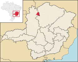
Location of Urucuia in the state of Minas Gerais

Urucuia is a municipality in the north of the stateofMinas GeraisinBrazil. As of 2020 the population was 17,173 in an area of 2,072 km2 (800 sq mi).[1] The elevation of the municipal seat is 498 meters. It became a municipality in 1993. The postal code (CEP) is 39315-000 and it belongs to the statistical microregion of Januária[2]

Urucuia is located in an isolated region between the São Francisco River and the Distrito Federal It is connected by dirt road to Arinos and to São Romãoon the São Francisco River. It lies on the left bank of the Urucuia Rivers, a tributary of the São Francisco.[3]

The economy is based on agriculture with emphasis on cattle raising. There were 35,000 head in 2006. The main agricultural crops were coffee, coconuts, manioc, and corn. The GDP was R$39,297,000 in 2005. In 2006 there were 4,300 people connected to agriculture among whom were 700 salaried workers. There were no banking agencies.[4]

This municipality is extremely isolated from major population centers and suffers from drought and poor soils. It is one of the poorest in the state and in the country. Like many impoverished districts it fought for municipal autonomy to apply for government assistance programs.

The social and health indicators were: degree of urbanization—44.9%; Literacy rate: 77.6; coverage of sewage system in the urban area—0.10%; coverage of garbage collection in the urban area—67.9; and infant mortality—18.60.[6]

References

[edit]
  • ^ "Citybrazil". Archived from the original on 2008-02-04. Retrieved 2008-02-04.
  • ^ "Mapa de Estradas". Archived from the original on 2008-05-12. Retrieved 2008-05-23.
  • ^ IBGE
  • ^ Frigoletto
  • ^ a b Indicators
  • See also

    [edit]

    16°07′51S 45°44′33W / 16.13083°S 45.74250°W / -16.13083; -45.74250


    Retrieved from "https://en.wikipedia.org/w/index.php?title=Urucuia&oldid=1164137549"

    Category: 
    Municipalities in Minas Gerais
    Hidden categories: 
    Pages using gadget WikiMiniAtlas
    Articles with short description
    Short description matches Wikidata
    Coordinates on Wikidata


    This page was last edited on 8 July 2023, at 02:27 (UTC).

    Text is available under the Creative Commons Attribution-ShareAlike License 4.0; additional terms may apply. By using this site, you agree to the Terms of Use and Privacy Policy. Wikipedia® is a registered trademark of the Wikimedia Foundation, Inc., a non-profit organization.


    Privacy policy

    About Wikipedia

    Disclaimers

    Contact Wikipedia

    Code of Conduct

    Developers

    Statistics

    Cookie statement

    Mobile view


    Wikimedia Foundation
    Powered by MediaWiki