Jump to content


Main menu


Navigation  


Main page
Contents
Current events
Random article
About Wikipedia
Contact us
Donate


Contribute  


Help
Learn to edit
Community portal
Recent changes
Upload file


Search  


Create account

Log in


Create account
 Log in


Pages for logged out editors learn more  


Contributions
Talk


Contents


(Top)


1 History  


2 Geography  


3 See also  


4 References  


5 External links  


Uvero


Kreyòl ayisyen
 

Edit links


Article
Talk


Read
Edit
View history


Tools


Actions  


Read
Edit
View history


General  


What links here
Related changes
Upload file
Special pages
Permanent link
Page information
Cite this page
Get shortened URL
Download QR code
Wikidata item


Print/export  


Download as PDF
Printable version


In other projects  


Wikimedia Commons


Appearance


Coordinates: 19°5657.3N 76°3524.2W / 19.949250°N 76.590056°W / 19.949250; -76.590056
 

From Wikipedia, the free encyclopedia


Uvero
Village
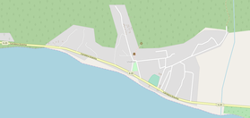
OSM map showing Uvero
Uvero is located in Cuba
Uvero

Location of Uvero in Cuba

Coordinates: 19°56′57.3″N 76°35′24.2″W / 19.949250°N 76.590056°W / 19.949250; -76.590056
Country Cuba
ProvinceSantiago de Cuba
MunicipalityGuamá
Founded18th century
Elevation
10 m (30 ft)
Population
 (2011)
 • Total2,581
Time zoneUTC-5 (EST)
Area code+53-226

Uvero, also known as El Uvero, is a Cuban village and consejo popular ("people's council", i.e. hamlet) of the municipality of Guamá, in Santiago de Cuba Province. In 2011 it had a population of 2,581.

History[edit]

The toponym derives from the Spanish common name of some species of Coccoloba, a genus of trees, found by Spanish explorers, at the entrance of the village, in the 18th century. On May 28, 1957, during the Cuban Revolution, the village was the site of a battle, between a columnofM-26-7 rebels, led by Fidel Castro,[1] and a garrison of the Cuban Army.[2][3]

Geography[edit]

Located by the Caribbean Coast, below the Sierra Maestra mountain range, Uvero spans along the "Carretera del Granma" highway (part of the Circuito Sur de Oriente), between Chivirico (the municipal seat, 22 km east) and Pilón (inGranma Province, 80 km west), in a sparsely populated coastal strip.[4]

The village, included in Turquino National Park's territory, is about 26 km east of Pico Turquino, the highest Cuban peak. It is 74 km east of Marea del Portillo, 96 km west of Santiago de Cuba and 127 km east of Niquero. Nearest villages are, to the west, La Uvita (15 km) and Ocujal (23 km); to the east Guamá Abajo (18 km).

See also[edit]

References[edit]

  • ^ "El Uvero Attack" (cuba1952-1957.blogspot.com)
  • ^ "Analysis of the Military Strategies and Warfare Principles of Che Guevara" (DTIC website)
  • ^ 3575034608 Uvero on OpenStreetMap
  • External links[edit]


    Retrieved from "https://en.wikipedia.org/w/index.php?title=Uvero&oldid=1216328657"

    Categories: 
    Populated places in Santiago de Cuba Province
    Populated places established in the 18th century
    Hidden categories: 
    Pages using gadget WikiMiniAtlas
    Articles with Spanish-language sources (es)
    Articles with short description
    Short description is different from Wikidata
    Coordinates on Wikidata
    Commons category link is on Wikidata


    This page was last edited on 30 March 2024, at 11:44 (UTC).

    Text is available under the Creative Commons Attribution-ShareAlike License 4.0; additional terms may apply. By using this site, you agree to the Terms of Use and Privacy Policy. Wikipedia® is a registered trademark of the Wikimedia Foundation, Inc., a non-profit organization.


    Privacy policy

    About Wikipedia

    Disclaimers

    Contact Wikipedia

    Code of Conduct

    Developers

    Statistics

    Cookie statement

    Mobile view


    Wikimedia Foundation
    Powered by MediaWiki