
This article may incorporate text from a large language model. It may include false information or fake references. Please remove claims that are unverifiableorcopyright violations. See the project page about this. (May 2024)
|

The Van Scoy Burial Ground, historically significant for its connection to educational and agricultural practices, is a site located at Northwest HarborinEast Hampton, a town in Suffolk County, New York, United States. This location holds unique significance as it marks the site of a once-thriving schoolhouse and its associated history with the Van Scoy family, the local community, and their mutual arrangements.[1]
 Isaac Van Scoy from Amagansett wed Mercy Edwards in February 1757, and during the spring of that year, the couple relocated to the region referred to as Northwest or Alewife Brook Neck,(Present day Barcelona Neck) located approximately six miles north of East Hampton Village.[2]
In 1758, upon the arrival of their first child, Van Scoy joyfully planted a sapling that stood at a height of five feet. By 1934, the tree had impressively grown to a towering height of 98 feet. Its girth, measured at a distance of one foot above the ground, reached an impressive circumference of 17 feet 5 inches. Unfortunately, this 260 yr old tree met its fate during the devastating hurricane of 1938, succumbing to the powerful gusts.[3]
In the year 1827, the Van Scoy family, who were prominent landowners in the area, granted permission to the town of East Hampton to construct a schoolhouse on a designated section of their property.[4] This agreement was reached under a notable arrangement: in exchange for the usage of the land for the schoolhouse, the town agreed to pay the Van Scoy family a sum of six cents per year, in addition to providing them with the ashes from the schoolhouse's stove. These ashes were utilized as a form of fertilizer for the Van Scoy family's farm, showcasing a pragmatic and sustainable approach to agricultural practices of that era.

The construction of the schoolhouse commenced, resulting in the establishment of a quaint, single-room wooden structure. This schoolhouse, constructed at a cost of $250, was designed to accommodate around thirty to forty pupils, along with their teacher. The teacher, in turn, was compensated with an annual salary of $50. This modest but functional learning environment served as a hub of education for the local community, providing a space for children to receive instruction during a time when education was a vital but often limited resource.[5]

For many years, the Van Scoy Schoolhouse which played a crucial role in the educational and social life of the Northwest Harbor area evolved, the schoolhouse eventually fell out of use. In 1885, the structure was abandoned to the elements, succumbing to the passage of time and the forces of nature.
Its role, in addition to agriculture, the settlement boasted industrial components that further fueled its prosperity. A mill, sawmill, and various other forms of infrastructure were established to harness the power of the local resources, enhancing the settlement's self-sufficiency and economic viability. The construction of wharves and warehouses along the waterfront facilitated trade and commerce, enabling the community to engage in maritime activities such as shipping and trade.
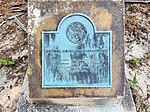
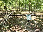
Today, the Van Scoy Burial Ground serves as a historical marker, preserving the memory of the schoolhouse, the Van Scoy family, and their unique arrangements with the town of East Hampton. While the original wooden structure has long since disappeared, the foundation stones that once supported the schoolhouse remain as a tangible link to the past. The site offers a glimpse into a bygone era, where education, agriculture, and community cooperation intertwined to shape the landscape of East Hampton.[6]

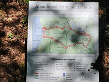
The Burying ground stands as part of the Northwest "Ghost town" settlement, a nature trail that winds thru the Van Scoy Homestead, to Northwest Harbor, East Hampton's first harbor on the South Fork of Long Island and back on the 'whalebone landing road'. During the 18th century, this settlement encompassed fifteen expansive farms, a mill, a sawmill, and various wharves and warehouses situated along the shores of Northwest Harbor. Both the Northwest trail and the Paumanok Path intersect in the Old Grace Estate[7] on Barcelona Neck.
In recognition of its historical and cultural significance,[8] the Van Scoy Burial Ground was added to the NRHP on January 27, 2023. NRHP#100008577[9]

Northwest Landing, Suffolk County, New York, USA
41°1′19.5″N 72°13′30″W / 41.022083°N 72.22500°W / 41.022083; -72.22500