Vauxhall, New Jersey
| |
|---|---|
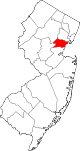
 Vauxhall Location in Union County Show map of Union County, New Jersey Vauxhall Location in New Jersey Show map of New Jersey Vauxhall Location in the United States Show map of the United States | |
| Coordinates: 40°43′06″N 74°17′03″W / 40.71833°N 74.28417°W / 40.71833; -74.28417 | |
| Country | |
| State | |
| County | Union |
| Township | Union |
| Area | |
| • Total | 0.59 sq mi (1.52 km2) |
| • Land | 0.59 sq mi (1.52 km2) |
| • Water | 0.00 sq mi (0.00 km2) |
| Elevation | 190 ft (58 m) |
| Population | |
| • Total | 5,251 |
| • Density | 8,915.11/sq mi (3,443.77/km2) |
| ZIP Code |
07088[3]
|
| FIPS code | 34-75590[4] |
| GNIS feature ID | 0881436[5] |
Vauxhall is an unincorporated community and census-designated place (CDP)[6] located within Union TownshipinUnion County, in the U.S. stateofNew Jersey.[7] Vauxhall borders Millburn, Maplewood and Springfield. The area is served as United States Postal Service ZIP Code 07088.[8]
As of the 2010 United States Census, the population for ZIP Code Tabulation Area 07088 was 3,606.[9]
Vauxhall is home to The Home Depot Superstore, that at 217,000 square feet (20,200 m2) was the chain's largest store in the world as of 2012.[10]
| Census | Pop. | Note | %± |
|---|---|---|---|
| 2020 | 5,251 | — | |
| U.S. Decennial Census[11] | |||
People who were born in, residents of, or otherwise closely associated with Vauxhall include:
|
Municipalities and communities of Union County, New Jersey, United States
| ||
|---|---|---|
| Cities |
|
|
| Boroughs |
| |
| Town |
| |
| Townships |
| |
| CDPs |
| |
| Other communities |
| |
| ||