Jump to content


Main menu


Navigation  


Main page
Contents
Current events
Random article
About Wikipedia
Contact us
Donate


Contribute  


Help
Learn to edit
Community portal
Recent changes
Upload file


Search  


Create account

Log in


Create account
 Log in


Pages for logged out editors learn more  


Contributions
Talk


Contents


(Top)


1 Etymology  


2 History  


3 Economy  


4 References  


Viracachá


 / Bân-lâm-gú
Cebuano
Español
فارسی
Français
Galego
Italiano

Kotava
Bahasa Melayu
Nederlands
Oʻzbekcha / ўзбекча
Polski
Português
Русский
Svenska
Tagalog
Tiếng Vit
Winaray


Edit links


Article
Talk


Read
Edit
View history


Tools


Actions  


Read
Edit
View history


General  


What links here
Related changes
Upload file
Special pages
Permanent link
Page information
Cite this page
Get shortened URL
Download QR code
Wikidata item


Print/export  


Download as PDF
Printable version


In other projects  


Wikimedia Commons


Appearance


Coordinates: 5°26N 73°18W / 5.433°N 73.300°W / 5.433; -73.300
 

From Wikipedia, the free encyclopedia


Viracachá
Municipality and town
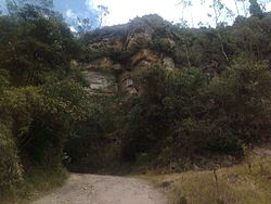
Ancient road used by the Muisca in Viracachá
Flag of Viracachá
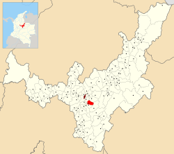
Location of the municipality and town of Viracachá in the Boyacá Department of Colombia
Country Colombia
DepartmentBoyacá Department
ProvinceMárquez Province
Founded15 February 1556
Government
 • MayorGregorio Rodríguez Soler
(2020-2023)
Area
 • Municipality and town68 km2 (26 sq mi)
 • Urban
km2 (0.4 sq mi)
Elevation
2,520 m (8,270 ft)
Population
 (2015)
 • Municipality and town3,222
 • Density47/km2 (120/sq mi)
 • Urban
374
Time zoneUTC-5 (Colombia Standard Time)
WebsiteOfficial website

Viracachá is a town and municipality in the Márquez Province, Colombia, part of the Colombian departmentofBoyacá. Viracachá is situated on the Altiplano Cundiboyacense at 22 kilometres (14 mi) from the department capital Tunja and the small urban center at 2,520 metres (8,270 ft) above sea level. Other parts of Viracachá reach 3,200 metres (10,500 ft). The municipality borders Siachoque, Rondón and Soracá in the north and east, in the south Ciénega and Ciénega, Soracá and Ramiriquí in the west.[1]

Etymology[edit]

About the name Viracachá exist different interpretations. One interpretation says the name is derived from Quechua and means "air of the lake".[1] Another attributes it to Chibcha meaning "lord of the enclosure of the wind".[2][3]

History[edit]

In the centuries before the Spanish conquest Viracachá was inhabited by the Muisca, organized in their loose Muisca Confederation. Due to its proximity to the northern capital Hunza, Viracachá was ruled by the zaque. Modern Viracachá was founded by Dominican missionaries on February 15, 1556.[1]

Economy[edit]

Viracachá is a rural village where most of the people work in the tertiary sector of services. Also agriculture and chicken farming is executed. The town does not have a bank.[1]

Sunset in Viracachá

References[edit]

  1. ^ a b c d (in Spanish) Official website Viracachá
  • ^ Espejo Olaya, Maria Bernarda (1999). Notas sobre toponimia en algunas coplas colombianas [Notes about toponomy of some Colombian ballads - Thesaurus] (PDF) (in Spanish). Vol. Tomo LIV, Núm. 3. p. 1126.
  • ^ (in Spanish) Etymology Viracachcá - Excelsio.net
  • 5°26′N 73°18′W / 5.433°N 73.300°W / 5.433; -73.300


    Retrieved from "https://en.wikipedia.org/w/index.php?title=Viracachá&oldid=1162686190"

    Categories: 
    Municipalities of Boyacá Department
    Populated places established in 1556
    1556 establishments in the Spanish Empire
    Populated places of the Muisca Confederation
    Hidden categories: 
    Articles with Spanish-language sources (es)
    CS1: long volume value
    CS1 Spanish-language sources (es)
    Pages using gadget WikiMiniAtlas
    Articles with short description
    Short description is different from Wikidata
    Pages using infobox settlement with no coordinates
    Articles with VIAF identifiers
    Articles with J9U identifiers
    Articles with LCCN identifiers
    Coordinates on Wikidata


    This page was last edited on 30 June 2023, at 15:28 (UTC).

    Text is available under the Creative Commons Attribution-ShareAlike License 4.0; additional terms may apply. By using this site, you agree to the Terms of Use and Privacy Policy. Wikipedia® is a registered trademark of the Wikimedia Foundation, Inc., a non-profit organization.


    Privacy policy

    About Wikipedia

    Disclaimers

    Contact Wikipedia

    Code of Conduct

    Developers

    Statistics

    Cookie statement

    Mobile view


    Wikimedia Foundation
    Powered by MediaWiki