
Vogtareuth
| |
|---|---|

Church of Saint Emmeram
| |

Coat of arms | |
Location of Vogtareuth within Rosenheim district 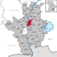 | |
 Vogtareuth Show map of Germany  Vogtareuth Show map of Bavaria | |
| Coordinates: 47°57′N 12°11′E / 47.950°N 12.183°E / 47.950; 12.183 | |
| Country | Germany |
| State | Bavaria |
| Admin. region | Oberbayern |
| District | Rosenheim |
| Government | |
| • Mayor (2020–26) | Rudolf Leitmannstetter[1] |
| Area | |
| • Total | 34.23 km2 (13.22 sq mi) |
| Elevation | 484 m (1,588 ft) |
| Population
(2022-12-31)[2]
| |
| • Total | 3,232 |
| • Density | 94/km2 (240/sq mi) |
| Time zone | UTC+01:00 (CET) |
| • Summer (DST) | UTC+02:00 (CEST) |
| Postal codes |
83569
|
| Dialling codes | 08038 |
| Vehicle registration | RO |
| Website | www.vogtareuth.de |
Vogtareuth (Central Bavarian: Vogtareith) is a municipality in the district of RosenheiminBavariainGermany. It lies on the river Inn.
| International |
|
|---|---|
| National |
|
This Rosenheim district location article is a stub. You can help Wikipedia by expanding it. |