Whiteville
| |
|---|---|
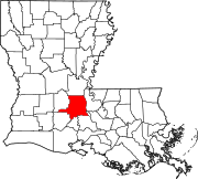
 Whiteville Location within the state of Louisiana | |
| Coordinates: 30°47′18″N 92°8′51″W / 30.78833°N 92.14750°W / 30.78833; -92.14750 | |
| Country | United States |
| State | Louisiana |
| Parish | St. Landry |
| Time zone | UTC-6 (Central (CST)) |
| • Summer (DST) | UTC-5 (CDT) |
| GNIS feature ID | 1628499[1] |
Whiteville is an unincorporated communityinSt. Landry Parish, Louisiana, United States. It is located approximately 20 miles north of Opelousas along Louisiana Highway 29.
The community is part of the Opelousas–Eunice Micropolitan Statistical Area.
|
Municipalities and communities of St. Landry Parish, Louisiana, United States
| ||
|---|---|---|
| Cities |
|
|
| Towns |
| |
| Villages |
| |
| CDPs |
| |
| Other communities |
| |
| Footnotes | ‡This populated place also has portions in an adjacent parish or parishes | |
| ||
This Louisiana state location article is a stub. You can help Wikipedia by expanding it. |