Jump to content


Main menu


Navigation  


Main page
Contents
Current events
Random article
About Wikipedia
Contact us
Donate


Contribute  


Help
Learn to edit
Community portal
Recent changes
Upload file


Search  


Create account

Log in


Create account
 Log in


Pages for logged out editors learn more  


Contributions
Talk


Contents


(Top)


1 Municipalities  


2 Dissolution  


3 References  


Wien-Umgebung District


Boarisch
Bosanski
Cebuano
Čeština
Dansk
Deutsch
Eesti
Español
Esperanto
فارسی
Français
Bahasa Indonesia
Italiano
Magyar
Bahasa Melayu
Nederlands
Oʻzbekcha / ўзбекча
Polski
Português
Русский
Simple English
Slovenčina
Srpskohrvatski / српскохрватски
Svenska
Українська
Vèneto
Tiếng Vit
Winaray


Edit links


Article
Talk


Read
Edit
View history


Tools


Actions  


Read
Edit
View history


General  


What links here
Related changes
Upload file
Special pages
Permanent link
Page information
Cite this page
Get shortened URL
Download QR code
Wikidata item


Print/export  


Download as PDF
Printable version


In other projects  


Wikimedia Commons


Appearance


Coordinates: 48°18N 16°19E / 48.300°N 16.317°E / 48.300; 16.317
 

From Wikipedia, the free encyclopedia


Wien-Umgebung District
Bezirk Wien-Umgebung
CountryAustria
StateLower Austria
Number of municipalities21
Area
 • Total484.5 km2 (187.1 sq mi)
Population
 (1 January 2016)
 • Total120,446
 • Density250/km2 (640/sq mi)
Time zoneUTC+01:00 (CET)
 • Summer (DST)UTC+02:00 (CEST)
NUTS codeAT126, AT127
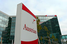
Austrian Airlines headquarters

Bezirk Wien-Umgebung was a district of the stateofLower AustriainAustria. The district comprised four non-contiguous districts on the outer fringes of Vienna: Klosterneuburg and Gerasdorf to the north of the city, Schwechat to its south-east and Purkersdorf on Vienna's western side.

Vienna International Airport, the headquarters of Austrian Airlines, and the headquarters of Niki are in the city of Schwechat, in the district.[1][2][3]

The district existed from 1954 to 2016. In 2017 the municipalities became part of four adjacent districts.[4][5]

Municipalities[edit]

Suburbs, hamlets and other subdivisions of a municipality are indicated by lower dots.

Dissolution[edit]

The district Wien-Umgebung was dissolved in 2017; 13 municipalities in the South East became part of the Bruck an der Leitha District, namely Ebergassing, Fischamend, Gramatneusiedl, Himberg, Klein-Neusiedl, Lanzendorf, Leopoldsdorf, Maria Lanzendorf, Moosbrunn, Rauchenwarth, Schwadorf, Schwechat and Zwölfaxing. Six municipalities in the West became part of the Sankt Pölten-Land District, namely Gablitz, Mauerbach, Pressbaum, Purkersdorf, Tullnerbach and Wolfsgraben. Klosterneuburg in the North West became part of the Tulln District and Gerasdorf bei Wien in the North East became part of the Korneuburg District.[4][5]

Situation in 2017
Situation in 2017

References[edit]

  1. ^ "Offices in Austria." Austrian Airlines. Retrieved on 26 May 2009.
  • ^ "About Us Contact." Niki. Retrieved on 2 September 2009.
  • ^ "Information about the city plan." City of Schwechat. Retrieved on 5 September 2009.
  • ^ a b "Wien-Umgebung will be dissolved" (in German). Niederösterreichische Nachrichten (NÖN.at). 9 October 2015.
  • ^ a b "Wien-Umgebung: Aufteilung geändert" [Wien-Umgebung: Modified division] (in German). Niederösterreichische Nachrichten (NÖN.at). 24 September 2015.
  • 48°18′N 16°19′E / 48.300°N 16.317°E / 48.300; 16.317


    Retrieved from "https://en.wikipedia.org/w/index.php?title=Wien-Umgebung_District&oldid=1232303297"

    Categories: 
    Wien-Umgebung District
    Former districts of Austria
    Hidden categories: 
    CS1 German-language sources (de)
    Pages using gadget WikiMiniAtlas
    Articles with short description
    Short description is different from Wikidata
    Pages using infobox settlement with no map
    Pages using infobox settlement with no coordinates
    Articles with VIAF identifiers
    Coordinates on Wikidata


    This page was last edited on 3 July 2024, at 01:45 (UTC).

    Text is available under the Creative Commons Attribution-ShareAlike License 4.0; additional terms may apply. By using this site, you agree to the Terms of Use and Privacy Policy. Wikipedia® is a registered trademark of the Wikimedia Foundation, Inc., a non-profit organization.


    Privacy policy

    About Wikipedia

    Disclaimers

    Contact Wikipedia

    Code of Conduct

    Developers

    Statistics

    Cookie statement

    Mobile view


    Wikimedia Foundation
    Powered by MediaWiki