Jump to content


Main menu


Navigation  


Main page
Contents
Current events
Random article
About Wikipedia
Contact us
Donate


Contribute  


Help
Learn to edit
Community portal
Recent changes
Upload file


Search  


Create account

Log in


Create account
 Log in


Pages for logged out editors learn more  


Contributions
Talk


Contents


(Top)


1 History  


2 1975 train hostage crisis  


3 Education  


4 Gallery  


5 References  


Wijster


 / Bân-lâm-gú
Cebuano
فارسی
Français
Frysk
Nederlands
Português
Українська
 

Edit links


Article
Talk


Read
Edit
View history


Tools


Actions  


Read
Edit
View history


General  


What links here
Related changes
Upload file
Special pages
Permanent link
Page information
Cite this page
Get shortened URL
Download QR code
Wikidata item


Print/export  


Download as PDF
Printable version


In other projects  


Wikimedia Commons


Appearance


Coordinates: 52°4858N 6°310E / 52.81611°N 6.51667°E / 52.81611; 6.51667
 

From Wikipedia, the free encyclopedia


Wijster
Village
Farm in Wijster
Farm in Wijster
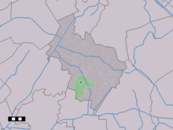
The town centre (dark green) and the statistical district (light green) of Wijster in the municipality of Midden-Drenthe.
Wijster is located in Drenthe
Wijster

Wijster

Location in the Netherlands

Wijster is located in Netherlands
Wijster

Wijster

Wijster (Netherlands)

Coordinates: 52°48′58N 6°31′0″E / 52.81611°N 6.51667°E / 52.81611; 6.51667
CountryNetherlands
ProvinceDrenthe
MunicipalityMidden-Drenthe
Area
 • Total26.25 km2 (10.14 sq mi)
Elevation 16 m (52 ft)
Population
 (2021)[1]
 • Total1,085
 • Density41/km2 (110/sq mi)
Time zoneUTC+1 (CET)
 • Summer (DST)UTC+2 (CEST)
Postal code
9418[1]
Dialing code0593

Wijster is a village in the Dutch province of Drenthe. It is a part of the municipality of Midden-Drenthe, and lies about 11 km north of Hoogeveen.

History[edit]

The village was first mentioned in 1206 as in Wisnare. The etymology is unknown.[3] Wijster is an esdorp which developed in the Early Middle Ages as a satellite of Beilen. It used to have no church, but did have a large funnel shaped brink (village square).[4]

Wijster was home to 300 people in 1840.[5] The Dutch Reformed church dates from 1929 and is a simple church with a little ridge turret.[4]

Wijster is best known for its landfill. From 1929 onwards, garbage was dumped in Wijster, and has resulted in 56 metres (184 ft) high hill.[6][7]

1975 train hostage crisis[edit]

Wijster was the site of the 1975 Dutch train hostage crisis. In 1949, Indonesia became independent, and the Royal Netherlands East Indies Army was disbanded. The islands of Ambon, Buru, and Seram had fought on side of the Netherlands. They were opposed to a Java-dominated Indonesia, and proclaimed the Republic of South Maluku which resulted in an attack by Indonesia. In 1951, 12,000 refugees from South Maluku were temporarily resettled in the Netherlands. They started to feel betrayed, because it developed into permanent exile.[8]

On 2 December 1975, the train from GroningentoZwolle stopped in a field near Wijster. Seven South Moluccans had ceased the train and killed the driver. The Dutch government was reluctant to negotiate, and the hijackers tried to kill a passenger, however he managed to escape and after being shot at, pretended to be dead. During the twelve days which followed, two more passengers were shot. Johan Manusama, the former president of the Republic of South Maluku, managed to persuade the hijackers to surrender. In 1976, the hijackers were sentenced to 14 year imprisonment.[9]

Education[edit]

There is one primary school, Zuiderenk.[10]

Gallery[edit]

References[edit]

  1. ^ a b c "Kerncijfers wijken en buurten 2021". Central Bureau of Statistics. Retrieved 11 April 2022.
  • ^ "Postcodetool for 9418PB". Actueel Hoogtebestand Nederland (in Dutch). Het Waterschapshuis. Retrieved 11 April 2022.
  • ^ "Wijster". Etymologiebank (in Dutch). Retrieved 11 April 2022.
  • ^ a b Ronald Stenvert (2001). Wijster (in Dutch). Zwolle: Waanders. p. 61. ISBN 90 400 9454 3. Retrieved 11 April 2022.
  • ^ "Wijster". Plaatsengids (in Dutch). Retrieved 11 April 2022.
  • ^ "Wijster". Historie Beilen (in Dutch). Retrieved 12 March 2022.
  • ^ "Wijster (VAM-berg)". MTB Routes (in Dutch). Retrieved 12 March 2022.
  • ^ J.H.W. Veenstra (1978). "Ambon, een blok aan Nederlands been". Ons Erfdeel (in Dutch). pp. 511–512. Retrieved 11 April 2022.
  • ^ "Treinkaping Wijster". Wijster.info (in Dutch). Retrieved 11 April 2022.
  • ^ "Scholen" (in Dutch). Midden-Drenthe. Retrieved 2023-04-15.

  • Retrieved from "https://en.wikipedia.org/w/index.php?title=Wijster&oldid=1150024357"

    Categories: 
    Midden-Drenthe
    Populated places in Drenthe
    Hidden categories: 
    Pages using gadget WikiMiniAtlas
    CS1 Dutch-language sources (nl)
    Articles with short description
    Short description is different from Wikidata
    Coordinates on Wikidata
    Pages using infobox settlement with image map1 but not image map
    Commons category link from Wikidata
    Articles with VIAF identifiers
    Articles with J9U identifiers
    Articles with LCCN identifiers


    This page was last edited on 15 April 2023, at 22:22 (UTC).

    Text is available under the Creative Commons Attribution-ShareAlike License 4.0; additional terms may apply. By using this site, you agree to the Terms of Use and Privacy Policy. Wikipedia® is a registered trademark of the Wikimedia Foundation, Inc., a non-profit organization.


    Privacy policy

    About Wikipedia

    Disclaimers

    Contact Wikipedia

    Code of Conduct

    Developers

    Statistics

    Cookie statement

    Mobile view


    Wikimedia Foundation
    Powered by MediaWiki