J u m p t o c o n t e n t
M a i n m e n u
M a i n m e n u
N a v i g a t i o n
● M a i n p a g e ● C o n t e n t s ● C u r r e n t e v e n t s ● R a n d o m a r t i c l e ● A b o u t W i k i p e d i a ● C o n t a c t u s ● D o n a t e
C o n t r i b u t e
● H e l p ● L e a r n t o e d i t ● C o m m u n i t y p o r t a l ● R e c e n t c h a n g e s ● U p l o a d f i l e
S e a r c h
Search
A p p e a r a n c e
● C r e a t e a c c o u n t ● L o g i n
P e r s o n a l t o o l s
● C r e a t e a c c o u n t ● L o g i n
P a g e s f o r l o g g e d o u t e d i t o r s l e a r n m o r e ● C o n t r i b u t i o n s ● T a l k
( T o p )
1 H i s t o r y
2 G e o g r a p h y a n d c l i m a t e
T o g g l e G e o g r a p h y a n d c l i m a t e s u b s e c t i o n
2 . 1 A i r q u a l i t y
2 . 2 X i n g t a i e a r t h q u a k e
3 A d m i n i s t r a t i v e d i v i s i o n s
4 E c o n o m y
5 T r a n s p o r t
6 N o t a b l e p e r s o n s
7 S e e a l s o
8 R e f e r e n c e s
9 E x t e r n a l l i n k s
T o g g l e t h e t a b l e o f c o n t e n t s
X i n g t a i
4 3 l a n g u a g e s
● A f r i k a a n s ● ا ل ع ر ب ي ة ● 閩 南 語 / B â n - l â m - g ú ● Б ъ л г а р с к и ● C a t a l à ● C e b u a n o ● Č e š t i n a ● D a n s k ● D e u t s c h ● E s p a ñ o l ● E s p e r a n t o ● E u s k a r a ● ف ا ر س ی ● F r a n ç a i s ● G ĩ k ũ y ũ ● 한 국 어 ● B a h a s a I n d o n e s i a ● I t a l i a n o ● ע ב ר י ת ● K a p a m p a n g a n ● K u r d î ● M a l a g a s y ● م ا ز ِ ر و ن ی ● 閩 東 語 / M ì n g - d ĕ ̤ n g - n g ṳ ̄ ● N e d e r l a n d s ● 日 本 語 ● N o r s k b o k m å l ● N o r s k n y n o r s k ● P o l s k i ● P o r t u g u ê s ● Р у с с к и й ● С р п с к и / s r p s k i ● S u o m i ● S v e n s k a ● T ü r k ç e ● У к р а ї н с ь к а ● ا ر د و ● T i ế n g V i ệ t ● 文 言 ● W i n a r a y ● 吴 语 ● 粵 語 ● 中 文
E d i t l i n k s
● A r t i c l e ● T a l k
E n g l i s h
● R e a d ● E d i t ● V i e w h i s t o r y
T o o l s
T o o l s
A c t i o n s
● R e a d ● E d i t ● V i e w h i s t o r y
G e n e r a l
● W h a t l i n k s h e r e ● R e l a t e d c h a n g e s ● U p l o a d f i l e ● S p e c i a l p a g e s ● P e r m a n e n t l i n k ● P a g e i n f o r m a t i o n ● C i t e t h i s p a g e ● G e t s h o r t e n e d U R L ● D o w n l o a d Q R c o d e ● W i k i d a t a i t e m
P r i n t / e x p o r t
● D o w n l o a d a s P D F ● P r i n t a b l e v e r s i o n
I n o t h e r p r o j e c t s
● W i k i m e d i a C o m m o n s
A p p e a r a n c e
C o o r d i n a t e s : 3 7 ° 0 4 ′ 18 ″ N 1 1 4 ° 3 0 ′ 17 ″ E / 3 7 . 0 7 1 7 ° N 1 1 4 . 5 0 4 8 ° E / 37.0717; 114.5048
F r o m W i k i p e d i a , t h e f r e e e n c y c l o p e d i a
This article needs to be updated . The reason given is: On June 23, 2020 The State Council have approved the renaming of Qiaoxi and Qiaodong district s, the full annexation of Xingtai County and the character-retaining annexation of Ren County(as Renze District) and Nanhe County(as Nanhe district). Please help update this article to reflect recent events or newly available information. (June 2020 )
Prefecture-level city in Hebei, People's Republic of China
Clockwise from top: Xingtai Liberation Monument, sculpture of Lying Bull, Xingtai Telegraph Building, city wall ruins and Huoshen Temple, Zhongxing West Street, Dakaiyuan Temple, Qingfeng Tower, statue of
Guo Shoujing
Nickname:
Sitting Bull City (卧牛城
Location of Xingtai City jurisdiction in Hebei
Show map of Hebei
Xingtai (Northern China)
Show map of Northern China
Xingtai (China)
Show map of China
People's Republic of China
Hebei
3500 BC
November 15, 1983
12,432 km 2 mi )
114.80 km 2 mi )
132.3 km 2 mi )
7,111,106
570/km2 mi )
971,300
8,500/km2 mi )
971,000
CN¥ 223.6 billionUS$ 32.4 billion
CN¥ 24,256
UTC+8 (China Standard )
0319
CN-HE-05
冀 E
www
邢台
邢臺
Hsingtai
"temple of Xing"
Xíngtái
Hsing2 2
Xingtai (simplified Chinese : 邢 台 traditional Chinese : 邢臺 ; pinyin : Xíngtái Wade–Giles : Hsing2 2 Xingzhou Shunde , is a prefecture-level city in southern Hebei province, People's Republic of China. It has a total area of 12,486 km 2 mi ) and administers 4 districts , 2 county-level cities and 12 counties . At the 2020 census, its population was 7,111,106 inhabitants. It borders Shijiazhuang and Hengshui in the north, Handan in the south, and the provinces of Shandong and Shanxi in the east and west respectively.
History [ edit ]
Xingtai is the oldest city in North China.[citation needed The history of Xingtai can be traced back 3500 years ago. During the Shang dynasty , Xingtai functioned as a capital city . During the Zhou dynasty , the State of Xing – from which the present name derives – was founded in the city. During the Warring States period , the state of Zhao made Xingtai its provisional capital. The city was known as Xindu for most of the Qin dynasty , but after the 207 BC Battle of Julu (within present-day Pingxiang County , not today's Julu County ), it became known as Xiangguo . During the Sixteen Kingdoms Period , when the Later Zhao was founded by Shi Le of the Jie , the capital was again at Xiangguo. During the Sui and Tang dynasties , the city was known as Xingzhou .
Sui, Tang and Song times saw the zenith of ceramics production in what was the most prolific ceramics center of northern China (rivaling the Yue ware from the South). The white ware and new technologies developed in the Xing kiln mark the transition from proto-porcelain to proper porcelain [3] [4] [5] [6]
During the Yuan dynasty , Ming , and Qing dynasties , Xingtai was called Shunde (Shundefu ) and functioned as a prefecture in China.
Geography and climate [ edit ]
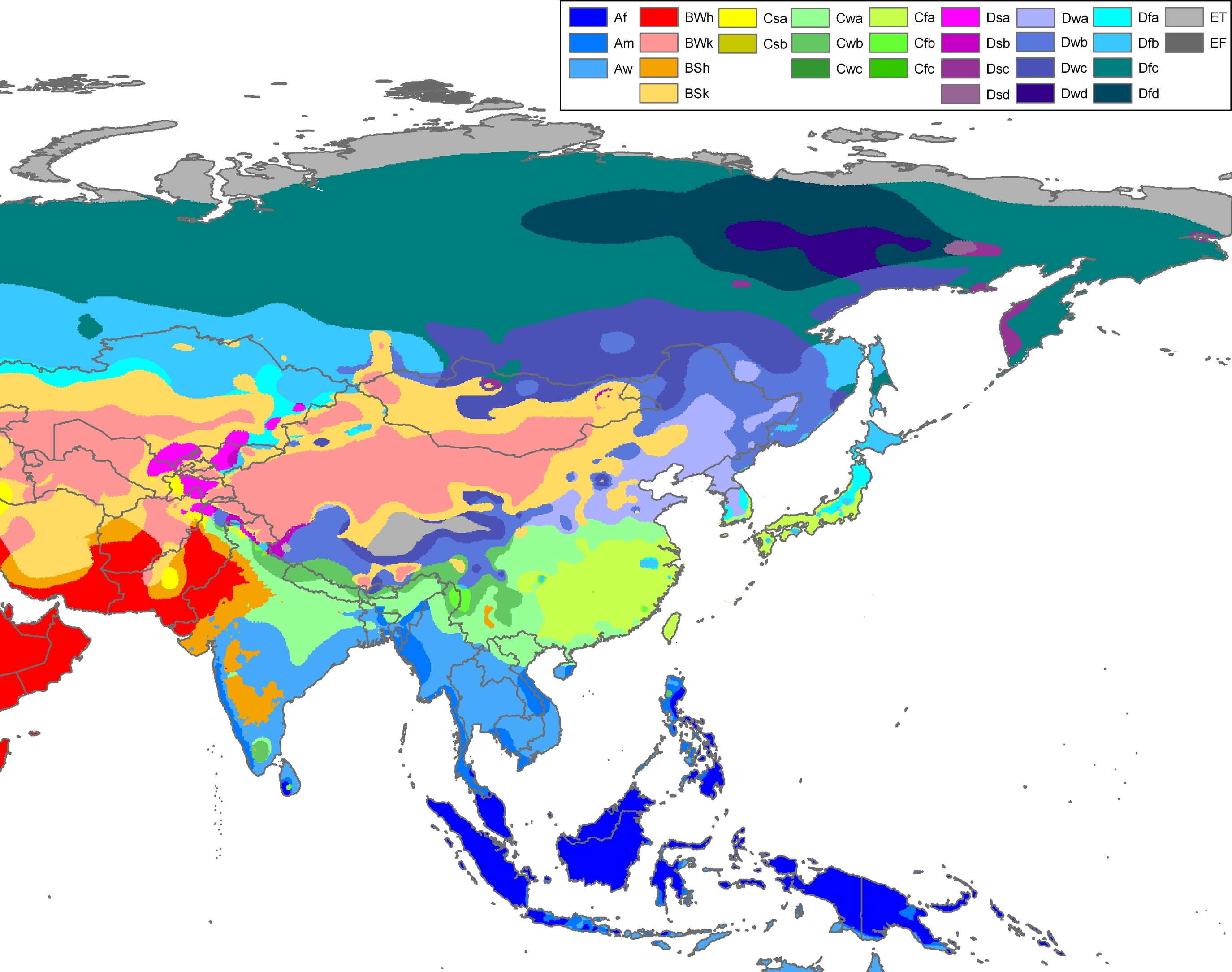
Xingtai has a continental, monsoon -influenced semi-arid climate (Köppen BSk ).[7] in ) per annum.
Climate data for Xingtai (1991–2014 normals, extremes 1971–2010)
Jan
Feb
Mar
Apr
May
Jun
Jul
Aug
Sep
Oct
Nov
Dec
Year
20.9
27.4
33.9
36.5
39.7
42.4
41.7
38.7
39.0
37.0
27.8
27.6
42.4
Mean daily maximum °C (°F)
3.9
8.2
14.7
21.9
27.6
32.3
32.4
30.7
26.8
21.2
12.4
5.5
19.8
−0.7
3.0
9.1
16.2
22.1
26.6
27.8
26.2
21.6
15.5
7.1
0.9
14.6
Mean daily minimum °C (°F)
−4.3
−1.0
4.4
10.9
16.7
21.4
23.7
22.4
17.3
10.8
3.0
−2.5
10.2
−20.2
−15.6
−10.9
−4.9
5.0
9.9
15.7
13.2
5.6
−1.7
−9.2
−17.4
−20.2
2.9
6.4
10.3
22.0
43.4
50.1
151.0
117.5
59.8
23.1
15.1
3.9
505.5
Average precipitation days (≥ 0.1 mm)
1.9
3.0
2.9
5.0
6.5
8.5
11.6
9.7
7.5
5.1
4.0
2.5
68.2
3.4
3.4
1.2
0.2
0
0
0
0
0
0
1.3
3.3
12.8
52
50
47
51
53
55
71
74
68
61
61
57
58
138.0
149.7
189.8
221.4
247.4
215.6
179.5
188.7
172
177.2
144.4
134.5
2,158.2
45
49
51
56
56
49
41
45
47
52
48
45
49
Source 2: Weather China[10]
Air quality [ edit ]
According to a survey made by "Global voices China" in February 2013, 7 cities in Hebei including Xingtai, Shijiazhuang , Baoding , Handan , Langfang , Hengshui and Tangshan , were among China's 10 most polluted cities; Xingtai ranked 1st in the list and had the worst air quality.[11]
Xingtai earthquake [ edit ]
A major earthquake, known as the Xingtai earthquake , with magnitude 6.8 on the Richter scale and epicenter in Longyao County occurred in the early morning of March 8, 1966. It was followed by 5 earthquakes above magnitude 6 on the Richter scale that lasted until March 29, 1966. The strongest of these quakes had a magnitude of 7.2 and took place in the southeastern part of Ningjin County on March 22. The earthquake damage included 8,064 dead, 38,000 injured and more than 5 million destroyed houses.[12]
Administrative divisions [ edit ]
Map including Xingtai (labeled as HSING-T'AI (SHUNTEH) 邢台 AMS , 1954)
Lincheng
Neiqiu
Baixiang
Longyao
Ningjin
Julu
Xinhe
Guangzong
Pingxiang
Wei
Qinghe
Linxi
Nangong(city)
Shahe(city)
Chinese
Pinyin
Population (2020)
Area (km 2
襄都区
Xiāngdū Qū
362,857
116
信都区
Xìndū Qū
798,770
1941
任泽区
Rènzé Qū
342,869
431
南和区
Nánhé Qū
350,384
405
临城县
Línchéng Xiàn
199,793
797
内丘县
Nèiqiū Xiàn
260,000
788
柏乡县
Bǎixiāng Xiàn
168,761
268
隆尧县
Lóngyáo Xiàn
480,447
749
宁晋县
Níngjìn Xiàn
745,389
1,032
巨鹿县
Jùlù Xiàn
346,007
631
新河县
Xīnhé Xiàn
134,095
366
广宗县
Guǎngzōng Xiàn
280,603
504
平乡县
Píngxiāng Xiàn
323,675
406
威县
Wēi Xiàn
496,230
994
清河县
Qīnghé Xiàn
421,582
500
临西县
Línxī Xiàn
326,968
542
南宫市
Nángōng Shì
396,718
861
沙河市
Shāhé Shì
431,746
859
Xingtai Economic Development Area
邢台经济开发区
Xíng Tái Jīng Jì Kāi Fā Qū
182,585
-
邢东新区
Xíng Dōng Xīn Qū
63,367
-
Xingtai Economic Development Area and Xingdong New Area belong to Xiangdu District.
Economy [ edit ]
Xingtai is the most important base for natural resources in North China, producing 20 million metric tonnes of coal annually. It also features the largest power plant in the southern part of this region of China, with an output of 2.06 GW [13]
Transport [ edit ]
Located on the Beijing−Guangzhou , the Beijing−Kowloon , the Xingtai-Huanghua and Xingtai-Heshun Railways, as well as the Beijing−Shenzhen , Daqing-Guangzhou, Taihangshan, Xingtai-Hengshui, Qingdao−Yinchuan , and Dongying-Lvliang Expressways and Xingtai Dalian Airport. Xingtai is a transport hub connecting the Eastern , Northern, and Central China .
Notable persons [ edit ]
See also [ edit ]
References [ edit ]
^ Song, Xiaoyan (October 11, 2018). "The Most Ancient White Porcelain in China" . China Today . Retrieved 3 March 2020 .
^ Song, Xiaoyan (April 12, 2013). "Significant Results from the Excavation of Xing Kiln Site in 2012" . Chinese Archaeology . Retrieved 3 March 2020 .
^ "Chinese Xingyao Museum" . Shijiazhuang Municipality Official Website . Retrieved 3 March 2020 .
^ "Xing Kiln Museum / YCA" . ArchDaily . May 29, 2019. Retrieved 3 March 2020 .
^ Peel, M. C. and Finlayson, B. L. and McMahon, T. A. (2007). "Updated world map of the Köppen-Geiger climate classification" . Hydrol. Earth Syst. Sci. 11: 1633-1644. ISSN 1027-5606 .
^ 中国气象数据网 – WeatherBk Data China Meteorological Administration . Retrieved 25 August 2023 .
^
"Experience Template" 中国气象数据网 (in Simplified Chinese). China Meteorological Administration . Retrieved 25 August 2023 .
^ 邢台 - 气象数据 -中国天气网 . Retrieved 29 November 2022 .
^ Bildner, Eli (27 February 2013). "Interactive Maps of China's Most–and Least–Polluted Places" . Global Voices China . newsmotion.org. Archived from the original on 3 September 2014. Retrieved 1 September 2014 .
^ "Major earthquakes on Chinese mainland since 1966" by the Consulate General of the People's Republic of China in Houston
^ 邢台市情介绍 . Retrieved 2011-05-20 .
External links [ edit ]
Wikimedia Commons has media related to
Xingtai .
Politics
Economy
North China Plain
Taihang Mountains
Yan Mountains
Shanhai Pass
Bohai Sea
Hai River watershed
Luan River watershed
Baiyangdian Lake
Hebei Normal University
Hebei Agricultural University
Hebei University of Technology
Hebei University of Economics and Business
Hebei University of Science and Technology
Northeastern University at Qinhuangdao
Music
Ping opera
Errentai
Chengde Mountain Resort
Eastern Qing Tombs
Western Qing Tombs
Anji Bridge
Hebei Museum
Dajingmen
Yuhua District
Luquan
Gaocheng
Luancheng
Jingxingkuang
Xinji city
Jinzhou city
Xinle city
Shenze County
Wuji County
Zhao County
Lingshou County
Gaoyi County
Yuanshi County
Zanhuang County
Pingshan County
Jingxing County
Zhengding County
Xingtang County
Lunan District
Guye District
Kaiping District
Fengrun District
Fengnan District
Caofeidian District
Zunhua city
Qian'an city
Luanzhou city
Luannan County
Laoting County
Qianxi County
Yutian County
Shanhaiguan District
Beidaihe District
Funing District
Changli County
Lulong County
Qinglong County
Hanshan District
Fuxing District
Fengfeng Mining District
Feixiang District
Yongnian District
Wu'an city
Linzhang County
Cheng'an County
Daming County
She County
Ci County
Qiu County
Jize County
Guangping County
Guantao County
Wei County
Quzhou County
Renze District
Xiangdu District
Xindu District
Nangong city
Shahe city
Lincheng County
Neiqiu County
Baixiang County
Longyao County
Ningjin County
Julu County
Xinhe County
Guangzong County
Pingxiang County
Wei County
Qinghe County
Linxi County
Xushui District
Dingzhou city
Zhuozhou city
Anguo city
Gaobeidian city
Yi County
Laiyuan County
Dingxing County
Shunping County
Tang County
Wangdu County
Laishui County
Gaoyang County
Quyang County
Fuping County
Boye County
Li County
Anxin County
Rongcheng County
Qiaodong District
Xuanhua District
Xiahuayuan District
Wanquan District
Chongli District
Zhangbei County
Kangbao County
Shangyi County
Guyuan County
Yu County
Yangyuan County
Huai'an County
Huailai County
Zhuolu County
Chicheng County
Shuangluan District
Yingshouyingzi Mining District
Pingquan city
Chengde County
Xinglong County
Luanping County
Longhua County
Fengning County
Kuancheng County
Weichang County
Xinhua District
Botou city
Renqiu city
Huanghua city
Hejian city
Cang County
Qing County
Dongguang County
Haixing County
Yanshan County
Suning County
Nanpi County
Wuqiao County
Xian County
Mengcun County
Guangyang District
Bazhou city
Sanhe city
Gu'an County
Yongqing County
Xianghe County
Dacheng County
Wen'an County
Dachang County
Jizhou District
Shenzhou city
Zaoqiang County
Wuyi County
Wuqiang County
Raoyang County
Anping County
Gucheng County
Jing County
Fucheng County
North China Oilfield single jurisdiction
Chuzhou
Fuyang
Suzhou
Lu'an
Bozhou
Chizhou
Xuancheng
★Xiamen
Putian
Sanming
Quanzhou
Zhangzhou
Nanping
Longyan
Ningde
Jiayuguan
Jinchang
Baiyin
Tianshui
Wuwei
Zhangye
Pingliang
Jiuquan
Qingyang
Dingxi
Longnan
Linxia (Hui)
Gannan (Tibetan)
★Shenzhen
Shaoguan
Zhuhai
Shantou
Foshan
Jiangmen
Zhanjiang
Maoming
Zhaoqing
Huizhou
Meizhou
Yangjiang
Shanwei
Heyuan
Qingyuan
Dongguan
Zhongshan
Jieyang
Yunfu
Liupanshui
Zunyi
Anshun
Bijie
Tongren
Qianxinan (Buyei and Miao)
Qiannan (Buyei and Miao)
Qiandongnan (Miao and Dong)
Sanya
Danzhou
Sansha
* Wuzhishan
* Qionghai
* Wenchang
* Wanning
* Dongfang
* Ding'an County
* Tunchang County
* Chengmai County
* Lingao County
* Baisha County (Li )
* Changjiang County (Li )
* Ledong County (Li )
* Lingshui County (Li )
* Baoting County (Li and Miao)
* Qiongzhong County (Li and Miao)
✧Tangshan
Qinhuangdao
Handan
Xingtai
Baoding
Zhangjiakou "Kalgan"
Chengde
Cangzhou
Langfang
Hengshui
Kaifeng
Luoyang
Pingdingshan
Anyang
Hebi
Xinxiang
Jiaozuo
Puyang
Xuchang
Luohe
Sanmenxia
Nanyang
Shangqiu
Xinyang
Zhoukou
Zhumadian
* Jiyuan
Huangshi
Shiyan
Yichang
Xiangyang
Ezhou
Jingmen
Xiaogan
Jingzhou
Huanggang
Xianning
Suizhou
Enshi (Tujia and Miao)
* Xiantao
* Qianjiang
* Tianmen
* Shennongjia Forestry District
Qiqihar
Jixi
Hegang
Shuangyashan
Daqing
Yichun
Jiamusi
Qitaihe
Mudanjiang
Heihe
Suihua
Daxing'anling Prefecture
Zhuzhou
Xiangtan
Hengyang
Shaoyang
Yueyang
Changde
Zhangjiajie
Yiyang
Chenzhou
Yongzhou
Huaihua
Loudi
Xiangxi (Tujia and Miao)
Jilin
Siping
Liaoyuan
Tonghua
Baishan
Songyuan
Baicheng
Yanbian (Korean)
Wuxi
Xuzhou
Changzhou
✧Suzhou
Nantong
Lianyungang
Huai'an
Yancheng
Yangzhou
Zhenjiang
Taizhou
Suqian
Jingdezhen
Pingxiang
Jiujiang
Xinyu
Yingtan
Ganzhou
Ji'an
Yichun
Fuzhou
Shangrao
★Dalian
Anshan
Fushun
Benxi
Dandong
Jinzhou
Yingkou
Fuxin
Liaoyang
Panjin
Tieling
Chaoyang
Huludao
Haidong
Haibei (Tibetan)
Huangnan (Tibetan)
Hainan (Tibetan)
Golog "Guolog" (Tibetan)
Yushu (Tibetan)
Haixi "Qaidam" (Mongol and Tibetan)
Zigong
Panzhihua
Luzhou
Deyang
Mianyang
Guangyuan
Suining
Neijiang
Leshan
Nanchong
Meishan
Yibin
Guang'an
Dazhou
Bazhong
Ziyang
Ya'an
Ngawa "Aba" (Tibetan and Qiang)
Garzê "Ganzi" (Tibetan)
Liangshan (Yi )
Tongchuan
Baoji
Xianyang
Weinan
Yan'an
Hanzhong
Yulin
Ankang
Shangluo
★Qingdao
Zibo
Zaozhuang
Dongying
Yantai
Weifang
Jining
Tai'an
Weihai
Rizhao
Linyi
Dezhou
Liaocheng
Binzhou
Heze
Datong
Yangquan
Changzhi
Jincheng
Shuozhou
Jinzhong
Yuncheng
Xinzhou
Linfen
Lüliang
Gaoxiong
Xinbei
Taizhong
Tainan
Taoyuan
Qujing
Yuxi
Baoshan
Zhaotong
Lijiang
Pu'er
Lincang
Chuxiong (Yi )
Honghe (Hani and Yi)
Wenshan (Zhuang and Miao)
Xishuangbanna (Dai)
Dali (Bai)
Dehong (Dai and Jingpo)
Nujiang (Lisu)
Dêqên (Tibetan)
★Ningbo
✧Wenzhou
Jiaxing
Huzhou
Shaoxing
Jinhua
Quzhou
Zhoushan
Taizhou
Lishui
Qinzhou
Guigang
Yulin
Baise
Hezhou
Hechi
Laibin
Chongzuo
Shizuishan
Wuzhong
Guyuan
Zhongwei
✧Baotou
Wuhai
Chifeng "Ulankhad"
Tongliao
Ordos
Hulunbuir
Bayannur "Bayannao'er"
Ulanqab
Hinggan League
Xilingol League
Alxa League "Ālāshàn League"
Karamay
Turpan
Hami
Changji (Hui)
Bortala (Mongol)
Bayingolin (Mongol)
Kizilsu (Kyrgyz)
( ☆Ili (Kazakh)
Tacheng Prefecture
Altay Prefecture )
Aksu Prefecture
Kashgar "Kashi" Prefecture
Hotan Prefecture
* Shihezi
* Aral
* Tumxuk
* Wujiaqu
* Beitun
* Tiemenguan
* Shuanghe
* Kokdala
* Kunyu
* Huyanghe
* Xinxing
Shigatse "Xigazê"
Chamdo "Qamdo"
Nyingchi "Linzhi"
Shannan
Nagqu
Ngari Prefecture
Macau
VIAF
R e t r i e v e d f r o m " https://en.wikipedia.org/w/index.php?title=Xingtai&oldid=1210023270 " C a t e g o r i e s : ● X i n g t a i ● C i t i e s i n H e b e i ● P r e f e c t u r e - l e v e l d i v i s i o n s o f H e b e i H i d d e n c a t e g o r i e s : ● P a g e s u s i n g g a d g e t W i k i M i n i A t l a s ● C S 1 u s e s C h i n e s e - l a n g u a g e s c r i p t ( zh ) ● C S 1 S i m p l i f i e d C h i n e s e - l a n g u a g e s o u r c e s ( z h - h a n s ) ● C S 1 C h i n e s e - l a n g u a g e s o u r c e s ( zh ) ● W i k i p e d i a a r t i c l e s i n n e e d o f u p d a t i n g f r o m J u n e 2 0 2 0 ● A l l W i k i p e d i a a r t i c l e s i n n e e d o f u p d a t i n g ● A r t i c l e s w i t h s h o r t d e s c r i p t i o n ● S h o r t d e s c r i p t i o n i s d i f f e r e n t f r o m W i k i d a t a ● A r t i c l e s c o n t a i n i n g C h i n e s e - l a n g u a g e t e x t ● C o o r d i n a t e s o n W i k i d a t a ● A r t i c l e s c o n t a i n i n g s i m p l i f i e d C h i n e s e - l a n g u a g e t e x t ● A r t i c l e s c o n t a i n i n g t r a d i t i o n a l C h i n e s e - l a n g u a g e t e x t ● P a g e s u s i n g t e m p l a t e Z h w i t h s u p t a g s ● A l l a r t i c l e s w i t h u n s o u r c e d s t a t e m e n t s ● A r t i c l e s w i t h u n s o u r c e d s t a t e m e n t s f r o m O c t o b e r 2 0 1 1 ● C o m m o n s c a t e g o r y l i n k i s o n W i k i d a t a ● A r t i c l e s w i t h F A S T i d e n t i f i e r s ● A r t i c l e s w i t h V I A F i d e n t i f i e r s ● A r t i c l e s w i t h L C C N i d e n t i f i e r s ● A r t i c l e s w i t h M u s i c B r a i n z a r e a i d e n t i f i e r s ● P a g e s u s i n g t h e K a r t o g r a p h e r e x t e n s i o n
● T h i s p a g e w a s l a s t e d i t e d o n 2 4 F e b r u a r y 2 0 2 4 , a t 1 6 : 4 5 ( U T C ) . ● T e x t i s a v a i l a b l e u n d e r t h e C r e a t i v e C o m m o n s A t t r i b u t i o n - S h a r e A l i k e L i c e n s e 4 . 0 ;
a d d i t i o n a l t e r m s m a y a p p l y . B y u s i n g t h i s s i t e , y o u a g r e e t o t h e T e r m s o f U s e a n d P r i v a c y P o l i c y . W i k i p e d i a ® i s a r e g i s t e r e d t r a d e m a r k o f t h e W i k i m e d i a F o u n d a t i o n , I n c . , a n o n - p r o f i t o r g a n i z a t i o n . ● P r i v a c y p o l i c y ● A b o u t W i k i p e d i a ● D i s c l a i m e r s ● C o n t a c t W i k i p e d i a ● C o d e o f C o n d u c t ● D e v e l o p e r s ● S t a t i s t i c s ● C o o k i e s t a t e m e n t ● M o b i l e v i e w


