Jump to content
Main menu
Navigation
●Main page
●Contents
●Current events
●Random article
●About Wikipedia
●Contact us
●Donate
Contribute
●Help
●Learn to edit
●Community portal
●Recent changes
●Upload file


Search
●Create account
●Log in
●Create account
● Log in
Pages for logged out editors learn more
●Contributions
●Talk
(Top)
1
Geography
1.1
Departmental boundaries
2
See also
3
References
Yí River
●Català
●Cebuano
●Deutsch
●Español
●فارسی
●Français
●Hrvatski
●Italiano
●ქართული
●Lietuvių
●Македонски
●Nederlands
●Polski
●Português
●Русский
●Srpskohrvatski / српскохрватски
●Тоҷикӣ
●Українська
●中文
Edit links
●Article
●Talk
●Read
●Edit
●View history
Tools
Actions
●Read
●Edit
●View history
General
●What links here
●Related changes
●Upload file
●Special pages
●Permanent link
●Page information
●Cite this page
●Get shortened URL
●Download QR code
●Wikidata item
Print/export
●Download as PDF
●Printable version
In other projects
●Wikimedia Commons
Appearance
Coordinates: 33°6′50″S 57°6′46″W / 33.11389°S 57.11278°W / -33.11389; -57.11278[2]
From Wikipedia, the free encyclopedia
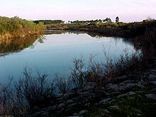 The Yí River
The Yí River (Spanish, Río Yí)[1] is a river in Uruguay. The Yí and the Tacuarembó Rivers are the principal tributaries of the Río Negro.
Geography
[edit]
The Yí River originates in the Cuchilla Grande highlands. It flows generally west through central Uruguay to the Río Negro.
Various other rivers, including the Porongos River and Chamangá River, are tributaries of the Yí River.
Departmental boundaries
[edit]
The Yí forms much of the boundary between Durazno Department and Florida Department.
Subsequently, it forms part of the boundary between Durazno Department and Flores Department, where the Chamangá River its tributary.
See also
[edit]
33°6′50″S 57°6′46″W / 33.11389°S 57.11278°W / -33.11389; -57.11278[2]
References
[edit]
t
e
Retrieved from "https://en.wikipedia.org/w/index.php?title=Yí_River&oldid=961485531"
Categories:
●Rivers of Uruguay
●Tributaries of the Uruguay River
●Rivers of Durazno Department
●Rivers of Florida Department
●Rivers of Flores Department
●South America river stubs
●Uruguay geography stubs
Hidden categories:
●Pages using gadget WikiMiniAtlas
●Articles with short description
●Short description matches Wikidata
●Coordinates on Wikidata
●All stub articles
●This page was last edited on 8 June 2020, at 19:10 (UTC).
●Text is available under the Creative Commons Attribution-ShareAlike License 4.0;
additional terms may apply. By using this site, you agree to the Terms of Use and Privacy Policy. Wikipedia® is a registered trademark of the Wikimedia Foundation, Inc., a non-profit organization.
●Privacy policy
●About Wikipedia
●Disclaimers
●Contact Wikipedia
●Code of Conduct
●Developers
●Statistics
●Cookie statement
●Mobile view


