Jump to content


Main menu


Navigation  


Main page
Contents
Current events
Random article
About Wikipedia
Contact us
Donate


Contribute  


Help
Learn to edit
Community portal
Recent changes
Upload file


Search  


Create account

Log in


Create account
 Log in


Pages for logged out editors learn more  


Contributions
Talk


Contents


(Top)


1 Notes  


Yeşilırmak (river)


Azərbaycanca
تۆرکجه
Български
Català
Cebuano
Čeština
Deutsch
Ελληνικά
Español
Esperanto
فارسی
Français
Հայերեն
Italiano
עברית

Қазақша
Кырык мары
Lietuvių

مصرى
Norsk bokmål
Norsk nynorsk
Polski
Português
Română
Русский
Slovenčina
Тоҷикӣ
Türkçe
Удмурт
Українська


Edit links


Article
Talk


Read
Edit
View history


Tools


Actions  


Read
Edit
View history


General  


What links here
Related changes
Upload file
Special pages
Permanent link
Page information
Cite this page
Get shortened URL
Download QR code
Wikidata item


Print/export  


Download as PDF
Printable version


In other projects  


Wikimedia Commons


Appearance


Coordinates: 41°2254N 36°3937E / 41.3816°N 36.6603°E / 41.3816; 36.6603
 

From Wikipedia, the free encyclopedia
 

(Redirected from Yeşilırmak River)

Yeşilırmak River
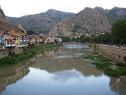
Yeşilırmak River in Amasya
Map of Yeşilırmak
Location
CountryTurkey
Physical characteristics
Source 
 • locationSivas
Mouth 

 • location

Black Sea

 • coordinates

41°22′54N 36°39′37E / 41.3816°N 36.6603°E / 41.3816; 36.6603

 • elevation

0 m (0 ft)
Length418 km (260 mi)

Yeşilırmak (Turkish: Yeşilırmak, lit.'green river'), known as Iris in antiquity (Ancient Greek: Ἶρις), is a river in northern Turkey. From its source northeast of Sivas, it flows past Tokat and Amasya, crosses the Pontic Mountains and the Çarşamba Plain, reaching the Black Sea east of Samsun after 418 km (260 mi).

Its tributaries include the Çekerek (ancient Scylax) and the Kelkit (ancient Lycus).

It was mentioned by Menippus of Pergamon in the 1st century BC.[1][2]

Strabo's Geographica describes it as flowing through Comana Pontica, the plain of Dazimonitis (Kaşova) (40°17′41N 36°17′48E / 40.2947808°N 36.296736°E / 40.2947808; 36.296736), and Gaziura (probably modern Turhal)[3] before receiving the waters (40°33′42N 35°45′34E / 40.5615797°N 35.7595217°E / 40.5615797; 35.7595217) of the Scylax, then flowing through Amaseia (Amasya) before reaching the valley of Phanaroea.[4]

Starting with Dionysius Periegetes, in his Periegesis of the World, the Iris is often confused with the Thermodon (modern Terme), which also crosses the Themiscyra Plain (modern Çarşamba Plain), with its mouth about 40 km further east; the Thermodon is much smaller and clearer.[5]

Notes[edit]

  1. ^ Serena Bianchetti, Michele Cataudella, Hans-Joachim Gehrke, [Brill's Companion to Ancient Geography: The Inhabited World in Greek and Roman Tradition (BRILL, 4 Dec 2015) p 263.
  • ^ Georgia L. IrbyGeorgia L. Irby, A Companion to Science, Technology, and Medicine in Ancient Greece and Rome, 2 Volume Set (John Wiley & Sons, 2016) p 865.
  • ^ Phytoplankton and seasonal variations of the River Yeşilırmak, Amasya, Turkey (9 May 2003)
  • ^ Strabo 12:3:15 at Perseus
  • ^ Tønnes Bekker-Nielsen, Marit Jensen, "Two Pontic Rivers", Cedrus: The Journal of MCRI 3:231-2142 (2015), doi:10.13113/CEDRUS.2015011411

  • t
  • e
  • t
  • e

  • Retrieved from "https://en.wikipedia.org/w/index.php?title=Yeşilırmak_(river)&oldid=1180826215"

    Categories: 
    Rivers of Turkey
    Black Sea Region
    Landforms of Sivas Province
    Landforms of Tokat Province
    Landforms of Amasya Province
    Landforms of Samsun Province
    Black Sea Region geography stubs
    Turkey river stubs
    Hidden categories: 
    Pages using gadget WikiMiniAtlas
    Articles with short description
    Short description is different from Wikidata
    Coordinates on Wikidata
    Articles containing Turkish-language text
    Articles containing Ancient Greek (to 1453)-language text
    Commons category link is on Wikidata
    Articles with VIAF identifiers
    Articles with J9U identifiers
    Articles with LCCN identifiers
    All stub articles


    This page was last edited on 19 October 2023, at 02:33 (UTC).

    Text is available under the Creative Commons Attribution-ShareAlike License 4.0; additional terms may apply. By using this site, you agree to the Terms of Use and Privacy Policy. Wikipedia® is a registered trademark of the Wikimedia Foundation, Inc., a non-profit organization.


    Privacy policy

    About Wikipedia

    Disclaimers

    Contact Wikipedia

    Code of Conduct

    Developers

    Statistics

    Cookie statement

    Mobile view


    Wikimedia Foundation
    Powered by MediaWiki