
アダムズ山 (ワシントン州)
| アダムズ山 Mount Adams | |
|---|---|
 アダムズ山、1999年撮影 | |
| 最高地点 | |
| 標高 | 12,281 ft (3,743 m) [1] |
| プロミネンス | 8,116 ft (2,474 m) [2] |
| 座標 | 北緯46度12分09秒 西経121度29分27秒 / 北緯46.202411792度 西経121.490894694度座標: 北緯46度12分09秒 西経121度29分27秒 / 北緯46.202411792度 西経121.490894694度 [1] |
| 地形 | |
 アダムズ山 ワシントン州におけるアダムズ山の位置  アダムズ山 アダムズ山 | |
| 所在地 | ワシントン州ヤキマ郡 / スカマニア郡 |
| 所属山脈 | カスケード山脈 |
| 地形図 | USGS Mount Adams East |
| 地質 | |
| 岩石の年代 | 275,000 年未満 |
| 山の種類 | 成層火山 |
| 火山弧 | カスケード火山弧 |
| 最新の噴火 | 西暦950年頃 |
| 登山 | |
| 初登頂 | 1854年、A・G・エイケンと登山隊 |
| 最容易 ルート | サウス・クライム・トレイル第183号 |
アダムズ山︵アダムズさん、英: Mount Adams︶は、アメリカ合衆国北西部のカスケード山脈にある、活火山の可能性がある[3]成層火山である。ワシントン州ではレーニア山に次いで2番目に高い山である[4]。カスケード火山弧に入っており、この弧では最大の火山である[5]。セント・ヘレンズ山の東31マイル (50 km) の遠隔原生地の中にある[6]。アダムズ山原生地はこの山の上部と西部で構成されている。東側はヤカマ族インディアン居留地に入る[7]。
アダムズ山の非対称形で幅広い山体はカスケード山脈より1.5マイル (2,400 m) 高い。ほぼ平坦な山頂は異なる火道からの円錐形成噴火の結果として形成された。この地域上空を移動する人は、同じように平坦な山頂をしているレーニア山とアダムズ山を混同することもある。
パシフィック・クレスト・トレイルがアダムズ山の西斜面を通っている[8][9]。アダムズ山は1400年以上噴火していないが、死火山とは考えられていない。

アダムズ山頂上付近

アダムズ氷河、ハイキャンプから見る
氷河という形で形成された氷はアダムズ山上部約 6.2平方マイル (16.1 km2) を覆っている。氷が溶けた水や雨は緩りと多孔質の山塊内部に浸透し、麓近くにある泉から湧き出ている。
氷河はアダムズ山表面の2.5%を覆っているだけだが、最終氷期には約90%が氷に覆われていた。万年雪は209か所あり、公式の名前を持つ氷河は12ある。氷に覆われた表面の総計は 24 km2 あり、実際に名付けられた氷河の面積は 20 km2 ある[11]。残っている大型氷河の大半︵アダムズ、クリッキタト、ライマン、ホワイトサーモンの各氷河︶は頂上の氷冠から出たものである。山の北西面にあるアダムズ氷河は一連の氷瀑にある険しい溝を流れ降り、その後広がって標高7,000フィート (2,100 m) で終わる。そこからシスパス川の支流であるアダムズ・クリークが始まる。東側の斜面は小さな氷湖であるエクストリア湖で終わる。東斜面にあるクリッキタト氷河は幅1マイル (1.6 km) の圏谷に始まり、頂部の氷冠から出た小さな氷河2個から氷が供給される。標高約6,600フィート (2,000 m) で止まり、クリッキタト川の支流であるビッグマッディ・クリークの水源となる。カスケード山脈の中で、アダムズ氷河はレーニア山のカーボン氷河に次いで第2位の大きさである[12]。

アダムズ氷河の深いクレバスと氷瀑
西斜面にあるピナクル氷河、ホワイトサーモン氷河、アバランシェ氷河は厚さが薄く量が少ない。外観はつぎはぎである。真頂上の下の圏谷から発している。南面のサクスドーフ尾根に沿ったところはほとんど氷河が無い。比較的小さなゴッチェン氷河とクレセント氷河があるのみである。しかし、南面にはその斜面に万年雪の原が幾つかある。岩がちな東面には4つの氷河がある。すなわちマザマ氷河、クリッキタト氷河、ラスク氷河、ウィルソン氷河である。最終氷期にこれらがヘルロアリング・キャニオンとアバランシェ・バレーという2つの大きな峡谷を造った。北面はアダムズ氷河、ラバ氷河、ライマン氷河という3つの大きな氷河がある。アダムズ、ライマン各氷河は頂上の氷冠から滝のように落ちるときに深いクレバスと多くの氷瀑を造っている。ラバ氷河は頂上下の大きな圏谷から発し、東のノース・クリーバーと西のアダムズ尾根に挟まれている[13]。
アダムズ山の氷河面積は1904年の31.5 km2 から2006年の16.2 km2 まで49%減った[14]。

コロンビア川渓谷越しにアダムズ山の南面を望む
アダムズ山の周辺には他の火山性の地形や火山そのものがある。最大の側面火山はゴートビュートと呼ばれる東面にある玄武岩質楯状火山である。少なくとも15万年前に形成されたものである。
南東面のリッジ・オブ・ワンダーズの上には対象形の噴石丘であるリトル・アダムズ山がある[15]。
ポテトヒルは北面にある噴石丘であり、更新世後期に形成され、溶岩面から800フィート (240 m) 立ち上がっている[16]。その基底から流れた溶岩はシスパス・バレーに入り、後に氷河によって形を変えられた。アダムズ山南面の標高7,500フィート (2,300 m) にはサウスビュートがある。ここの溶岩はサクスドーフ尾根のものより若いが、氷河期末以前に置かれたものである[16]。

トラウト湖︵トラウト湖クリーク︶に映るアダムズ山
アダムズ山の北、数マイルにはゴートロックス原生地があり、アダムズ山よりかなり古く浸食が進んだ成層火山の残骸である。アダムズ山とは異なり、ゴートロックスは周期的に噴火し、250万年前の火山灰を積もらせ、それが固化して厚さ2,100フィート (640 m) の凝灰岩層になっている[17]。
さらにインディアン・ヘイブン原生地の最高峰であるレミーロックはアダムズ山から西にセントヘレンズ山に向かうマグマの動きに関わった火山域である。
アダムズ山の周辺で、不活性な溶岩道の周りに多くの地下洞窟が形成されてきた。これら洞窟は地表に近く、数百フィートの深さや幅であることが多い[18]。
ハイライン・トレイルがアダムズ山を囲んでおり、約35マイル (56 km) の長さがある[19]。このトレイルは﹁アラウンド・ザ・マウンテン﹂トレイルとも呼ばれる。そのうち8マイル (13 km) はヤカマ・インディアン居留地に入っており、特別許可を必要とする[19]。また一部はパシフィック・クレスト・トレイルに重なっている。

アダムズ山麓のタクタク溶岩流
アダムズ山は南北軸が長い直径18マイル (29 km) の基底に何層かの円錐が重なって形成され、投影面積は250平方マイル (650 km2) ある。この火山は容積85立方マイル (350 km3) あり、カスケード山脈の成層火山ではシャスタ山についで第2位である[5]。太平洋岸北西部海岸沖にあるファンデフカプレートの沈み込みによって造られた可能性がある。
更新世でも比較的後期に生まれており、幾つか溶岩を押し出す噴火によって成長した。それぞれの噴火は長い休眠期間によって隔てられて起こり、その間に氷河が侵食して9,000フィート (2,700 m) 以下の高さにしていた。カリウム-アルゴン法によって噴火の時期を2つ特定している。1つは275,000年から200,000年前に、もう1つは150,000年から100,000年前に起こった。これら噴火の大半、それ故に火山活動の大半はテフラの少ない溶岩流だった。アダムズ山の中核を作り上げている物質は角礫岩の溶岩である[5]。
安山岩と玄武岩が流れてアダムズ山の基底周辺に厚さ20ないし200フィート (6 - 60 m) の円盤を形成し、そのときにあった低地を埋め、バレーに広がった。火山の大半は安山岩であり、アダムズ山成長の初期に噴出していた幾らかのデイサイトや火砕流が入っていた。現在の円錐は最終氷期に頂部が氷河に覆われたときに形成された。噴出した溶岩は氷に触れたときに粉砕されており、それ故に円錐の内部はたやすく浸食される安山岩の破片でできている。その形成以来、常に熱と腐食性ガスを放出したので、岩の多くを粘土︵大半はカオリナイト︶、酸化鉄、硫黄分の多い化合物、および石英に変えた[20]。
現在、標高7,000フィート (2,100 m) より上にある円錐部は25,000年から10,000年前に形成された。その時から少なくとも7回は噴火しており、その全ては頂上から6,500フィート (1,980 m) 以上を形成した。最近の溶岩流はサウスビュートからであり、長さ4.5マイル (7.2 km) 、幅0.5マイル (0.8 km) のA・G・エイケン溶岩ベッドを形成した。この溶岩流は若く見えるが、セントヘレンズ山から放出された3,500年前の灰を乗せており、少なくとも3,500年以上経っていることがわかる。アダムズ山から噴出したことが分かっている最後の溶岩は、2,500年から3,500年前のマッディ・フォーク溶岩流である[3]。

セントヘレンズ山から見たアダムズ山
トラウト湖マッドフローは、アダムズ山から最新の大きな土石流であり、最終氷期以降唯一の大きなものである。このフローがトラウト湖の堤を作り、ホワイトサーモン川バレーの25マイル (40 km) を覆った。堰き止められた水がトラウト湖となった。1921年の大地すべりはホワイトサーモン氷河の上部付近に始まり、有史のアダムズ山では最大の雪崩となった。この雪崩は約1マイル (1.6 km) 滑落し、ソルト・クリーク上流の約1平方マイル (2.6 km2) を覆った。この雪崩のときに蒸気道が3年間活動していたとされており、小さな蒸気爆発で雪崩が誘発されたと考えられている[20]。これがアダムズ山で記録にある唯一の土石流だが、火山泥流は5度起きたことが分かっている[21]。
その時から熱的異常︵温点︶とガス放出︵硫化水素など︶が、特に頂部台地で起きており、アダムズ山が休眠中であり、死火山ではないことを示している。今後噴火があるとすれば、従来のパターンを踏襲すると思われ、安山岩あるいは玄武岩の溶岩流が側面に降ると考えられる。主円錐部の中は砕片化された溶岩と熱水的に変化した岩の積層に過ぎないので、大規模な地滑りや土石流の可能性がある[20]。
インディアン・ヘイブン火山域はセントヘレンズ山とアダムズ山の間にある。その主たる様相は長さ18マイル (29 km) におよぶ楯状火山、噴石丘、溶岩流の帯であり、体積は23立方マイル (96 km3) ある。この火山域の背骨となる楯状火山は火山域の北側と南側にある。セントヘレンズ山とアダムズ山は西側と東側にある[12]。

アダムズ山原生地の草原
アダムズ山の西面は、ギフォード・ピンチョー国立の森に入るアダムズ山原生地である。その東側はヤカマ族インディアン居留地に入っている。この原生地はハイキング、バックパッキング、登山、乗馬などに開放されている。ある程度の高度以上では、アメリカ合衆国森林局の﹁ボルケイノ・パス﹂を受ける必要がある。
ヤカマ族インディアン居留地のある地域はレクリエーションに開放されているが、その他は部族員のみが利用できる。
コンボイ湖国定野生生物保護区がアダムズ山麓にある。この保護区の広さは6,500エーカー (26 km2) あり、針葉樹林、草原、浅い湿地がある。保護される野生生物としては、鹿、エルク、ビーバー、コヨーテ、カワウソ、小型のネズミ、ハクトウワシ、大型のカナダヅル、オレゴンマダラカエルなどがいる[22]。
山の斜面ではエルクが普通に見られ、クズリが見られることもある[23]。
ビッグツリー︵トラウト湖ビッグツリーとも呼ばれる︶が、アダムズ山南部麓の壮大で原生の松と樅の林にある巨大なポンデローサ松である[24]。樹高は202フィート (62 m) に達し[25]、幹の太さは7フィート (2.1 m)[26]、世界でも最大級のポンデローサ松とされている[24]。

トラウト湖ハイウェイから見たアダムズ山
地域のインディアンは、コロンビア川を守る3つの﹁煙を吐く山﹂に関する伝説があった。﹁神の橋﹂伝説に拠れば、ワイイースト︵フッド山︶とパート︵アダムズ山、インディアンはパッドあるいはクリッキタトと呼んだ︶が、﹁大いなる神秘﹂の息子達である。この兄弟は共に美しいラワラクロー︵セントヘレンズ山︶の愛を競った。ラワラクローがパートを選んだとき、ワイイーストはその兄弟を激しく殴ったので、パートの頭が平らになり、ワイイーストがラワラクローを奪った。これがアダムズ山のしゃがんでいるような外観を説明している。この話の別の形では、ラワラクローを失ったことで、パートは悲しみに沈み、恥じて頭を落としたとしている[27][28][29]。
1805年、ルイス・クラーク探検隊が、この山を見たことを記録した。彼らはそれが以前に発見して名付けていたセントヘレンズ山だと見誤っていた。これがヨーロッパ系の探検家によるアダムズ山の最初の記録である[30]。
1830年から1834年、ホール・J・ケリーがカスケード山脈をプレジデントの山脈と改名する運動を行い、山脈にある主な山も大統領の名前を付けようとした。アダムズ山についてケリーは知らず、その計画に入っていなかった。フッド山は実際にケリーがジョン・アダムズ大統領に因んで改名しようとしたが、地図制作者の誤りでアダムズ山をフッド山の北、セントヘレンズ山の東40マイル (64 km) に据えた。偶然の一致でその場所には名前を与えられるだけの大きな山があった。当時この山には公式の名前が無かったので、ケリーの付けた名前が付けられた。ただし他の山の改名は失敗した[31]。
1901年、地元の開拓者で登山家のC・E・ラスクが、著名な氷河学者ハリー・リードをアダムズ山の場所に案内した。リードはこの火山の体系的な研究を初めて行い、重要な氷河に名前を付けた[32]。
1929年と1931年、ウェイド・ディーンが、アダムズ山頂台地210エーカー (0.8 km2) で硫黄の採掘権を申請した。馬とラバの道を建設した後、ダイアモンド工具を付けた掘削機を頂上に運び上げ、テスト坑を掘った。硫黄の汚泥は見つかったが、利益を出すには量と質が悪く、1959年に計画を放棄した。商業的鉱山師が頂上を掘削したことではカスケード山脈唯一の火山になった[21]。

ハイキャンプ︵アダムズ氷河草地、氷河盆地とも呼ばれる︶、アダムズ 氷河は頂上氷冠から岩の傾斜台を滑り落ちる

アダムズ山北西面を下るアダムズ氷河

アダムズ山北西面のタクラク湖
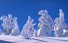
アダムズ山の屈曲した低木についた樹氷
冬のレクリエーションでは、アダムズ山の南面にスノーモービルやクロスカントリースキーで人気のあるワシントン州のスノー公園が多くある。南斜面にはスノーキング、パインサイド、スミスビュートと3か所のスノー公園がある。特にA・G・エイケン溶岩ベッドはスノーモービルやスキーに人気がある。森林サービスの冬季予算に余裕がある限り、アダムズ山レクリエーション・ハイウェイは標高3,000フィート (900 m) にあるパインサイドやスノーキングの公園まで雪掻きされている。標高約4,000フィート (1,200 m) のスミスビュートは、雪が少ない年のみ行くことができる[49]。
地理[編集]

頂上付近[編集]
アダムズ山頂の平坦さは、伝説とは異なり、頂部が飛ばされたからではない。異なる火道からの円錐形成噴火の結果として形成された。偽の山頂が、半マイル (800 m) 近い幅のある頂部の南側に、高さ11,500フィート (3,510 m) で聳えている。真の頂上は約800フィート (240 m) 高く、北側にある穏やかな斜面の上にある。小さな溶岩の円錐が最高地点になっている。サクスドーフ尾根は長い壁であり、偽頂上から標高8,000フィート (2,440 m) まで降っている。この構造は更新世後期に繰り返し溶岩が流れて形成された。偽頂上の北西にあるピナクルはアダムズ氷河とホワイトサーモン氷河の浸食によって形成された。頂部のクレーターは雪で埋まっており、西部に口が開いている[5]。アダムズ山の頂上から晴れた日に見えるカスケード山脈の峰としては、北のレーニア山、南のオレゴン州にあるフッド山とジェファーソン山、西のセントヘレンズ山がある[10]。氷河[編集]


周辺地域[編集]


地質[編集]


原生地と野生動物[編集]

歴史[編集]

レクリエーション[編集]
カスケード山脈にある多くの火山と同様に、アダムズ山では登山、ハイキング、バックパッキング、ベリー摘み、キャンプ、ボート、釣り、筏乗り、写真撮影、野生生物観察、景観道のドライブなど多くのレクリエーションを楽しむことができる[33] 。登山[編集]
毎年多くの人がアダムズ山登頂を目指す。氷河や険しさによって多くの登山道でアイゼンやピッケルが必要になる。夏の南面はブーツとスキーストックがあれば容易に登ることができる。大きな障害は固定されていない岩であり、容易に動かせるので下から来る登山者には危険である。アダムズ山登山は様々な理由で危険なものになることがあり、死亡事故もありうる[34]。ハイキング[編集]
西斜面にあるアダムズ山原生地は広さが46,353エーカー (185 km2) あり、ハイカーには様々な可能性がある。原生地のトレイルは東側の乾燥した森や西側の湿気た森を通り、アダムズ山や氷河の絶景を楽しみ、水流、開けた高山林、草原を巡り、様々な野草が溶岩流や縁辺岩の間に点在するのを楽しむ[35]。アダムズ山原生地のハイキング[編集]
多くのトレイルがアラウンド・ザ・マウンテン・トレイルにアクセスしている。南面ではショートホーン・トレイルがモリソン・クリーク・キャンプ場近くからスタートし、サウス・クライム・トレイルはコールド・スプリングス・キャンプ場をスタートしてサウス・スパーに向かう人気のある登山道である。西面では3つの登山道がある。スタグマン尾根トレイル、パシフィック・クレスト・トレイル、ライリー・クリーク・トレイルである。北面ではディバイド・キャンプ、キルン・クリーク、マッディメドウズの各トレイルがあり、ここでもパシフィック・クレスト・トレイルが下山道になっている。これらのトレイルは概して3マイル (5 km) から6マイル (10 km) の間に1,500ないし3000フィート (450 m - 900 m) 登ることになる。これらは初冬から初夏までほとんど雪に覆われている。その他人気のあるトレイルはルッキンググラス湖トレイル、ハイキャンプ・トレイル第10、ソルト・クリーク・トレイル第75、クロフトン・ビュート・トレイル第73、ライリー・コネクター・トレイル第64Aがある[36]。
アダムズ山レクリエーション地域のハイキング[編集]
南東面にあるアダムズ山レクリエーション地域では、バード・クリーク草原が野草の見事さで知られるピクニックとハイキングの適地になっている[37]。またアダムズ山とその氷河や南のフッド山も眺められる[38]。ヘルロアリング展望台に行くと、約1,000フィート (300 m) 下に開けるヘルロアリング草原や氷河バレーを見られる。ここから5,800フィート (1,800 m) 上のアダムズ山、クリッキタト氷河を望むことができ、氷河端部から下にある高い崖から落ちる様々な滝がある[39]。バード・クリーク草原には花のトレイルなど多くの巡回トレイルがある。草原、水流、クルックド・クリーク滝などの滝を巡る道もある[40][41]。標高6,821フィート (2,079 m) のリトル・アダムズ山は、ワンダーズ尾根の上にある対象形の噴石丘であり、ヘルロアリング草原やヘルロアリング・クリーク・バレーの北東端から立ち上がっている。山の東麓に続くトレイルがある。頂上に行くには岩がちの地形を通らなければならない。ハイカーが造ったトレイルもある[42]。人気のある地域[編集]
アダムズ山には人気のある地域が2つある。ミッドウェイ・ハイレイクス地域とヤキマ族アダムズ山レクリエーション地域である。ミッドウェイ・ハイレイクス地域ではタクラク湖が最も人気のある場所であり、アダムズ山レクリエーション地域ではバード・クリーク草原の人気が高い[43]。
ミッドウェイ・ハイレイクス地域[編集]
アダムズ山に近いキャンプ場は夏の雪が無い季節には自由に使える。タクラク湖キャンプ場などこの地域にあるキャンプ場は湖の向こうにアダムズ山を見られる。オラリー湖ホースシュー湖、キルン・クリーク、カウンシル湖、キーンズホース・キャンプなどがある。アダムズ・フォーク・キャンプ場とツインフォールズ・キャンプ場はルイス川とシスパス川沿いにある[44]。ミッドウェイ・ハイレイクス地域に入る湖の大半からはアダムズ山と氷河が見える[45]。アダムズ・フォーク・キャンプ場、キャット・クリーク・キャンプ場、ツインフォールズ・キャンプ場はアダムズ山に近く、かつ景観の良いルイス川やシスパス川に沿っているキャンプ場の1つである。
アダムズ山レクリエーション地域[編集]
南東面にあるアダムズ山レクリエーション地域では、ハイキング、キャンプ、ピクニック、釣りなどができる。バード・クリーク草原が野草の見事さで知られるピクニックとハイキングの適地になっている[46]。またアダムズ山とその氷河の絶景や南のフッド山も眺められる[47]。 ここにはキャンプ場が3か所ある。バード湖、ミラー湖、ベンチ湖である。アダムズ山レクリエーション・ハイウェイを通りトラウト湖から行くことができる。林道82号線を北東に、林道8225銭に移り、部族道路285号線︵ベンチ湖道路︶、バード・クリーク草原パーキング地域を経てベンチ湖で終わる。バード湖道路がベンチ湖道路から離れバード湖の北に向かう。アダムズ山レクリエーション・ハイウェイと呼ばれる短い部分の後は砂利と土の道であり、トラックか車高の高い車のみが通れるような荒れた道になる[48]。冬のレクリエーション[編集]

脚注[編集]
(一)^ ab"Mount Adams". NGS data sheet. U.S. National Geodetic Survey. 2008年10月16日閲覧。
(二)^ "Mount Adams, Washington". Peakbagger.com. 2008年10月16日閲覧。
(三)^ ab
Wright, T.L.; Pierson, T.C. (1992). Living With Volcanoes: The U.S. Geological Survey's Volcano Hazards Program: U.S. Geological Survey Circular 1073. USGS 2008年8月4日閲覧。.
(四)^
“Washington's 100 highest Mountains”. Cascade Alpine Guide. 2008年12月21日閲覧。
(五)^ abcd
Scott, W.E.; Iverson, R.M.; Vallance, J.W.; Hildreth, W. (1995). Volcano Hazards in the Mount Adams Region, Washington: U.S. Geological Survey Open-File Report 95-492. USGS 2008年8月4日閲覧。.
(六)^
Wood, Charles A.; Kienle, Jürgen (1990). Volcanoes of North America. Cambridge University Press. pp. 164–165. ISBN 0-521-43811-X
(七)^
“Official Site of the Yakama Nation”. 2012年5月21日閲覧。
(八)^
“Pacific Northwest Region Viewing Area - Mt. Adams Wilderness, Pacific Crest Trail, Adams Creek”. Celebrating Wildflowers. United States Forest Service (2008年6月24日). 2008年8月6日閲覧。
(九)^
“Washington Segment”. Pacific Crest National Scenic Trail Website. United States Forest Service. 2008年8月6日閲覧。
(十)^ North Cascades (2011年9月24日). “Mount Adams South Climb — Washington Trails Association”. Wta.org. 2012年6月24日閲覧。
(11)^ “Glaciers of Washington”. Portland State University. 2013年12月13日閲覧。
(12)^ ab
Wood first1 = Charles A.; Kienle, Jürgen (1990). Volcanoes of North America. Cambridge University Press. pp. 166–167. ISBN 0-521-43811-X
(13)^ “Glaciers of Washington”. Portland State University. 2013年12月13日閲覧。
(14)^
Sitts, D.J.; Fountain, A.G.; Hoffman, M.J. (2010). “Twentieth Century Glacier Change on Mount Adams, Washington, USA”. Northwest Science (Northwest Scientific Association) 84 (4): 378–385. doi:10.3955/046.084.0407.
(15)^
“Mount Adams Natural History” (PDF). 2008年8月4日閲覧。
(16)^ ab
“South butte Summit - Washington Mountain Peak Information”. MountainZone.com. 2008年12月21日閲覧。
(17)^ “Mount Adams, Washington - Volcanic Fields - Mount Adams Vicinity”. Cascades Volcano Observatory. USGS (2008年4月15日). 2008年8月4日閲覧。
(18)^
“Ice Caves of Mount Adams” (PDF). New York Times. (1890年8月3日) 2008年8月11日閲覧。
(19)^ abSpring, Ira; Manning, Harvey (1992). 100 Hikes in Washington's South Cascades and Olympics (second ed.). The Mountaineers. p. 112. ISBN 0-89886-301-5
(20)^ abc
Hoblitt, R.P.; Miller, C.D.; Scott, W.E. (1987). Volcanic Hazards with Regard to Siting Nuclear-Power Plants in the Pacific Northwest: U.S. Geological Survey Open-File Report 87-297. United States Geological Survey 2008年8月4日閲覧。.
(21)^ ab
Vallance, James W. (1999). Postglacial Lahars and Potential Hazards in the White Salmon River System on the Southwest Flank of Mount Adams, Washington: U.S. Geological Survey Bulletin 2161. United States Geological Survey 2008年8月4日閲覧。.
(22)^  この記事にはパブリックドメインである、アメリカ合衆国連邦政府が作成した次の文書本文を含む。Conboy Lake National Wildlife Refuge. Fish and Wildlife Service.
(23)^
“Rare wolverine spotted on Mount Adams”. The Oregonian. (2009年6月25日) 2009年6月25日閲覧。
(24)^ ab“Big Tree Loop”. trails.com. 2013年4月6日閲覧。
(25)^ Richard, Terry (2011年9月30日). “Big ponderosa pine near Mount Adams lives up to its name: Big Tree (video)”. The Oregonian 2013年4月6日閲覧。
(26)^ “Big Tree Interpretive Site”. 2013年4月6日閲覧。
(27)^ Scott, W.E; Gardner, C.A.; Sherrod, D.R.; Tilling, R.I.; Lanphere, M.A.; Conrey, R.M. (1997). Geologic History of Mount Hood Volcano, Oregon -- A Field-Trip Guidebook: U.S. Geological Survey Open-File Report 97-263. United States Geological Survey 2008年8月4日閲覧。.
(28)^
“Cascade Range Volcanoes - Volcano Names”. Cascades Volcano Observatory. United States Geological Survey (2007年11月27日). 2008年8月4日閲覧。
(29)^ Hill, Richard L. (2004). Volcanoes of the Cascades: Their Rise and Their Risks. Globe Pequot. ISBN 0-7627-3072-2
(30)^
“The Volcanoes of Lewis and Clark”. United States Geological Survey. 2008年12月21日閲覧。
(31)^
“Description: Mount Adams Volcano, Washington”. Cascades Volcano Observatory. United States Geological Survey. 2008年12月21日閲覧。
(32)^
Beckey, Fred (2000-08-15). Cascade Alpine Guide: Climbing and High Routes. 1 (3rd ed.). Mountaineers Books. p. 56. ISBN 0-89886-577-8
(33)^ “Mt. Adams Wilderness”. Gifford Pinchot National Forest. 2013年12月10日閲覧。
(34)^ “Man Spends Night on Mt. Adams after Father Dies During Climb”. KATU. Associated Press. (2010年9月17日) 2012年7月23日閲覧。
(35)^ “Mt. Adams Wilderness”. GPNF. 2013年12月10日閲覧。
(36)^ “Mt. Adams Wilderness”. GPNF. 2013年12月10日閲覧。
(37)^ Barker, Brian. “Bird Creek Meadows Trail”. Portland Monthly Magazine. 2013年4月25日閲覧。
(38)^ “Bird Creek Meadows”. WTA. 2013年4月25日閲覧。
(39)^ “The Gifford Pinchot National Forest: Bird Creek Meadows Hike”. 2013年4月25日閲覧。
(40)^ “Wild and Easy - Bird Creek Meadows Loop: Waterfalls, meadows, glacier, canyon overlook — it's all here!”. GORP. 2013年4月25日閲覧。
(41)^ Slichter, Paul. “Bird Creek Meadows”. http://science.halleyhosting.com.+2013年4月25日閲覧。
(42)^ “The Gifford Pinchot National Forest: Little Mount Adams Hike”. Northwest Hiker. 2013年4月25日閲覧。
(43)^ “Mount Adams Wilderness Area”. GPNF. 2013年12月10日閲覧。
(44)^ “About the Forest”. Gifford Pinchot National Forest. 2014年3月8日閲覧。
(45)^ Gifford Pinchot National Forest: About the Forest
(46)^ Barker, Brian. “Bird Creek Meadows Trail”. Portland Monthly Magazine. 2013年4月25日閲覧。
(47)^ “Bird Creek Meadows”. WTA. 2013年4月25日閲覧。
(48)^ “Yakama Nation Mt. Adams Recreation Area”. 2013年4月25日閲覧。
(49)^ “Mount Adams”. 2013年12月10日閲覧。
この記事にはパブリックドメインである、アメリカ合衆国連邦政府が作成した次の文書本文を含む。Conboy Lake National Wildlife Refuge. Fish and Wildlife Service.
(23)^
“Rare wolverine spotted on Mount Adams”. The Oregonian. (2009年6月25日) 2009年6月25日閲覧。
(24)^ ab“Big Tree Loop”. trails.com. 2013年4月6日閲覧。
(25)^ Richard, Terry (2011年9月30日). “Big ponderosa pine near Mount Adams lives up to its name: Big Tree (video)”. The Oregonian 2013年4月6日閲覧。
(26)^ “Big Tree Interpretive Site”. 2013年4月6日閲覧。
(27)^ Scott, W.E; Gardner, C.A.; Sherrod, D.R.; Tilling, R.I.; Lanphere, M.A.; Conrey, R.M. (1997). Geologic History of Mount Hood Volcano, Oregon -- A Field-Trip Guidebook: U.S. Geological Survey Open-File Report 97-263. United States Geological Survey 2008年8月4日閲覧。.
(28)^
“Cascade Range Volcanoes - Volcano Names”. Cascades Volcano Observatory. United States Geological Survey (2007年11月27日). 2008年8月4日閲覧。
(29)^ Hill, Richard L. (2004). Volcanoes of the Cascades: Their Rise and Their Risks. Globe Pequot. ISBN 0-7627-3072-2
(30)^
“The Volcanoes of Lewis and Clark”. United States Geological Survey. 2008年12月21日閲覧。
(31)^
“Description: Mount Adams Volcano, Washington”. Cascades Volcano Observatory. United States Geological Survey. 2008年12月21日閲覧。
(32)^
Beckey, Fred (2000-08-15). Cascade Alpine Guide: Climbing and High Routes. 1 (3rd ed.). Mountaineers Books. p. 56. ISBN 0-89886-577-8
(33)^ “Mt. Adams Wilderness”. Gifford Pinchot National Forest. 2013年12月10日閲覧。
(34)^ “Man Spends Night on Mt. Adams after Father Dies During Climb”. KATU. Associated Press. (2010年9月17日) 2012年7月23日閲覧。
(35)^ “Mt. Adams Wilderness”. GPNF. 2013年12月10日閲覧。
(36)^ “Mt. Adams Wilderness”. GPNF. 2013年12月10日閲覧。
(37)^ Barker, Brian. “Bird Creek Meadows Trail”. Portland Monthly Magazine. 2013年4月25日閲覧。
(38)^ “Bird Creek Meadows”. WTA. 2013年4月25日閲覧。
(39)^ “The Gifford Pinchot National Forest: Bird Creek Meadows Hike”. 2013年4月25日閲覧。
(40)^ “Wild and Easy - Bird Creek Meadows Loop: Waterfalls, meadows, glacier, canyon overlook — it's all here!”. GORP. 2013年4月25日閲覧。
(41)^ Slichter, Paul. “Bird Creek Meadows”. http://science.halleyhosting.com.+2013年4月25日閲覧。
(42)^ “The Gifford Pinchot National Forest: Little Mount Adams Hike”. Northwest Hiker. 2013年4月25日閲覧。
(43)^ “Mount Adams Wilderness Area”. GPNF. 2013年12月10日閲覧。
(44)^ “About the Forest”. Gifford Pinchot National Forest. 2014年3月8日閲覧。
(45)^ Gifford Pinchot National Forest: About the Forest
(46)^ Barker, Brian. “Bird Creek Meadows Trail”. Portland Monthly Magazine. 2013年4月25日閲覧。
(47)^ “Bird Creek Meadows”. WTA. 2013年4月25日閲覧。
(48)^ “Yakama Nation Mt. Adams Recreation Area”. 2013年4月25日閲覧。
(49)^ “Mount Adams”. 2013年12月10日閲覧。
関連項目[編集]
参考文献[編集]
- Harris, Stephen L. (1988). Fire Mountains of the West: The Cascade and Mono Lake Volcanoes. Missoula: Mountain Press Publishing Company. ISBN 0-87842-220-X
外部リンク[編集]
- Mount Adams - USGS: Volcano Hazards Program
- Adams - Smithsonian Institution: Global Volcanism Program
| 全般 |
|
|---|---|
| 国立図書館 |
|
| 地理 |
|