Jump to content


Main menu


Navigation  


Main page
Contents
Current events
Random article
About Wikipedia
Contact us
Donate


Contribute  


Help
Learn to edit
Community portal
Recent changes
Upload file


Search  


Create account

Log in


Create account
 Log in


Pages for logged out editors learn more  


Contributions
Talk


Contents


(Top)


1 History  


2 Population  


3 Populated places  


4 Prominent people from the Aksy district  


5 References  


Aksy District


Azərbaycanca
Deutsch
Español
فارسی
Français
Italiano

Қазақша
Кыргызча
Нохчийн
Oʻzbekcha / ўзбекча
پنجابی
Polski
Русский
Тоҷикӣ
Türkçe
Українська


Edit links


Article
Talk


Read
Edit
View history


Tools


Actions  


Read
Edit
View history


General  


What links here
Related changes
Upload file
Special pages
Permanent link
Page information
Cite this page
Get shortened URL
Download QR code
Wikidata item


Print/export  


Download as PDF
Printable version


In other projects  


Wikimedia Commons


Appearance


Coordinates: 41°30N 71°45E / 41.500°N 71.750°E / 41.500; 71.750
 

From Wikipedia, the free encyclopedia


Aksy
Аксы району
Coat of arms of Aksy
CountryKyrgyzstan
RegionJalal-Abad Region
Area
 • Total4,578 km2 (1,768 sq mi)
Population
 (2021)
 • Total137,103
 • Density30/km2 (78/sq mi)
Time zoneUTC+6

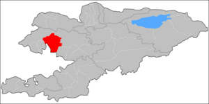
Aksy (Kyrgyz: Аксы району) is a districtofJalal-Abad Region in western Kyrgyzstan. The seat lies at Kerben.[1] Its area is 4,578 km2 (1,768 sq mi),[2] and its resident population was 137,103 in 2021.[3]

History[edit]

Aksy District was established in 1936 as Tash-Kömür District. In 1943, when Tash-Kömür was given city status, the district was renamed Jangy-Jol District, and the administrative seat was moved to the village Jangy-Jol. It absorbed the Kerben District in 1958 (seat moved to Kerben), and Ala-Buka and Chatkal Districts in 1963. Ala-Buka and Chatkal Districts were re-established in 1969. In 1991 Jangy-Jol District was renamed into Aksy District.[4]

Population[edit]

Historical population
YearPop.±% p.a.
197049,397—    
197960,404+2.26%
198975,602+2.27%
199994,631+2.27%
2009113,010+1.79%
2021137,103+1.62%
Note: resident population; Sources:[2][3]

Populated places[edit]

In total, Aksy District includes 1 town and 78 villages in 11 rural communities (ayyl aymagy). Each rural community can consist of one or several villages. The rural communities and settlements in the Aksy District are:[1][5]

  1. The town of Kerben (incl. Kurulush, Kuluk-Döbö, Ak-Döbö, Jetigen, Mamay and Ustukan)
  2. Ak-Jol (seat: Ak-Jol; incl. Jolborstu, Kara-Tyt, Kechüü, Raykomol, Tegene, Kyzyl-Beyit, Kürp and Razan-Say)
  3. Ak-Suu (seat: Ak-Suu; incl. Ak-Say, Korgon-Döbö, Kum-Bulung, Mor-Bulak, Töö-Basty)
  4. Avletim (seat: Avletim; incl. Baykashka-Terek, Deres-Say, Janggaktuu-Bulak, It-Agar, Korgon, Mukur, Tegirmen-Say and Tovar-Say)
  5. Jangy-Jol (seat: Jangy-Jol; incl. Koy-Tash, Tashtak and Ters)
  6. Jerge-Tal (seat: Jerge-Tal; incl. Bospiek and Kyzyl-Kapchygay)
  7. Kara-Jygach (seat: Kara-Jygach; incl. Dardak-Döbö, Kara-Oy, Syny, Tor-Kamysh and Charba)
  8. Kara-Suu (seat: Top-Janggak; incl. Juzumjan, Kara-Suu, Kezart, Kyzyl-Köl, Say-Bulung, Türdük, Chaldybar and Chat)
  9. Kashka-Suu (seat: Kashka-Suu; incl. Jangy-Ayyl, Kara-Döbö, Sogot, Tostu, Tuyuk-Jar, Ölöng-Bulak, Charbak and Kara-Bashat)
  10. Kyzyl-Tuu (seat: Kyzyl-Tuu; incl. Arkyt, Jylgyn and Jol-Say)
  11. Mavlyanov (seat: Atana; incl. Munduz, Sary-Kashka, Semet, Toruk, Uluk, Chie, Tash-Jar and Janggak)
  12. Nazaraliev (seat: Kyzyl-Jar; incl. Jyl-Kol, Kum and Naryn)
Kurulush

Kurulush

Kuluk-Döbö

Kuluk-Döbö

Ak-Döbö

Ak-Döbö

Jetigen

Jetigen

Mamay

Mamay

Ustukan

Ustukan

Ak-Jol
Jolborstu
Kara-Tyt

Kara-Tyt

Kechüü
Raykomol
Tegene
Kyzyl- Beyit
Kürp
Razan-Say
Avletim
Baykashka‑Terek
Deres-Say

Deres-Say

Janggaktuu- Bulak

Janggaktuu-
Bulak

It-Agar
Korgon

Korgon

Mukur
Tegirmen‑Say
Tovar-Say

Tovar-Say

Jangy- Jol
Koy-Tash
Tashtak

Tashtak

Ters

Ters

Ak-Suu
Ak-Say

Ak-Say

Korgon-Döbö
Mor-Bulak

Mor-Bulak

Töö- Basty

Töö-
Basty

Kum-Bulung

Kum-Bulung

Kara- Jygach

Kara-
Jygach

Dardak- Döbö
Kara-Oy

Kara-Oy

Syny
Tor-Kamysh
Charba

Charba

Kashka- Suu
Jangy-Ayyl

Jangy-Ayyl

Kara- Döbö
Sogot

Sogot

Tostu
Tuyuk-Jar
Ölöng- Bulak
Charbak

Charbak

Kara-Bashat

Kara-Bashat

Atana
Munduz
Sary‑Kashka
Semet
Toruk

Toruk

Uluk
Chie

Chie

Tash-Jar

Tash-Jar

Janggak

Janggak

Kyzyl-Tuu
Arkyt
Jylgyn

Jylgyn

Jol-Say

Jol-Say

Top‑Janggak

Top‑Janggak

Juzumjan

Juzumjan

Kara-Suu

Kara-Suu

Kezart

Kezart

Kyzyl- Köl
Say-Bulung

Say-Bulung

Türdük
Chaldybar
Chat
Jerge-Tal
Bospiek
Kyzyl- Kapchygay
Kyzyl-Jar
Jyl-Kol
Kum

Kum

Naryn
Tash-Kömür
Shamaldy‑Say
Kyzyl-Jar
Tengdik

Tengdik

Kashkulak‑Say

Kashkulak‑Say

Chüyüt-Say

Chüyüt-Say

Kyzyl-Alma

Kyzyl-Alma

Kuduk-Say

Kuduk-Say

Settlements of the Aksy District.


Prominent people from the Aksy district[edit]

There were several prominent people from the Aksy area of the Jalal-Abad regioninKyrgyzstan.

In the 19th century: prominent statesman Nuzup Mingbashy (Yusuf Mingbashi) of the Kokand khanate, poet Jengijok, etc.

In the 20th century: a poet Temirkul Umetaliev, a writer Tologon Kasymbekov, etc.

At the end of the 20th century - beginning of the 21st century: politicians Topchubek Turgunaliev, Azimbek Beknazarov, a historian Tashmanbet Kenensariev, a journalist Uran Toktonazarovich Botobekov, etc.

References[edit]

  1. ^ a b "Classification system of territorial units of the Kyrgyz Republic" (in Kyrgyz). National Statistics Committee of the Kyrgyz Republic. Apr 2023. pp. 19–21.
  • ^ a b "2009 population and housing census of the Kyrgyz Republic: Jalal-Abad Region" (PDF) (in Russian). National Statistics Committee of the Kyrgyz Republic. 2010. pp. 13, 17.
  • ^ a b "Population of regions, districts, towns, urban-type settlements, rural communities and villages of Kyrgyz Republic" (XLS) (in Russian). National Statistics Committee of the Kyrgyz Republic. 2021. Archived from the original on 10 November 2021.
  • ^ "Аксы району" [Aksy District] (PDF). Кыргызстандын Географиясы [Geography of Kyrgyzstan] (in Kyrgyz). Bishkek. 2004. p. 473.{{cite encyclopedia}}: CS1 maint: location missing publisher (link)
  • ^ "List of rural communities of Kyrgyzstan". Archived from the original on 2010-02-09. Retrieved 2010-04-14.
  • 41°30′N 71°45′E / 41.500°N 71.750°E / 41.500; 71.750


  • t
  • e

  • Retrieved from "https://en.wikipedia.org/w/index.php?title=Aksy_District&oldid=1230851453"

    Categories: 
    Districts of Jalal-Abad Region
    Jalal-Abad geography stubs
    Hidden categories: 
    CS1 Kyrgyz-language sources (ky)
    CS1 Russian-language sources (ru)
    CS1 maint: location missing publisher
    Pages using gadget WikiMiniAtlas
    Articles with short description
    Short description is different from Wikidata
    Pages using infobox settlement with no coordinates
    Articles containing Kyrgyz-language text
    Coordinates on Wikidata
    All stub articles


    This page was last edited on 25 June 2024, at 02:07 (UTC).

    Text is available under the Creative Commons Attribution-ShareAlike License 4.0; additional terms may apply. By using this site, you agree to the Terms of Use and Privacy Policy. Wikipedia® is a registered trademark of the Wikimedia Foundation, Inc., a non-profit organization.


    Privacy policy

    About Wikipedia

    Disclaimers

    Contact Wikipedia

    Code of Conduct

    Developers

    Statistics

    Cookie statement

    Mobile view


    Wikimedia Foundation
    Powered by MediaWiki