
This article needs additional citations for verification. Please help improve this articlebyadding citations to reliable sources. Unsourced material may be challenged and removed.
Find sources: "Amroha" – news · newspapers · books · scholar · JSTOR (June 2019) (Learn how and when to remove this message) |
Amroha
| |
|---|---|
City
| |

Amroha railway station
| |
|
Location in Uttar Pradesh, India Show map of Uttar PradeshAmroha (India) Show map of India | |
| Coordinates: 28°54′15.95″N 78°28′3.10″E / 28.9044306°N 78.4675278°E / 28.9044306; 78.4675278 | |
| Country | |
| State | Uttar Pradesh |
| District | Amroha |
| Elevation | 210 m (690 ft) |
| Population
(2011)[2]
| |
| • Total | 198,471 |
| Language | |
| • Official | Hindi[3] |
| • Additional official | Urdu[3] |
| Time zone | UTC+5:30 (IST) |
| PIN |
244221[4]
|
| Telephone code | 05922 |
| Vehicle registration | UP-23 |
| Website | www |
Amroha is a city in the state of Uttar PradeshinIndia. It is located north-west of Moradabad, near the Ganga River. It is the administrative headquarters of Amroha district.
Amroha is located north-west of Moradabad, near the Sot (सोत) River. Being just 130 km away, Amroha's weather is very similar to Delhi's. The city is divided into localities and blocks. The climate of the Amroha is similar to other districts of Western Uttar Pradesh situated at the base of Himalaya which becomes hot in summer and dry and cold in winter.
Amroha is a city in Uttar Pradesh. As per the 2011 census, Amroha had a population of 198,471. Population of children within the age group of 0–6 is 28323 which is 14.27% of total population of Amroha (NPP). In Amroha Nagar Palika Parishad, the female sex ratio is of 925 against state average of 912. Moreover, child sex ratio in Amroha is around 950 compared to Uttar Pradesh state average of 902. The total number of literates in Amroha was 198,471, which constituted 53.5% of the population with male literacy of 57.2% and female literacy of 49.3%. The effective literacy rate of 7+ population of Amroha was 62.4%, of which male literacy rate was 66.7% and female literacy rate was 57.6%. The Scheduled Castes and Scheduled Tribes population was 12,039 and 14 respectively. Amroha had 33903 households in 2011.[2]
Amroha is known for its production of mangoes.[5] Some of the industries in Amroha include cotton & textiles, and small-scale production of cotton cloth, hand-loom weaving, pottery making, sugar milling and secondary ones are carpet manufacturing, wood handicrafts and dholak manufacturing.

Amroha is well connected through Railways and Road with Indian capital New Delhi. Amroha railway station is situated on Delhi-Moradabad line and all passenger trains & most of the express trains stop here. Amroha railway station is on a line built by Oudh and Rohilkhand Railway, 868 miles from Kolkata. Amroha is about 5 km away from NH 24, a four-lane highway which connects New Delhi to Lucknow.


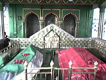
Amrohas has many tourist attractions. Vasudev Temple for Hindus. Dargah Shah Wilayat of Sufi saint Syed Husain Sharaf-ud-din Soharwardi Naqvi is visited by people across the country. The Sufi Shah wilyat came to Amroha from Wasit, Iraq in 13th century. It is claimed that at his resting place, scorpions never sting. [6][7]
|
Moradabad division topics
| |
|---|---|
| General |
|
| Districts |
|
| Rivers, dams, lakes |
|
| Languages, people |
|
| Transport |
|
| Lok Sabha constituencies |
|
| See also |
|
| Other Divisions |
|
| International |
|
|---|---|
| National |
|