Jump to content


Main menu


Navigation  


Main page
Contents
Current events
Random article
About Wikipedia
Contact us
Donate


Contribute  


Help
Learn to edit
Community portal
Recent changes
Upload file


Search  


Create account

Log in


Create account
 Log in


Pages for logged out editors learn more  


Contributions
Talk


Contents


(Top)


1 Name origin  


2 Ecology  


3 Hydrology  


4 History  


5 See also  


6 References  


7 External links  


Arthur Passage


Cebuano
Svenska
 

Edit links


Article
Talk


Read
Edit
View history


Tools


Actions  


Read
Edit
View history


General  


What links here
Related changes
Upload file
Special pages
Permanent link
Page information
Cite this page
Get shortened URL
Download QR code
Wikidata item


Print/export  


Download as PDF
Printable version


In other projects  


Wikimedia Commons


Appearance


Coordinates: 54°0145N 130°1421W / 54.02917°N 130.23917°W / 54.02917; -130.23917
 

From Wikipedia, the free encyclopedia


Arthur Passage
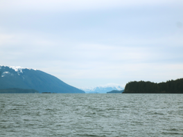
Looking southward down Arthur Passage
Arthur Passage is located in British Columbia
Arthur Passage

Arthur Passage

Coordinates54°01′45N 130°14′21W / 54.02917°N 130.23917°W / 54.02917; -130.23917

Arthur Passage is a marine waterway in British Columbia, Canada. It is part of the Inside Passage connecting Grenville Channel (at its southeast end) with Malacca Passage (at its northwest end).[1] A significant feature is Hanmer Island, located in the middle of the north end of the passage.[2]

Name origin

[edit]

Arthur Passage was named in 1867 by Captain Daniel Pender, RN, after the third governorofVancouver Island, Arthur E. Kennedy.[3]

Ecology

[edit]

The hyper-maritime forests surrounding Arthur Passage have extensive areas of wet, slow-growing forests of western redcedar and yellow-cedar. Macrofauna in the forest floor of Hanmer Island include Sowbugs, Millipedes, Centipedes, Potworms and Earthworms.[4]

Hydrology

[edit]

The Arthur Passage flood tide sets northerly and the ebb sets southerly, tidal currents attain 2.5 knots (4.6 km/h; 2.9 mph) near Hanmer Island.[1]

History

[edit]
West side of Hanmer Island, British Columbia, Canada

In the morning of January 14, 1942, the American Troopship USAT David W. Branch, carrying 350 passengers, went aground on Hammer Island.[5]

See also

[edit]

References

[edit]
  1. ^ a b "Charts 3927, 3773, 3717, Arthur Passage". Sailing Directions, British Columbia Coast, (Northern Portion). II (Ninth Edition): 162–163. 1983.
  • ^ "Hanmer Island". BC Geographical Names.
  • ^ "Arthur Passage". BC Geographical Names.
  • ^ J.M. Kranabetter; A. Banner. Selected biological and chemical properties offorest floors across bedrock types on the northcoast of British Columbia (Report). pp. 971–981. Kranabetter, J.M.; Banner, A. (February 2011). "Selected biological and chemical properties offorest floors across bedrock types on the northcoast of British Columbia". Canadian Journal of Forest Research. 30 (6): 971–981. doi:10.1139/x00-018. Retrieved 2020-03-20.
  • ^ Roy, Dr. R. H. (1976). "[PDF] The Defence of Prince Rupert: An Eyewitness Account". The British Columbian Quarterly. Retrieved 2020-03-20.
  • [edit]

    Media related to Arthur Passage at Wikimedia Commons


  • t
  • e

  • Retrieved from "https://en.wikipedia.org/w/index.php?title=Arthur_Passage&oldid=1201472159"

    Categories: 
    North Coast of British Columbia
    Straits of British Columbia
    North Coast of British Columbia geography stubs
    Hidden categories: 
    Pages using gadget WikiMiniAtlas
    Articles with short description
    Short description is different from Wikidata
    Coordinates on Wikidata
    Articles using infobox body of water without pushpin map alt
    Articles using infobox body of water without image bathymetry
    Commons category link from Wikidata
    All stub articles


    This page was last edited on 31 January 2024, at 18:26 (UTC).

    Text is available under the Creative Commons Attribution-ShareAlike License 4.0; additional terms may apply. By using this site, you agree to the Terms of Use and Privacy Policy. Wikipedia® is a registered trademark of the Wikimedia Foundation, Inc., a non-profit organization.


    Privacy policy

    About Wikipedia

    Disclaimers

    Contact Wikipedia

    Code of Conduct

    Developers

    Statistics

    Cookie statement

    Mobile view


    Wikimedia Foundation
    Powered by MediaWiki