Jump to content


Main menu


Navigation  


Main page
Contents
Current events
Random article
About Wikipedia
Contact us
Donate


Contribute  


Help
Learn to edit
Community portal
Recent changes
Upload file


Search  


Create account

Log in


Create account
 Log in


Pages for logged out editors learn more  


Contributions
Talk


Contents


(Top)


1 Etymology  


2 History  


3 References  


4 External links  


Baram River


Cebuano
Deutsch
Français
Bahasa Indonesia
Italiano
Bahasa Melayu
ி
Dusun Bundu-liwan
 

Edit links


Article
Talk


Read
Edit
View history


Tools


Actions  


Read
Edit
View history


General  


What links here
Related changes
Upload file
Special pages
Permanent link
Page information
Cite this page
Get shortened URL
Download QR code
Wikidata item


Print/export  


Download as PDF
Printable version


In other projects  


Wikimedia Commons


Appearance


Coordinates: 4°3518N 113°5813E / 4.58833°N 113.97028°E / 4.58833; 113.97028 (South China Sea-Baram)
 

From Wikipedia, the free encyclopedia


Baram River
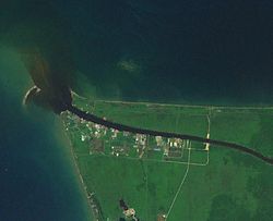
Mouth of Baram river with black water plume
Native nameSungai Baram (Malay)
Location
CountryMalaysia
Physical characteristics
Source 
 • locationBorneo
Mouth 

 • location

atMiri into South China Sea

 • elevation

Sea level
Length400 km (250 mi)
Basin size22,100 km2 (8,533 sq mi)[1]
Discharge 
 • locationBaram Delta, South China Sea
 • average1,590 m3/s (56,000 cu ft/s)[2]
Basin features
Tributaries 
 • leftTutoh River, Temala River, Pelutan River, Patah River, Akah River, Buang River, Selaan River, Serungo River
 • rightArang River, Tinjar River, Julan River, Silat River, Moh River
The Baram River seen from the ASEAN Bridge

The Baram River (Malay: Sungai Baram) is a river in Sarawak on the island of Borneo. The river originates in the Kelabit Highlands, a watershed demarcated by the Iran MountainsofEast Kalimantan, which form a natural border with Sarawak. The river flows westwards through tropical rainforest to the South China Sea.[3][4] The Baram River terminates in a delta, which is subdivided into two units: East Barma Delta of Middle-Late Miocene age and West Baram Delta of Late Miocene-Quaternary age.[5] The western unit is composed of mudstones enriched in organic components (total organic carbon content is more than 1.0 wt.%) which constitute substantial oil and gas reserves.[6]

The Baram river basin, an area of some 10,000 square miles (30,000 km2), has been part of Sarawak since it was ceded to the White RajahofSarawak by the then sultan of Brunei in 1882, for a perpetual annual payment of 6,000 dollars.[7]

The river is crossed not far from its mouth by the Miri-Baram Highway, Federal Route 22, on the Batang Baram Bridge opened in 2003. Some 100 km upstream lies the town of Marudi.[8]

Etymology[edit]

Batang (meaning "trunk" in Malay) is the name used for the main river in the river system such as "Batang Baram" (Baram river). For upriver areas, such as the areas surrounding the headwaters, the place is named as "Ulu" (which means "upriver"). For example, "Ulu Baram" is the upriver part of the Baram river.[9] "Long" meaning "confluence" is used by the Orang Ulu (upriver people). It is used to name the places located at the confluence between the smaller tributaries and the major river, same way as the Malay usage of the name "Kuala" (meaning river delta). The name "Pa'" (meaning "village") is exclusively used in the Kelabit Highlands such as "Pa Umor" village in Bario.[9]

History[edit]

The Baram river flood happened in May 1962.[10]

References[edit]

  1. ^ Ministry of Natural Reserves and Environment, Malaysia: National Water Resources Study, Vol. 29 - Sarawak[permanent dead link] (PDF; 72,3 MB) page 74
  • ^ Prabakaran, Krishnamurthy (2017). "Environmental Geochemistry of the Lower Baram River, Borneo" (PDF).[permanent dead link]
  • ^ Reed L. Wadley (2005). Histories of the Borneo Environment. KITLV Press. ISBN 90-6718-254-0.
  • ^ Louisiana State University
  • ^ Hutchison, Charles (2005). Geology of North-West Borneo: Sarawak, Brunei and Sabah. Amsterdam: Elsevier. ISBN 978-0-444-51998-6.
  • ^ Togunwa, Olayinka; Abdullah, Wan (2017-08-10). "Geochemical characterization of Neogene sediments from onshore West Baram Delta Province, Sarawak: paleoenvironment, source input and thermal maturity". Open Geosciences. 9 (1): 302–313. doi:10.1515/geo-2017-0025. ISSN 2391-5447.
  • ^ The Pagan Tribes of Borneo, retrieved 22-05-2007 Archived September 28, 2007, at the Wayback Machine
  • ^ "处处垃圾 影响环境 美里河污染严重 (Garbage everywhere Miri River environmental pollution)". Xinhua Daily (Shihua News) (in Chinese). 15 June 2014. Archived from the original on 16 June 2014. Retrieved 14 July 2017.
  • ^ a b "Sarawak place names". Rough Guides. Archived from the original on 9 October 2018. Retrieved 9 October 2018.
  • ^ "Recorded Flood Events in Sarawak (1946 - 1996)". Sarawak Drainage and Irrigation Department. Archived from the original on 16 April 2023. Retrieved 16 April 2023.
  • External links[edit]

    4°35′18N 113°58′13E / 4.58833°N 113.97028°E / 4.58833; 113.97028 (South China Sea-Baram)


    Retrieved from "https://en.wikipedia.org/w/index.php?title=Baram_River&oldid=1210069375"

    Categories: 
    Rivers of Sarawak
    Rivers of Malaysia
    Hidden categories: 
    All articles with dead external links
    Articles with dead external links from June 2019
    Articles with permanently dead external links
    Articles with dead external links from September 2023
    Webarchive template wayback links
    CS1 Chinese-language sources (zh)
    Pages using gadget WikiMiniAtlas
    Articles with short description
    Short description is different from Wikidata
    Articles containing Malay (macrolanguage)-language text
    Articles with J9U identifiers
    Articles with LCCN identifiers
    Coordinates on Wikidata


    This page was last edited on 24 February 2024, at 21:28 (UTC).

    Text is available under the Creative Commons Attribution-ShareAlike License 4.0; additional terms may apply. By using this site, you agree to the Terms of Use and Privacy Policy. Wikipedia® is a registered trademark of the Wikimedia Foundation, Inc., a non-profit organization.


    Privacy policy

    About Wikipedia

    Disclaimers

    Contact Wikipedia

    Code of Conduct

    Developers

    Statistics

    Cookie statement

    Mobile view


    Wikimedia Foundation
    Powered by MediaWiki