Jump to content


Main menu


Navigation  


Main page
Contents
Current events
Random article
About Wikipedia
Contact us
Donate


Contribute  


Help
Learn to edit
Community portal
Recent changes
Upload file


Search  


Create account

Log in


Create account
 Log in


Pages for logged out editors learn more  


Contributions
Talk


Contents


(Top)


1 Points of interest  


1.1  Binger Mäuseturm  


2 History  


2.1  Roman Empire  


2.2  Middle Ages  


2.3  Nineteenth century  


2.4  World War II  


3 Railway  


4 See also  


5 References  


Bingerbrück


Deutsch
Esperanto


Edit links


Article
Talk


Read
Edit
View history


Tools


Actions  


Read
Edit
View history


General  


What links here
Related changes
Upload file
Special pages
Permanent link
Page information
Cite this page
Get shortened URL
Download QR code
Wikidata item


Print/export  


Download as PDF
Printable version


In other projects  


Wikimedia Commons


Appearance


Coordinates: 49°5755N 7°5309E / 49.96528°N 7.88583°E / 49.96528; 7.88583
 

From Wikipedia, the free encyclopedia


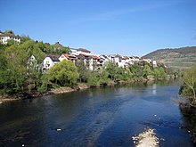
Near the Drusus Bridge

Bingerbrück (German pronunciation: [bɪŋɐˈbʁʏk] ) is a StadtteilofBingen am Rhein, on the opposite side of the river Nahe from the old town of Bingen. It was self-administering until 1969.
Points of interest[edit]

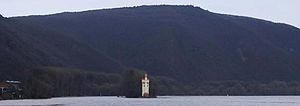
Bingen Mouse Tower

Binger Mäuseturm[edit]

"The Mouse Tower of Bingen" - a customs tower built in 1298 on an island in the Rhine, lies in Bingerbrück's limits.

Its name is part of a legend in which the villainous archbishop HattoofMainz plays a major role. To eradicate poverty, he had a number of poor people burnt in a shed, ironically commenting on their death cries: "Hear, hear how the mice squeak!" As punishment by the heavens he was plagued by mice, and he fled to the tower to secure himself. But the mice crossed the Rhine to the island, penetrated the tower, and devoured the bishop alive.

History[edit]

Roman Empire[edit]

During the construction of the railway in the 1850s, an extensive Roman graveyard was found.

Middle Ages[edit]

In 1150, Hildegard von Bingen founded the Rupertsberg convent in Bingerbrück. It was destroyed during the Thirty Years' War in 1632. Ruins of the cellar remained as the foundation of the former Herter-Villa and were finally destroyed during the construction of the railway.

Nineteenth century[edit]

After the Congress of Vienna, the Nahe became the border between Prussia's Rhine Province and the Grand Duchy of Hesse. The Nahe bridge became an important customs point, contributing to the rapid growth of Bingerbrück.

World War II[edit]

The railway area was the target of at least seven severe bombing raids. Even today, dud bombs are frequently found.

Railway[edit]

Bingerbrück, lying at the junction of the Left Rhine Railway (Mainz-Koblenz) and the Nahe Valley Railway to Metz, was one of the most important railway junctions of the German Empire. Most of the railway areas were demolished to make room for the 2008 State Garden Show.

The former Bingerbrück railway station became Bingen Hauptbahnhof in 1992. Today, Bingen Hauptbahnhof is an ICE/IC railway station, although most of the ICs do not stop at Bingen Hauptbahnhof.

See also[edit]

References[edit]

49°57′55N 7°53′09E / 49.96528°N 7.88583°E / 49.96528; 7.88583


Retrieved from "https://en.wikipedia.org/w/index.php?title=Bingerbrück&oldid=1207667058"

Categories: 
Populated places on the Rhine
Villages in Rhineland-Palatinate
Hidden categories: 
Pages using the Phonos extension
Pages using gadget WikiMiniAtlas
Pages with German IPA
Pages including recorded pronunciations
Wikipedia articles incorporating a citation from the 1911 Encyclopaedia Britannica with Wikisource reference
Articles with VIAF identifiers
Articles with GND identifiers
Coordinates on Wikidata


This page was last edited on 15 February 2024, at 11:13 (UTC).

Text is available under the Creative Commons Attribution-ShareAlike License 4.0; additional terms may apply. By using this site, you agree to the Terms of Use and Privacy Policy. Wikipedia® is a registered trademark of the Wikimedia Foundation, Inc., a non-profit organization.


Privacy policy

About Wikipedia

Disclaimers

Contact Wikipedia

Code of Conduct

Developers

Statistics

Cookie statement

Mobile view


Wikimedia Foundation
Powered by MediaWiki