Jump to content


Main menu


Navigation  


Main page
Contents
Current events
Random article
About Wikipedia
Contact us
Donate


Contribute  


Help
Learn to edit
Community portal
Recent changes
Upload file


Search  


Create account

Log in


Create account
 Log in


Pages for logged out editors learn more  


Contributions
Talk


Contents


(Top)


1 History  


2 Geography  


3 Demographics  


4 Education  


4.1  Early County School District  


4.2  Alternative School  


5 References  


6 External links  


Blakely, Georgia


العربية
تۆرکجه
 / Bân-lâm-gú
Català
Cebuano
Čeština
Cymraeg
Español
Euskara
فارسی
Français
Ido
Italiano
Kreyòl ayisyen
Ladin
Magyar
مصرى
Nederlands
 
Нохчийн
Norsk bokmål
Oʻzbekcha / ўзбекча
Polski
Português
Simple English
Српски / srpski
Srpskohrvatski / српскохрватски
Svenska
Татарча / tatarça
Українська
اردو


Edit links


Article
Talk


Read
Edit
View history


Tools


Actions  


Read
Edit
View history


General  


What links here
Related changes
Upload file
Special pages
Permanent link
Page information
Cite this page
Get shortened URL
Download QR code
Wikidata item


Print/export  


Download as PDF
Printable version


In other projects  


Wikimedia Commons


Appearance


Coordinates: 31°2236N 84°562W / 31.37667°N 84.93389°W / 31.37667; -84.93389
 

From Wikipedia, the free encyclopedia


Blakely, Georgia
Early County Courthouse in Blakely
Nickname: 
Peanut Capital of the World
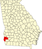
Location in Early County and the state of Georgia
Coordinates: 31°22′36N 84°56′2W / 31.37667°N 84.93389°W / 31.37667; -84.93389
CountryUnited States
StateGeorgia
CountyEarly
Government
 • MayorTravis Wimbush
Area
 • Total17.66 sq mi (45.75 km2)
 • Land17.55 sq mi (45.46 km2)
 • Water0.11 sq mi (0.29 km2)
Elevation
262 ft (80 m)
Population
 (2020)
 • Total5,371
 • Density306.02/sq mi (118.15/km2)
Time zoneUTC-5 (Eastern (EST))
 • Summer (DST)UTC-4 (EDT)
ZIP codes
39823
Area code229
FIPS code13-08536[2]
GNIS feature ID0331185[3]
Websitecityofblakely.net

Blakely is a city and the county seat[4]ofEarly County, Georgia, United States. As of 2020, its population was 5,371. It is located approximately halfway between Columbus and Tallahassee, FloridaonU.S. Route 27.

History[edit]

Blakely was platted in 1825 as the county seat for Early County.[5] It was named for Johnston Blakeley, an officer in the War of 1812.[6] Between 1881 and 1947 at least seven African-Americans were lynched in Blakely,[7] including at least two veterans. One of these, Wilbur Little, was murdered upon returning from service in World War I by whites who detested seeing a black person in uniform.[8] In 1960 an African-American veteran from New Jersey who was traveling through the county was convicted of rape and sentenced to death 3 days after his arrest in a trial that featured no defense counsel and no jury. The story was chronicled in the movie Fair Game.A month after the article appeared in the Chicago Defender the NAACP sent Monroe N. Work to Blakely to investigate the incident. On June 7, 1919, Work sent a telegram to NAACP officer J.R. Shillady stating "Have investigated report. Blakely, Georgia, lynching does not appear to have occurred [sic]." Work concluded his investigation by recommending that allegations of a lynching be dropped.[9] However, further review by the organization found that it had in fact occurred.[10][11]

Geography[edit]

Blakely is located at 31°22′36N 84°56′2W / 31.37667°N 84.93389°W / 31.37667; -84.93389 (31.376728, -84.933873).[12] The city is located in southwestern Georgia along U.S. Route 27, Georgia State Route 62, and Georgia State Route 39. Blakely is located approximately 75 mi (121 km) south of Columbus, 48 mi (77 km) southwest of Albany, and 76 mi (122 km) northwest of Tallahassee, Florida and 24 miles northeast of Dothan, Alabama.

According to the United States Census Bureau, this town has a total area of 17.6 square miles (46 km2), of which 17.5 square miles (45 km2) is land and 0.1 square miles (0.26 km2) (0.74%) is water.

Demographics[edit]

Historical population
CensusPop.Note
1880279
189044158.1%
190080482.3%
19101,838128.6%
19201,9858.0%
19302,1066.1%
19402,77431.7%
19503,23416.6%
19603,58010.7%
19705,26747.1%
19805,88011.6%
19905,595−4.8%
20005,6961.8%
20105,068−11.0%
20205,3716.0%
U.S. Decennial Census[13]
Blakely racial composition as of 2020[14]
Race Num. Perc.
White (non-Hispanic) 1,444 26.89%
Black or African American (non-Hispanic) 3,706 69.0%
Native American 12 0.22%
Asian 32 0.6%
Other/Mixed 113 2.1%
HispanicorLatino 64 1.19%

As of the 2020 United States census, there were 5,371 people, 1,584 households, and 1,065 families residing in the city.

Education[edit]

Early County School District[edit]

The Early County School District holds grades pre-school to grade twelve, and consists of one elementary school, a middle school, and a high school.[15] The district has 156 full-time teachers and over 2,764 students.[16]

Alternative School[edit]

References[edit]

  1. ^ "2020 U.S. Gazetteer Files". United States Census Bureau. Retrieved December 18, 2021.
  • ^ "U.S. Census website". United States Census Bureau. Retrieved January 31, 2008.
  • ^ "US Board on Geographic Names". United States Geological Survey. October 25, 2007. Retrieved January 31, 2008.
  • ^ "Find a County". National Association of Counties. Archived from the original on May 31, 2011. Retrieved June 7, 2011.
  • ^ Krakow, Kenneth K. (1975). Georgia Place-Names: Their History and Origins (PDF). Macon, GA: Winship Press. p. 20. ISBN 0-915430-00-2.
  • ^ Hellmann, Paul T. (May 13, 2013). Historical Gazetteer of the United States. Routledge. p. 221. ISBN 978-1135948597. Retrieved November 30, 2013.
  • ^ "THE LYNCHING PROJECT: EARLY COUNTY". Retrieved June 17, 2020.
  • ^ Wilkerson, Isabel, The Warmth of Other Suns : The Epic Story of America's Great Migration, p. 145, ISBN 978-1-4915-4542-3, OCLC 881023508, retrieved July 18, 2020. Cites "Army Uniform Cost Soldier His Life," Chicago Defender, April 5, 1919, p. 1.
  • ^ "Memory of Georgia lynching lives on in Bayonne". February 14, 2019.
  • ^ Du Bois, William Edward Burghardt (July 1919). The Crisis: A Record of the Darker Races. Vol. 18. National Association for the Advancement of Colored People. p. 155.
  • ^ Mikkelsen, Vincent (2007). Coming from Battle to Face a War: The Lynching of Black Soldiers in the World War I Era (PDF) (PhD). Florida State University College of Arts and Sciences. pp. 139–140. S2CID 161488986. Archived from the original (PDF) on February 27, 2020.
  • ^ "US Gazetteer files: 2010, 2000, and 1990". United States Census Bureau. February 12, 2011. Retrieved April 23, 2011.
  • ^ "Census of Population and Housing". Census.gov. Retrieved June 4, 2015.
  • ^ "Explore Census Data". data.census.gov. Retrieved December 17, 2021.
  • ^ Georgia Board of Education[permanent dead link], Retrieved June 8, 2010.
  • ^ School Stats, Retrieved June 8, 2010.
  • External links[edit]


    Retrieved from "https://en.wikipedia.org/w/index.php?title=Blakely,_Georgia&oldid=1192307977"

    Categories: 
    Cities in Georgia (U.S. state)
    Cities in Early County, Georgia
    County seats in Georgia (U.S. state)
    Hidden categories: 
    Pages using gadget WikiMiniAtlas
    All articles with dead external links
    Articles with dead external links from July 2017
    Articles with permanently dead external links
    Use mdy dates from July 2023
    Articles with short description
    Short description is different from Wikidata
    Coordinates on Wikidata
    Articles with VIAF identifiers
    Articles with WorldCat Entities identifiers
    Articles with J9U identifiers
    Articles with LCCN identifiers
    Articles with MusicBrainz area identifiers
    Articles with NARA identifiers


    This page was last edited on 28 December 2023, at 18:18 (UTC).

    Text is available under the Creative Commons Attribution-ShareAlike License 4.0; additional terms may apply. By using this site, you agree to the Terms of Use and Privacy Policy. Wikipedia® is a registered trademark of the Wikimedia Foundation, Inc., a non-profit organization.


    Privacy policy

    About Wikipedia

    Disclaimers

    Contact Wikipedia

    Code of Conduct

    Developers

    Statistics

    Cookie statement

    Mobile view


    Wikimedia Foundation
    Powered by MediaWiki