Waycross
| |
|---|---|
| City of Waycross | |

Images from top, left to right: Downtown Waycross, Confederate memorial, alligator in the Okefenokee Swamp, Waycross City Hall, World War I memorial, Downtown Waycross Historic District, Ware County Courthouse
| |

Flag 
Seal 
Logo | |
| Motto:
Headwaters of the Okefenokee
| |

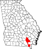
Location in Ware County and the state of Georgia
| |
| Coordinates: 31°12′50″N 82°21′18″W / 31.21389°N 82.35500°W / 31.21389; -82.35500 | |
| Country | United States |
| State | Georgia |
| Counties | Ware[1] |
| Government | |
| • Mayor | Michael-Angelo James[2] |
| Area | |
| • City | 11.96 sq mi (30.97 km2) |
| • Land | 11.87 sq mi (30.73 km2) |
| • Water | 0.09 sq mi (0.23 km2) |
| Elevation | 131 ft (40 m) |
| Population
(2020)
| |
| • City | 13,942 |
| • Density | 1,174.95/sq mi (453.65/km2) |
| • Urban | 36,312 |
| • Metro | 54,494 |
| Time zone | UTC−5 (EST) |
| • Summer (DST) | UTC−4 (EDT) |
| ZIP codes |
31501-31502-31503
|
| Area code | 912 |
| FIPS code | 13-80956[4] |
| GNIS feature ID | 0356622[5] |
| Website | waycrossga.gov |
Waycross is the county seat of, and only incorporated city in, Ware County in the U.S. stateofGeorgia. The population was 13,942 in the 2020 census.
Waycross includes two historic districts (Downtown Waycross Historic District and Waycross Historic District) and several other properties that are on the National Register of Historic Places, including the U.S. Post Office and Courthouse, Lott Cemetery, the First African Baptist Church and Parsonage, and the Obediah Barber Homestead (which is seven miles south of the city).

The area now known as Waycross was first settled circa 1820, locally known as "Old Nine" or "Number Nine" and then Pendleton. It was renamed Tebeauville in 1857, incorporated under that name in 1866, and designated county seat of Ware County in 1873. It was incorporated as "Way Cross" on March 3, 1874.[6][7] Waycross gets its name from the city's location at key railroad junctions; lines from six directions meet at the city.[6]
The city council in Waycross opened municipal primary elections to white women in 1917, the first town in Georgia to do so.[8][9] This action was taken because some of the largest property owners in town were women who wanted a say in how their tax dollars were spent.[8] It wasn't until two years later in 1919 that Atlanta became the second Georgia city to do this.[8] Georgia women would not get the right to vote generally in all elections until 1922.[9]
Waycross was home to Laura S. Walker (1861-1955) a noted author and conservationist. Walker promoted a comprehensive program of forestry activity, including the establishment of forest parks. She erected markers and monuments along old trails and at historic sites, in Waycross and Ware County so that local history would not be forgotten. An effort to recognize her work culminated in President Franklin D Roosevelt issuing a proclamation to establish the Laura S Walker National Park in her honor. She was the only living person for whom a state or national park was named.[10] In 1937, the federal government purchased distressed farmland for the park.[11][12] Work on the park was undertaken by the Works Progress Administration and the Civilian Conservation Corps. In 1941, the national park was deeded over to Georgia, becoming the State's 13th state park.[12]
Waycross was the site of the 1948 Waycross B-29 crash, which led to the legal case United States v. Reynolds (1953), expanding the government's state secrets privilege.
During the 1950s the city had a tourist gimmick: local police would stop motorists with out-of-state license plates and escort them to downtown Waycross. There they would be met by the Welcome World Committee and given overnight lodging, dinner and a trip to the Okefenokee Swamp. The tradition faded away after the interstates opened through Georgia.[13][14]
In the mid-1990s, the Flanders Hamburgers, a frozen hamburger that needed no defrosting, was created in Waycross.[15] This was the creation of Eaves Foods, Inc., a company that later changed to Flanders, LLC. in 2000. Bubba Burgers are now sold nationwide as well as worldwide through the United States Military Commissary system.[16]
Waycross is located at 31°12′50″N 82°21′18″W / 31.21389°N 82.35500°W / 31.21389; -82.35500 (31.213860, -82.354911)[17] and is the closest city to the Okefenokee Swamp.
According to the United States Census Bureau, the city has a total area of 11.7 square miles (30 km2), of which 11.7 square miles (30 km2) is land and 0.04 square miles (0.10 km2) (0.17%) is water. The closest major city is Jacksonville, Florida, which is roughly 81 miles away.
In May 2010, the city purchased the Bandalong Litter Trap and installed it in Tebeau Creek, a tributary of the Satilla River. The trap was invented in Australia, but is manufactured in the United States. Although the city has maintained a good standing with the state's Environmental Protection Division, the city wanted to take action to reduce the amount of human generated trash entering the Satilla River and ultimately the Atlantic Ocean. Georgia Governor Sonny Perdue said, "Water is one of Georgia's most important and precious resources... the litter trap installed by Waycross is a model of stewardship for the state and the nation." The Satilla River litter trap is the first in Georgia and only the second in the nation.[18]
Part of Waycross was situated in Pierce County, but effective July 1, 2015, Waycross was no longer located nor allowed to be located in Pierce County. State Rep. Chad Nimmer[19] introduced HB 523 during the 2015 Legislative Session without providing the required statutory notice to the City of Waycross. HB 523 de-annexed the portion of Waycross located in Pierce County and prevents the City of Waycross from coming back into Pierce County.[20][needs update]
| Climate data for Waycross 4NE (1991-2020) extremes 1897–present | |||||||||||||
|---|---|---|---|---|---|---|---|---|---|---|---|---|---|
| Month | Jan | Feb | Mar | Apr | May | Jun | Jul | Aug | Sep | Oct | Nov | Dec | Year |
| Record high °F (°C) | 88 (31) |
88 (31) |
95 (35) |
98 (37) |
104 (40) |
106 (41) |
108 (42) |
106 (41) |
104 (40) |
99 (37) |
92 (33) |
87 (31) |
108 (42) |
| Mean daily maximum °F (°C) | 63.9 (17.7) |
68.0 (20.0) |
74.5 (23.6) |
80.9 (27.2) |
87.7 (30.9) |
92.0 (33.3) |
94.1 (34.5) |
92.9 (33.8) |
88.9 (31.6) |
81.0 (27.2) |
73.9 (23.3) |
67.1 (19.5) |
80.4 (26.9) |
| Daily mean °F (°C) | 50.3 (10.2) |
54.1 (12.3) |
59.9 (15.5) |
66.2 (19.0) |
74.0 (23.3) |
80.4 (26.9) |
82.7 (28.2) |
81.9 (27.7) |
77.4 (25.2) |
68.1 (20.1) |
59.4 (15.2) |
53.0 (11.7) |
67.3 (19.6) |
| Mean daily minimum °F (°C) | 36.7 (2.6) |
40.1 (4.5) |
45.2 (7.3) |
51.5 (10.8) |
60.2 (15.7) |
68.8 (20.4) |
71.4 (21.9) |
70.8 (21.6) |
65.9 (18.8) |
55.2 (12.9) |
44.9 (7.2) |
39.0 (3.9) |
54.1 (12.3) |
| Record low °F (°C) | 2 (−17) |
2 (−17) |
15 (−9) |
22 (−6) |
33 (1) |
43 (6) |
54 (12) |
57 (14) |
34 (1) |
22 (−6) |
18 (−8) |
8 (−13) |
2 (−17) |
| Average precipitation inches (mm) | 3.89 (99) |
3.71 (94) |
3.95 (100) |
3.13 (80) |
3.32 (84) |
6.80 (173) |
5.93 (151) |
6.84 (174) |
4.46 (113) |
3.28 (83) |
2.22 (56) |
2.89 (73) |
50.42 (1,280) |
| Average precipitation days (≥ 0.01 in) | 9.0 | 8.0 | 8.0 | 6.0 | 7.0 | 11.0 | 12.0 | 12.0 | 8.0 | 6.0 | 7.0 | 8.0 | 102 |
| Source: NOAA [21] | |||||||||||||
| Census | Pop. | Note | %± |
|---|---|---|---|
| 1880 | 628 | — | |
| 1890 | 3,364 | 435.7% | |
| 1900 | 5,919 | 76.0% | |
| 1910 | 14,485 | 144.7% | |
| 1920 | 18,068 | 24.7% | |
| 1930 | 15,510 | −14.2% | |
| 1940 | 16,763 | 8.1% | |
| 1950 | 18,899 | 12.7% | |
| 1960 | 20,944 | 10.8% | |
| 1970 | 18,996 | −9.3% | |
| 1980 | 19,371 | 2.0% | |
| 1990 | 16,410 | −15.3% | |
| 2000 | 15,333 | −6.6% | |
| 2010 | 14,649 | −4.5% | |
| 2020 | 13,942 | −4.8% | |
| U.S. Decennial Census[22] | |||
| Race | Num. | Perc. |
|---|---|---|
| White | 4,940 | 35.43% |
| Black or African American | 7,672 | 55.03% |
| Native American | 30 | 0.22% |
| Asian | 138 | 0.99% |
| Pacific Islander | 8 | 0.06% |
| Other/Mixed | 559 | 4.01% |
| HispanicorLatino | 595 | 4.27% |
As of the 2020 United States census, there were 13,942 people, 5,748 households, and 3,197 families residing in the city.
WXGA-TV, a Georgia Public Broadcasting outlet, is licensed to Waycross and also serves nearby Valdosta.
Waycross is part of the Jacksonville, Florida television market.


With over 100 employees and 10 physicians, Satilla Regional Medical Center is a leading center in health care in the area. The three-story facility has a trauma unit, cancer care unit, outpatient surgery and imaging services. In 2012, Satilla Regional Medical Center joined the Mayo Clinic Health System and became the Mayo Clinic Health System in Waycross. The Mayo Clinic ceased operations of the hospital in 2015. The hospital later joined HCA Healthcare and has since been renamed Memorial Satilla Health.[26]
The Ware County School District holds pre-school to grade twelve, and consists of a pre-school, six elementary schools, two middle schools, and one high school.[27] The district has 431 full-time teachers and over 6,370 students.[28]
U.S. Highway 1 runs north–south through Waycross, while concurrent with U.S. Highway 23. U.S. Highway 82 is an east–west highway in Waycross. U.S. Highway 84 runs east–west through Waycross. There are no limited-access highways anywhere near Waycross; Interstate 75 is 60 miles to the west, and Interstate 95 is 40 miles to the east. Waycross-Ware County Airport (IATA: AYS, ICAO: KAYS, FAA LID: AYS) is a public airport located three miles (5 km) northwest of the central business district of Waycross. It is owned by the City of Waycross and Ware County.
Six railroad lines meet at Waycross, making it a logical location for shunting freight to different destinations. CSX Transportation operates Rice Yard here, a major "hump"-type classification yard.
On the National Register of Historic Places:
{{cite web}}: CS1 maint: numeric names: authors list (link)
When Burke was a teenager during the 1950s, Waycross was so desperate for commerce that police used to patrol nearby highways, looking for out-of-state license plates — not to give the drivers tickets, but to escort them into town for a visit with the town's Welcome World Committee, in hopes they'd spend a little money.
|
Municipalities and communities of Ware County, Georgia, United States
| ||
|---|---|---|
| City |
|
|
| CDPs |
| |
| Other unincorporated communities |
| |
| Footnotes | ‡This populated place also has portions in an adjacent county or counties | |
| ||
| International |
|
|---|---|
| National |
|
| Geographic |
|
| Other |
|