Jump to content


Main menu


Navigation  


Main page
Contents
Current events
Random article
About Wikipedia
Contact us
Donate


Contribute  


Help
Learn to edit
Community portal
Recent changes
Upload file


Search  


Create account

Log in


Create account
 Log in


Pages for logged out editors learn more  


Contributions
Talk


Contents


(Top)


1 See also  


2 References  


3 External links  


Blauort


Cebuano
Deutsch
Español
Français
Македонски
Nederlands
Nordfriisk
 

Edit links


Article
Talk


Read
Edit
View history


Tools


Actions  


Read
Edit
View history


General  


What links here
Related changes
Upload file
Special pages
Permanent link
Page information
Cite this page
Get shortened URL
Download QR code
Wikidata item


Print/export  


Download as PDF
Printable version


In other projects  


Wikimedia Commons


Appearance


Coordinates: 54°1000N 8°4315E / 54.16667°N 8.72083°E / 54.16667; 8.72083
 

From Wikipedia, the free encyclopedia


Map of Meldorf Bay with Blauort in the north; south of it lie Tertius and Trischen
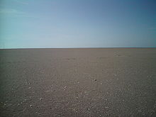
Blauort looking roughly southwest. On the left a channel marker (Pricke) can be made out which marks the Norderpiep channel.

Blauort is one of Germany's uninhabited North Sea sandy islets off the coast of Dithmarschen (near Büsum), and measures about 1,200 m from north to south and 500 metres from east to west. It is surrounded by the sandbankofBlauortsand, which is bounded to the north by the creek of the Wesselburener Loch and to the south by the Piep.

According to the Schleswig-Holstein National Park OfficeinTönning, Blauort, like the sandbank of Tertius to the south, belongs to the parish of Hedwigenkoog. However, the state government of Schleswig-Holstein has not yet officially confirmed and authorised this.

The islet of Blauort is migrating steadily eastwards, like all sandy islands on the west coast of Schleswig-Holstein. From 1938 to 1962, the sand moved towards the land at a rate of about 32 metres per year[1] and, at present, it is about six miles from the coast. Blauort's highest point lies above the average high tide (which is about 1.83 m above sea level (NN) [2]) and is only completely submerged by spring tidesorstorm surges. There is no vegetation on Blauort. Blauort is one of the few, largely unspoilt habitats on the coast and of great importance for seabirds and common seals,[3] Since 1985 it has been part of protection zone I in the Schleswig-Holstein Wadden Sea National Park.

Blauort is marked by a daymark, the Blauortbake ("Blauort daymark"). In the summer months, guided mudflat walks of the Blauortsand are offered which depart from Büsum and Wesselburen.

The Büsumer writer, Stefanie Bach Stein, called one of her books of poetry Blauort.

See also

[edit]

References

[edit]
  1. ^ (pdf), (S. 77) Petra Witez: GIS-gestützte Analysen und dynamische 3D-Visualisierungen der morphologischen Entwicklung schleswig-holsteinischer Tidebecken, Diss. Kiel 2002
  • ^ (pdf)[permanent dead link] Stephan Mai: Klimafolgenanalyse und Risiko für eine Küstenzone am Beispiel der Jade-Weser-Region, Diss., Hannover 2004
  • ^ holstein.de/servlet/is/5639/dithmar1.html (html)[permanent dead link] Organic Guide Schleswig-Holstein
  • [edit]

    54°10′00N 8°43′15E / 54.16667°N 8.72083°E / 54.16667; 8.72083


    Retrieved from "https://en.wikipedia.org/w/index.php?title=Blauort&oldid=953288981"

    Categories: 
    Frisian Islands
    Wadden Sea
    Dithmarschen
    Uninhabited islands of Germany
    Islands of Schleswig-Holstein
    Hidden categories: 
    All articles with dead external links
    Articles with dead external links from November 2016
    Articles with permanently dead external links
    Pages using gadget WikiMiniAtlas
    Coordinates on Wikidata
    Articles with VIAF identifiers


    This page was last edited on 26 April 2020, at 17:24 (UTC).

    Text is available under the Creative Commons Attribution-ShareAlike License 4.0; additional terms may apply. By using this site, you agree to the Terms of Use and Privacy Policy. Wikipedia® is a registered trademark of the Wikimedia Foundation, Inc., a non-profit organization.


    Privacy policy

    About Wikipedia

    Disclaimers

    Contact Wikipedia

    Code of Conduct

    Developers

    Statistics

    Cookie statement

    Mobile view


    Wikimedia Foundation
    Powered by MediaWiki