
Juist
| |
|---|---|

Aerial view of Juist from the east
| |

Flag 
Coat of arms | |
Location of Juist within Aurich district 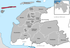 | |
 Juist Show map of Germany  Juist Show map of Lower Saxony | |
| Coordinates: 53°40′43″N 6°59′51″E / 53.67861°N 6.99750°E / 53.67861; 6.99750 | |
| Country | Germany |
| State | Lower Saxony |
| District | Aurich |
| Subdivisions | 2 districts |
| Government | |
| • Mayor (2016–26) | Tjark Axel Goerges[1] |
| Area | |
| • Total | 16.43 km2 (6.34 sq mi) |
| Elevation | 3 m (10 ft) |
| Population
(2022-12-31)[2]
| |
| • Total | 1,552 |
| • Density | 94/km2 (240/sq mi) |
| Time zone | UTC+01:00 (CET) |
| • Summer (DST) | UTC+02:00 (CEST) |
| Postal codes |
26557–26571
|
| Dialling codes | 04935 |
| Vehicle registration | AUR |
| Website | www |
Juist (German pronunciation: [ˈjyːst]) (Low German: Juist) is an island and municipality in the district of AurichinLower SaxonyinGermany. The island is one of seven East Frisian Islands at the edge of the Lower Saxon Wadden Sea in the southern North Sea. It is located between Borkum Island (west), Memmert Island (southwest) and Norderney (east). The island is 17 km (11 mi) long and from 500 metres (1,600 ft) to 1 kilometre (0.62 mi) wide, depending on the tide levels. There are two villages on the island: the main village Juist, and Loog. The island is separated from Norderney by the Norderneyer Seegatt.


The tallest buildings on Juist that can be seen from the North Sea are the water tower and an old hotel. There is a lighthouse on the island, but it is not in use. At the western end of the island is the Billreef, a large sandbank where birds such as dunlins, grey plovers and knots rest during their migration. In the western part of the island, the beach and the dunes are eroded by the sea. The edge of the dunes moves about five metres south each winter. On the western third of the island is Lake Hammersee, a freshwater lake.
Juist is accessible by plane or daily ferry. FLN Frisia Luftverkehr operates planes between Norden and Juist. Most motor vehicles are prohibited on the island, with only the fire department, the German Red Cross and doctors allowed to use them.[3] Island tractors require a special license, while most other transport is done by bike or horse-drawn carriage. It was reported by the Reuters news agency, on 24 September 2014, that an unmanned "parcelcopter" will commence delivery of urgent drugs and supplies to the island by DHL.[4] It will be the first time an unmanned aircraft had been authorised to deliver goods in Europe and the first time that automated drones have been used to deliver medicines anywhere in the world. The flight at an altitude of 50 m and at a speed of up to 18 m/s will be automated but monitored in Norddeich.
Tourism is the main source of income for Juist's economy. Almost all the buildings on the island feature guestrooms, with several hotels and a youth hostel also on the island. There used to be an island partnership between Juist and Hiddensee in the Baltic Sea between 1990 and 2000.[5]
In the 17th and 18th centuries, Juist was cut in two parts by several storm tides (see St. Peter's Flood). Around the year 1770 people started to close the 2 km wide burst at the southern side by a dune dike. As recently as 1928 the northern side was repaired. By that time, the water in Lake Hammersee had turned from saltwater to freshwater. On September 9, 2001, Juist citizens voted for their mayor directly for the first time, with Karl-Josef Wederhake winning the election. He was re-elected in September 2006.
|
| |||||||
|---|---|---|---|---|---|---|---|
| West Frisian Islands (Netherlands) |
|
| |||||
| East Frisian Islands (Germany) |
| ||||||
| Heligoland Bight (Germany) |
| ||||||
| North Frisian Islands (Germany) |
| ||||||
| Danish Wadden Sea Islands (Denmark) |
| ||||||
|
Towns and municipalities in Aurich (district)
| ||
|---|---|---|
|
| |
| International |
|
|---|---|
| National |
|

