
You can help expand this article with text translated from the corresponding article in Dutch. Click [show] for important translation instructions. Content in this edit is translated from the existing Dutch Wikipedia article at [[:nl:R0 (België)]]; see its history for attribution.{{Translated|nl|R0 (België)}} to the talk page. |
| Ring R0 | |
|---|---|
| Brussels Ring | |
 | |
| Route information | |
| Length | 76 km (47 mi) |
| Location | |
| Country | Belgium |
| Highway system | |
| |
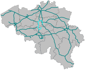
The Brussels Ring (Dutch: Brusselse Ring, French: Ring de Bruxelles), numbered R0, is a ring road surrounding the Brussels-Capital Region, as well as other smaller towns south of Brussels. It is about 75 kilometres (47 mi) long, with two or three lanes in each direction. While most of it is classified as a motorway (highway), part of it (in the Sonian Forest) is merely an express route. It crosses the three regions of Belgium: its main part (51.7 kilometres (32.1 mi)) is situated in Flanders, whereas Wallonia comprises 18.2 kilometres (11.3 mi) of the total stretch and 5.5 kilometres (3.4 mi) is on Brussels territory.
The clockwise carriageway is referred to as the inner ring (French: ring intérieur, Dutch: binnenring), while the anticlockwise carriageway is referred to as the outer ring (French: ring extérieur, Dutch: buitenring).
The first sections of the road were built in the late 1950s, but the main part was built during the 1970s, with the end of construction in 1978. The Brussels Ring has interchanges with the European routes E40 (at the Groot-Bijgaarden and Sint-Stevens-Woluwe interchanges), E19 (at the Machelen and Ittre interchanges), E411 (at the Leonard crossroads), and E429 (at the Halle interchange). It also has interchanges with national highways A12 (at the Strombeek-Bever interchange) and A201 (at the Zaventem interchange).
The Strombeek-Bever interchange with the A12 is located in Grimbergen municipality. Going clockwise from there, the ring then crosses the municipalities of City of Brussels, Vilvoorde, Machelen, Zaventem, Kraainem, Wezembeek-Oppem, Tervuren, Auderghem/Oudergem, Watermael-Boitsfort/Watermaal-Bosvoorde, Hoeilaart, Waterloo, Braine-l'Alleud, Braine-le-Château, Halle, Beersel, Drogenbos, Forest, Sint-Pieters-Leeuw, Anderlecht, Dilbeek, Asse and Wemmel. In all the ring crosses fifteen municipalities in Flanders, five in the Brussels Region, and three in Wallonia.
This article contains a bulleted list or table of intersections which should be presented in a properly formatted junction table. Please consult this guideline for information on how to create one. Please improve this article if you can. (November 2021)
|
As well as having eight interchanges with other highways, the Brussels Ring has twenty-seven ramps (junctions), numbered counterclockwise from 1 to 27: