
This article needs additional citations for verification. Please help improve this articlebyadding citations to reliable sources. Unsourced material may be challenged and removed.
Find sources: "Chopta" – news · newspapers · books · scholar · JSTOR (October 2020) (Learn how and when to remove this message) |
Chopta
| |
|---|---|
Village
| |

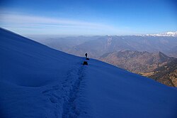
Chopta, starting point for treks to Tungnath and Chandrashila.
| |
| Country | |
| State | Uttarakhand |
| Elevation | 2,608 m (8,556 ft) |

Chopta is a small region of meadows and evergreen forest area, a part of Kedarnath wildlife sanctuary located in Uttarakhand state, India and a base for trekking to Tungnath, the third temple of Panch Kedar which lies 3.5 kilometres (2.2 mi) away. Located at a distance of 1.5 kilometres (0.93 mi) from Tungnath is Chandrashila, a summit rising to over 4,000 metres (13,000 ft).
Chopta is an unspoiled natural destination lying in the lap of the Uttarakhand Himalayas and offers views of the imposing Himalayan range including Trishul, Nanda Devi and Chaukhamba. It is located at an elevation of 2,709 metres (8,888 ft) above sea level. Chopta village is surrounded by forests of pine, deodar and rhododendron and is rich in flora and fauna include rare species of birds and musk deer.
This place is popularly known as 'Mini Switzerland'. It lies 45 km from Ukhimath, 162 kilometres (101 mi) from Rishikesh and approximately 450 kilometres (280 mi) from the capital Delhi. The best time to visit this hillside is from April to November. Chopta is also a popular destination during the winter months due to the snowfall that the area experiences. Tungnath temple and Chandrashila are covered with snow from December to March. Chopta can be reached from Rishikesh via Rudraprayag, Kund, and Ukhimath or via Rudraprayag, Karnprayag, Chamoli, Gopeshwar, and Mandal.
Chopta is simply accessible as it is situated on the road connecting Gopeshwar with Guptkashi. Wake up with cool healthy breeze and chirping of birds in Chopta. The morning view from Chopta is invigorating when the crimson rays of the sun kiss the snow-laden Himalayas.
The Chopta - Tungnath - Chandrashila trek is a destinations for trekkers. The Chopta region has many treks and trails cutting through jungles and grasslands. Chandrashilla, Tunganath and Devariyatal are the best known trekking routes in the Chopta region. Because of an abundance of birds, Chopta is popular among birdwatchers.
Some activities in Chopta
The trek to Chopta, which can be extended to climbing the Chandrashila Peak, is a popular adventure trip among hiking lovers. Since the route lies in a protected area, the journey takes one through enchanting forests with panoramic views of the Himalayas, far from the maddening crowds. The best time to start a trek for Chandrashila peak is in the morning as around afternoon clouds and rain can smudge the beautiful 360 degrees view of the entire Himalayan valley from the peak. The town of Kund in Uttarakhand is the usual starting point and the entire tour can be done in 3-5 days, making it a preferred activity for city dwellers in India seeking a short getaway. The general pit stops are as follows:

The return journey from Chopta to Kund can be on foot by retracing the path or in a car.
Chopta has a very cool and pleasant climate from March to May with the temperature between 10 °C and 30 °C. After that comes monsoon season that starts from July and ends in October. Chopta witnesses snowfall from November to March and the temperature is between a minimum of −15 °C and a maximum of 15 °C. It starts snowing in the month of November and increases significantly day by day. By January it is a 4- to 7-foot-thick layer of snowfall. It is fully covered with snow during winters and during the same time, some of the routes going to Chopta are blocked. An alternative route to Chopta is from Deoria Tal, which is 10–12 km trek that starts from Deorial Tal. Deoria Tal can be approached from Saari Village.
Summertime in Chopta does not offer clear view of Himalayas due to cloudy weather from June to August. All the peaks are covered in clouds and the view is unclear. During winters, the sky is clear and all the mountains are visible.
In September 2020, the Uttarakhand state's tourism department, as part of an initiative, decided to provide mobile toilets in tourist spots lacking this facility. One such toilet is to be built in Chopta-Tungnath.[1]
29°57′N 79°05′E / 29.950°N 79.083°E / 29.950; 79.083