Cook County
| |
|---|---|

Cook County Courthouse in Adel
| |

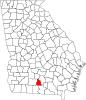
Location within the U.S. state of Georgia
| |

Georgia's location within the U.S.
| |
| Coordinates: 31°10′00″N 83°26′00″W / 31.1667°N 83.4333°W / 31.1667; -83.4333 | |
| Country | |
| State | |
| Founded | 1918; 106 years ago (1918) |
| Named for | Philip Cook |
| Seat | Adel |
| Largest city | Adel |
| Area | |
| • Total | 233 sq mi (600 km2) |
| • Land | 227 sq mi (590 km2) |
| • Water | 6.0 sq mi (16 km2) 2.6% |
| Population
(2020)
| |
| • Total | 17,229 |
| • Density | 76/sq mi (29/km2) |
| Time zone | UTC−5 (Eastern) |
| • Summer (DST) | UTC−4 (EDT) |
| Congressional district | 8th |
| Website | www |
Cook County is a county located in the south central portion of the U.S. stateofGeorgia. As of the 2020 census, the population was 17,229.[1] The county seatisAdel.[2] The constitutional amendment to create the county was proposed July 30, 1918, and ratified November 5, 1918. It is named for former Civil War general Philip Cook of the Confederate States Army.[3]
Reed Bingham State Park is in Cook County.
According to the U.S. Census Bureau, the county has a total area of 233 square miles (600 km2), of which 227 square miles (590 km2) is land and 6.0 square miles (16 km2) (2.6%) is water.[4]
The western half of Cook County, located roughly west of Interstate 75, is located in the Little River sub-basin of the Suwannee River basin. The eastern half of the county is located in the Withlacoochee River sub-basin of the same Suwannee River basin.[5]
| Census | Pop. | Note | %± |
|---|---|---|---|
| 1920 | 11,180 | — | |
| 1930 | 11,311 | 1.2% | |
| 1940 | 11,919 | 5.4% | |
| 1950 | 12,201 | 2.4% | |
| 1960 | 11,822 | −3.1% | |
| 1970 | 12,129 | 2.6% | |
| 1980 | 13,490 | 11.2% | |
| 1990 | 13,456 | −0.3% | |
| 2000 | 15,771 | 17.2% | |
| 2010 | 17,212 | 9.1% | |
| 2020 | 17,229 | 0.1% | |
| 2023 (est.) | 17,714 | [6] | 2.8% |
| U.S. Decennial Census[7] 1790-1880[8]1890-1910[9] 1920-1930[10] 1930-1940[11] 1940-1950[12] 1960-1980[13] 1980-2000[14] 2010[15] | |||
| Race | Num. | Perc. |
|---|---|---|
| White (non-Hispanic) | 10,658 | 61.86% |
| Black or African American (non-Hispanic) | 4,753 | 27.59% |
| Native American | 29 | 0.17% |
| Asian | 100 | 0.58% |
| Pacific Islander | 4 | 0.02% |
| Other/Mixed | 551 | 3.2% |
| HispanicorLatino | 1,134 | 6.58% |
As of the 2020 United States census, there were 17,229 people, 6,217 households, and 4,243 families residing in the county.
It is within the Cook County School District. It operates Cook County High School.
| Year | Republican | Democratic | Third party | |||
|---|---|---|---|---|---|---|
| No. | % | No. | % | No. | % | |
| 2020 | 4,900 | 69.63% | 2,059 | 29.26% | 78 | 1.11% |
| 2016 | 4,176 | 68.68% | 1,753 | 28.83% | 151 | 2.48% |
| 2012 | 3,935 | 65.14% | 2,042 | 33.80% | 64 | 1.06% |
| 2008 | 3,782 | 64.00% | 2,075 | 35.12% | 52 | 0.88% |
| 2004 | 3,065 | 63.56% | 1,733 | 35.94% | 24 | 0.50% |
| 2000 | 2,279 | 57.78% | 1,639 | 41.56% | 26 | 0.66% |
| 1996 | 1,354 | 39.74% | 1,780 | 52.25% | 273 | 8.01% |
| 1992 | 1,318 | 36.56% | 1,731 | 48.02% | 556 | 15.42% |
| 1988 | 1,555 | 55.69% | 1,226 | 43.91% | 11 | 0.39% |
| 1984 | 1,860 | 55.19% | 1,510 | 44.81% | 0 | 0.00% |
| 1980 | 1,188 | 32.25% | 2,461 | 66.80% | 35 | 0.95% |
| 1976 | 670 | 18.86% | 2,882 | 81.14% | 0 | 0.00% |
| 1972 | 2,135 | 80.26% | 525 | 19.74% | 0 | 0.00% |
| 1968 | 521 | 14.62% | 605 | 16.98% | 2,438 | 68.41% |
| 1964 | 2,058 | 60.62% | 1,337 | 39.38% | 0 | 0.00% |
| 1960 | 399 | 17.10% | 1,935 | 82.90% | 0 | 0.00% |
| 1956 | 245 | 10.45% | 2,100 | 89.55% | 0 | 0.00% |
| 1952 | 395 | 14.41% | 2,347 | 85.59% | 0 | 0.00% |
| 1948 | 123 | 7.81% | 1,192 | 75.73% | 259 | 16.45% |
| 1944 | 204 | 15.01% | 1,155 | 84.99% | 0 | 0.00% |
| 1940 | 143 | 13.19% | 941 | 86.81% | 0 | 0.00% |
| 1936 | 117 | 6.44% | 1,697 | 93.45% | 2 | 0.11% |
| 1932 | 25 | 1.74% | 1,408 | 97.78% | 7 | 0.49% |
| 1928 | 237 | 25.59% | 689 | 74.41% | 0 | 0.00% |
| 1924 | 44 | 7.57% | 502 | 86.40% | 35 | 6.02% |
| 1920 | 303 | 53.82% | 260 | 46.18% | 0 | 0.00% |
Places adjacent to Cook County, Georgia
| ||||||||||||||||
|---|---|---|---|---|---|---|---|---|---|---|---|---|---|---|---|---|
| ||||||||||||||||
|
Municipalities and communities of Cook County, Georgia, United States
| ||
|---|---|---|
| City |
|
|
| Towns |
| |
| Unincorporated community |
| |
| ||
| International |
|
|---|---|
| National |
|
| Other |
|