Heard County
| |
|---|---|

Heard County courthouse in Franklin
| |

Location within the U.S. state of Georgia
| |

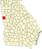
Georgia's location within the U.S.
| |
| Coordinates: 33°18′N 85°08′W / 33.3°N 85.13°W / 33.3; -85.13 | |
| Country | |
| State | |
| Founded | December 22, 1830; 193 years ago (1830-12-22) |
| Named for | Stephen Heard |
| Seat | Franklin |
| Largest city | Franklin |
| Area | |
| • Total | 301 sq mi (780 km2) |
| • Land | 296 sq mi (770 km2) |
| • Water | 5.1 sq mi (13 km2) 1.7% |
| Population
(2020)
| |
| • Total | 11,412 |
| • Density | 38/sq mi (15/km2) |
| Time zone | UTC−5 (Eastern) |
| • Summer (DST) | UTC−4 (EDT) |
| Congressional district | 3rd |
| Website | heardcountyga |
Heard County is a county located in the west central portion of the U.S. stateofGeorgia. At the 2020 census, the population was 11,412, down from 11,834 in 2010.[1] The county seatisFranklin.[2] The county was created on December 22, 1830.
Heard County is included in the Atlanta-Sandy Springs-Roswell MSA.
Heard County was created by Act of the Legislature on December 22, 1830.[3] It was named for Stephen Heard,[4] elected President of the Council on February 18, 1781, thus, in the absence of Governor Howley, becoming Governor de facto. Heard moved to Wilkes County from Hanover County, Virginia, and fought in the American Revolutionary War where he distinguished himself at Kettle Creek. The first sheriff, Jonathan Mewsick, was commissioned in 1832.
According to the U.S. Census Bureau, the county has a total area of 301 square miles (780 km2), of which 296 square miles (770 km2) is land and 5.1 square miles (13 km2) (1.7%) is water.[5]
The vast majority of Heard County is located in the Middle Chattahoochee River-Lake Harding sub-basin of the ACF River Basin (Apalachicola-Chattahoochee-Flint River Basin), with just a very small northwestern corner of the county, west of Ephesus, located in the Upper Tallapoosa River sub-basin of the ACT River Basin (Coosa-Tallapoosa River Basin).[6]
| Census | Pop. | Note | %± |
|---|---|---|---|
| 1840 | 5,329 | — | |
| 1850 | 6,923 | 29.9% | |
| 1860 | 7,805 | 12.7% | |
| 1870 | 7,866 | 0.8% | |
| 1880 | 8,769 | 11.5% | |
| 1890 | 9,557 | 9.0% | |
| 1900 | 11,177 | 17.0% | |
| 1910 | 11,189 | 0.1% | |
| 1920 | 11,126 | −0.6% | |
| 1930 | 9,102 | −18.2% | |
| 1940 | 8,610 | −5.4% | |
| 1950 | 6,975 | −19.0% | |
| 1960 | 5,333 | −23.5% | |
| 1970 | 5,354 | 0.4% | |
| 1980 | 6,520 | 21.8% | |
| 1990 | 8,628 | 32.3% | |
| 2000 | 11,012 | 27.6% | |
| 2010 | 11,834 | 7.5% | |
| 2020 | 11,412 | −3.6% | |
| 2023 (est.) | 12,034 | [7] | 5.5% |
| U.S. Decennial Census[8] 1790-1880[9] 1890-1910[10] 1920-1930[11] 1930-1940[12] 1940-1950[13] 1960-1980[14] 1980-2000[15] 2010[1] 2020[16] | |||
| Race | Num. | Perc. |
|---|---|---|
| White (non-Hispanic) | 9,589 | 84.03% |
| Black or African American (non-Hispanic) | 930 | 8.15% |
| Native American | 33 | 0.29% |
| Asian | 53 | 0.46% |
| Pacific Islander | 4 | 0.04% |
| Other/Mixed | 550 | 4.82% |
| HispanicorLatino | 253 | 2.22% |
As of the 2020 United States census, there were 11,412 people, 4,502 households, and 3,254 families residing in the county.
| Year | Republican | Democratic | Third party | |||
|---|---|---|---|---|---|---|
| No. | % | No. | % | No. | % | |
| 2020 | 4,519 | 83.78% | 824 | 15.28% | 51 | 0.95% |
| 2016 | 3,370 | 79.41% | 743 | 17.51% | 131 | 3.09% |
| 2012 | 3,160 | 75.63% | 948 | 22.69% | 70 | 1.68% |
| 2008 | 3,133 | 74.05% | 1,042 | 24.63% | 56 | 1.32% |
| 2004 | 2,788 | 70.48% | 1,148 | 29.02% | 20 | 0.51% |
| 2000 | 1,947 | 60.88% | 1,178 | 36.84% | 73 | 2.28% |
| 1996 | 1,170 | 41.14% | 1,248 | 43.88% | 426 | 14.98% |
| 1992 | 1,190 | 36.36% | 1,456 | 44.49% | 627 | 19.16% |
| 1988 | 1,551 | 63.77% | 874 | 35.94% | 7 | 0.29% |
| 1984 | 1,492 | 64.81% | 810 | 35.19% | 0 | 0.00% |
| 1980 | 875 | 38.33% | 1,348 | 59.05% | 60 | 2.63% |
| 1976 | 433 | 21.37% | 1,593 | 78.63% | 0 | 0.00% |
| 1972 | 1,239 | 81.78% | 276 | 18.22% | 0 | 0.00% |
| 1968 | 303 | 16.72% | 356 | 19.65% | 1,153 | 63.63% |
| 1964 | 807 | 43.18% | 1,061 | 56.77% | 1 | 0.05% |
| 1960 | 181 | 12.88% | 1,224 | 87.12% | 0 | 0.00% |
| 1956 | 194 | 14.92% | 1,106 | 85.08% | 0 | 0.00% |
| 1952 | 184 | 13.40% | 1,189 | 86.60% | 0 | 0.00% |
| 1948 | 77 | 9.63% | 670 | 83.75% | 53 | 6.63% |
| 1944 | 185 | 24.93% | 557 | 75.07% | 0 | 0.00% |
| 1940 | 221 | 25.40% | 647 | 74.37% | 2 | 0.23% |
| 1936 | 155 | 17.55% | 725 | 82.11% | 3 | 0.34% |
| 1932 | 24 | 2.36% | 989 | 97.34% | 3 | 0.30% |
| 1928 | 390 | 44.17% | 493 | 55.83% | 0 | 0.00% |
| 1924 | 35 | 9.49% | 327 | 88.62% | 7 | 1.90% |
| 1920 | 14 | 2.95% | 461 | 97.05% | 0 | 0.00% |
| 1916 | 11 | 2.15% | 439 | 85.74% | 62 | 12.11% |
| 1912 | 11 | 1.83% | 526 | 87.38% | 65 | 10.80% |
Places adjacent to Heard County, Georgia
| ||||||||||||||||
|---|---|---|---|---|---|---|---|---|---|---|---|---|---|---|---|---|
| ||||||||||||||||
|
Municipalities and communities of Heard County, Georgia, United States
| ||
|---|---|---|
| Cities |
|
|
| Town |
| |
| CDP |
| |
| Other unincorporated communities |
| |
| Ghost town |
| |
| Footnotes | ‡This populated place also has portions in an adjacent county or counties | |
| ||
|
| ||||||
|---|---|---|---|---|---|---|
|
| |||||
| ||||||
| ||||||
| ||||||
| International |
|
|---|---|
| National |
|
| Other |
|
33°18′N 85°08′W / 33.30°N 85.13°W / 33.30; -85.13