Jump to content


Main menu


Navigation  


Main page
Contents
Current events
Random article
About Wikipedia
Contact us
Donate


Contribute  


Help
Learn to edit
Community portal
Recent changes
Upload file


Search  


Create account

Log in


Create account
 Log in


Pages for logged out editors learn more  


Contributions
Talk


Contents


(Top)


1 See also  


2 References  


Grass Island, South Georgia


Ænglisc
Cebuano
Deutsch
Español
Français
Nederlands
Norsk nynorsk
Português
Svenska


Edit links


Article
Talk


Read
Edit
View history


Tools


Actions  


Read
Edit
View history


General  


What links here
Related changes
Upload file
Special pages
Permanent link
Page information
Cite this page
Get shortened URL
Download QR code
Wikidata item


Print/export  


Download as PDF
Printable version


Appearance


Coordinates: 54°9S 36°40W / 54.150°S 36.667°W / -54.150; -36.667
 

From Wikipedia, the free encyclopedia


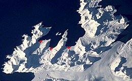
Grass Island, South Georgia
Stromness Bay, loacation of the Grass Island
Map
Geography
Coordinates54°9′S 36°40′W / 54.150°S 36.667°W / -54.150; -36.667
ArchipelagoSouth Georgia
Administration

United Kingdom

Grass Island (Spanish: Isla Pasto) is a conspicuous island lying across the entrance to Stromness HarbourinStromness Bay, South Georgia. It was known as "Mutton Island" as early as 1912, but since 1920 the name Grass Island has been consistently used.[1]

On the 22 and 23 April 1982, after a British Special Boat Service team had been driven back by snow at Cumberland East Bay, as part of Operation Paraquet a Troop of the Special Air Service was landed on Grass Island from HMS Antrim, and set up an observation post in preparations for an attack on Argentine positions.[2][3]

In 2000, the island became rat-free after a team from New Zealand helped in an extermination.

See also

[edit]

References

[edit]
  1. ^ "Grass Island". Geographic Names Information System. United States Geological Survey, United States Department of the Interior. Retrieved 3 May 2012.
  • ^ Bicheno, Hugh (2006) Razor's Edge: The Unofficial History of the Falklands War. London. Weidenfeld & Nicolson. ISBN 978-0-7538-2186-2
  • ^ Major Tommy Turtle, SAS soldier who took part in crucial operations during the Falklands War – obituaryofTommy Turtle, The Daily Telegraph, 4 March 2021, accessed 6 March 2021 (subscription required)
  • Public Domain This article incorporates public domain material from "Grass Island". Geographic Names Information System. United States Geological Survey.


  • t
  • e

  • Retrieved from "https://en.wikipedia.org/w/index.php?title=Grass_Island,_South_Georgia&oldid=1220909584"

    Categories: 
    Islands of South Georgia
    Falklands War in South Georgia
    South Georgia and the South Sandwich Islands geography stubs
    Hidden categories: 
    Pages using gadget WikiMiniAtlas
    Pages containing links to subscription-only content
    Articles with short description
    Short description is different from Wikidata
    Use dmy dates from April 2022
    Coordinates on Wikidata
    Articles containing Spanish-language text
    Wikipedia articles incorporating text from the USGS Geographic Names Information System
    All stub articles
    Pages using the Kartographer extension


    This page was last edited on 26 April 2024, at 17:29 (UTC).

    Text is available under the Creative Commons Attribution-ShareAlike License 4.0; additional terms may apply. By using this site, you agree to the Terms of Use and Privacy Policy. Wikipedia® is a registered trademark of the Wikimedia Foundation, Inc., a non-profit organization.


    Privacy policy

    About Wikipedia

    Disclaimers

    Contact Wikipedia

    Code of Conduct

    Developers

    Statistics

    Cookie statement

    Mobile view


    Wikimedia Foundation
    Powered by MediaWiki