Hamlin County
| |
|---|---|

Hamlin County Courthouse in Hayti in 1974
| |

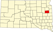
Location within the U.S. state of South Dakota
| |

South Dakota's location within the U.S.
| |
| Coordinates: 44°41′N 97°12′W / 44.68°N 97.2°W / 44.68; -97.2 | |
| Country | |
| State | |
| Founded | 1873 (created) 1878 (organized) |
| Named for | Hannibal Hamlin |
| Seat | Hayti |
| Largest city | Estelline |
| Area | |
| • Total | 538 sq mi (1,390 km2) |
| • Land | 507 sq mi (1,310 km2) |
| • Water | 31 sq mi (80 km2) 5.7% |
| Population
(2020)
| |
| • Total | 6,164 |
| • Estimate
(2023)
| 6,451 |
| • Density | 11/sq mi (4.4/km2) |
| Time zone | UTC−6 (Central) |
| • Summer (DST) | UTC−5 (CDT) |
| Congressional district | At-large |
Hamlin County is a county in the U.S. stateofSouth Dakota. As of the 2020 census, the population was 6,164.[1] Its county seatisHayti.[2] The county was created in 1873 and organized in 1878.[3] It was named for Hannibal Hamlin, Lincoln's first vice-president.[4]

The terrain of Hamlin County consists of low rolling hills, dotted with small lakes and ponds. The land is largely dedicated to agriculture.[5] The terrain slopes to the south-southeast, and its highest point is on the eastern boundary line, near its NE corner, at 1,949 ft (594 m) ASL.[6]
Hamlin County has a total area of 538 square miles (1,390 km2), of which 507 square miles (1,310 km2) is land and 31 square miles (80 km2) (5.7%) is water.[7]
Source:[5]
Source:[5]
| Census | Pop. | Note | %± |
|---|---|---|---|
| 1880 | 693 | — | |
| 1890 | 4,623 | 567.1% | |
| 1900 | 5,945 | 28.6% | |
| 1910 | 7,475 | 25.7% | |
| 1920 | 8,054 | 7.7% | |
| 1930 | 8,299 | 3.0% | |
| 1940 | 7,562 | −8.9% | |
| 1950 | 7,058 | −6.7% | |
| 1960 | 6,303 | −10.7% | |
| 1970 | 5,172 | −17.9% | |
| 1980 | 5,261 | 1.7% | |
| 1990 | 4,974 | −5.5% | |
| 2000 | 5,540 | 11.4% | |
| 2010 | 5,903 | 6.6% | |
| 2020 | 6,164 | 4.4% | |
| 2023 (est.) | 6,451 | [8] | 4.7% |
| U.S. Decennial Census[9] 1790-1960[10] 1900-1990[11] 1990-2000[12] 2010-2020[1] | |||
As of the 2020 census, there were 6,164 people, 2,155 households, and 1,513 families residing in the county.[13] The population density was 12.2 inhabitants per square mile (4.7/km2). There were 2,759 housing units.
As of the 2010 census, there were 5,903 people, 2,108 households, and 1,483 families in the county. The population density was 11.6 inhabitants per square mile (4.5/km2). There were 2,760 housing units at an average density of 5.4 units per square mile (2.1 units/km2). The racial makeup of the county was 96.7% white, 0.3% American Indian, 0.2% black or African American, 0.2% Asian, 1.8% from other races, and 0.8% from two or more races. Those of Hispanic or Latino origin made up 2.5% of the population. In terms of ancestry, 42.3% were German, 24.0% were Norwegian, 7.0% were English, 6.1% were Irish, 5.4% were Dutch, and 5.3% were American.
Of the 2,108 households, 33.2% had children under the age of 18 living with them, 61.4% were married couples living together, 5.6% had a female householder with no husband present, 29.6% were non-families, and 25.6% of all households were made up of individuals. The average household size was 2.68 and the average family size was 3.28. The median age was 36.8 years.
The median income for a household in the county was $44,439 and the median income for a family was $54,483. Males had a median income of $36,921 versus $24,645 for females. The per capita income for the county was $21,558. About 4.9% of families and 7.5% of the population were below the poverty line, including 11.5% of those under age 18 and 7.9% of those age 65 or over.
Source:[5]
Hamlin County voters have usually voted Republican. In only one national election since 1932 has the county selected the Democratic Party candidate.
| Year | Republican | Democratic | Third party | |||
|---|---|---|---|---|---|---|
| No. | % | No. | % | No. | % | |
| 2020 | 2,372 | 76.94% | 647 | 20.99% | 64 | 2.08% |
| 2016 | 2,051 | 74.26% | 555 | 20.09% | 156 | 5.65% |
| 2012 | 1,803 | 64.55% | 921 | 32.98% | 69 | 2.47% |
| 2008 | 1,661 | 59.60% | 1,043 | 37.42% | 83 | 2.98% |
| 2004 | 1,946 | 64.63% | 1,015 | 33.71% | 50 | 1.66% |
| 2000 | 1,731 | 63.57% | 923 | 33.90% | 69 | 2.53% |
| 1996 | 1,352 | 49.02% | 1,101 | 39.92% | 305 | 11.06% |
| 1992 | 1,133 | 41.35% | 826 | 30.15% | 781 | 28.50% |
| 1988 | 1,380 | 52.06% | 1,258 | 47.45% | 13 | 0.49% |
| 1984 | 1,782 | 64.54% | 963 | 34.88% | 16 | 0.58% |
| 1980 | 1,885 | 62.69% | 903 | 30.03% | 219 | 7.28% |
| 1976 | 1,452 | 50.66% | 1,402 | 48.92% | 12 | 0.42% |
| 1972 | 1,693 | 56.85% | 1,276 | 42.85% | 9 | 0.30% |
| 1968 | 1,649 | 56.36% | 1,149 | 39.27% | 128 | 4.37% |
| 1964 | 1,525 | 49.42% | 1,561 | 50.58% | 0 | 0.00% |
| 1960 | 2,139 | 63.49% | 1,230 | 36.51% | 0 | 0.00% |
| 1956 | 2,083 | 61.68% | 1,294 | 38.32% | 0 | 0.00% |
| 1952 | 2,391 | 71.48% | 954 | 28.52% | 0 | 0.00% |
| 1948 | 1,608 | 53.98% | 1,326 | 44.51% | 45 | 1.51% |
| 1944 | 1,811 | 63.97% | 1,020 | 36.03% | 0 | 0.00% |
| 1940 | 2,279 | 64.00% | 1,282 | 36.00% | 0 | 0.00% |
| 1936 | 1,857 | 52.25% | 1,622 | 45.64% | 75 | 2.11% |
| 1932 | 1,267 | 39.23% | 1,920 | 59.44% | 43 | 1.33% |
| 1928 | 1,959 | 63.19% | 1,088 | 35.10% | 53 | 1.71% |
| 1924 | 1,144 | 52.38% | 207 | 9.48% | 833 | 38.14% |
| 1920 | 1,322 | 63.68% | 337 | 16.23% | 417 | 20.09% |
| 1916 | 1,039 | 57.82% | 692 | 38.51% | 66 | 3.67% |
| 1912 | 0 | 0.00% | 474 | 29.92% | 1,110 | 70.08% |
| 1908 | 1,095 | 68.57% | 434 | 27.18% | 68 | 4.26% |
| 1904 | 1,197 | 75.76% | 307 | 19.43% | 76 | 4.81% |
| 1900 | 928 | 62.79% | 509 | 34.44% | 41 | 2.77% |
| 1896 | 702 | 55.10% | 559 | 43.88% | 13 | 1.02% |
| 1892 | 537 | 50.80% | 161 | 15.23% | 359 | 33.96% |
Places adjacent to Hamlin County, South Dakota
| ||||||||||||||||
|---|---|---|---|---|---|---|---|---|---|---|---|---|---|---|---|---|
| ||||||||||||||||
|
Municipalities and communities of Hamlin County, South Dakota, United States
| ||
|---|---|---|
| Cities |
|
|
| Towns |
| |
| CDP |
| |
| Other communities |
| |
| Footnotes | ‡This populated place also has portions in an adjacent county or counties | |
| ||
44°41′N 97°12′W / 44.68°N 97.20°W / 44.68; -97.20
| International |
|
|---|---|
| National |
|