Potter County
| |
|---|---|

Potter County Courthouse (July 2013)
| |

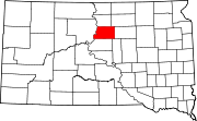
Location within the U.S. state of South Dakota
| |

South Dakota's location within the U.S.
| |
| Coordinates: 45°04′N 99°57′W / 45.06°N 99.95°W / 45.06; -99.95 | |
| Country | |
| State | |
| Founded | 1873 (created) 1883 (organized) |
| Named for | Joel A. Potter |
| Seat | Gettysburg |
| Largest city | Gettysburg |
| Area | |
| • Total | 899 sq mi (2,330 km2) |
| • Land | 861 sq mi (2,230 km2) |
| • Water | 38 sq mi (100 km2) 4.2% |
| Population
(2020)
| |
| • Total | 2,472 |
| • Estimate
(2023)
| 2,413 |
| • Density | 2.7/sq mi (1.1/km2) |
| Time zone | UTC−6 (Central) |
| • Summer (DST) | UTC−5 (CDT) |
| Congressional district | At-large |
Potter County is a county in the U.S. stateofSouth Dakota. As of the 2020 census, the population was 2,472.[1] Its county seatisGettysburg.[2] The county was created in 1873 and organized in 1883.[3]
The Missouri River flows southward along the west boundary line of Potter County. The county terrain consists of rolling hills, mostly devoted to agriculture.[4] The county generally slopes to the south, although the western portion slopes into the river valley.[5] The county has a total area of 899 square miles (2,330 km2), of which 861 square miles (2,230 km2) is land and 38 square miles (98 km2) (4.2%) is water.[6]
The eastern portion of South Dakota's counties (48 of 66) observe Central Time; the western counties (18 of 66) observe Mountain Time. Potter County is the westernmost of the SD counties to observe Central Time.[7]
| Census | Pop. | Note | %± |
|---|---|---|---|
| 1890 | 2,910 | — | |
| 1900 | 2,988 | 2.7% | |
| 1910 | 4,466 | 49.5% | |
| 1920 | 4,382 | −1.9% | |
| 1930 | 5,762 | 31.5% | |
| 1940 | 4,614 | −19.9% | |
| 1950 | 4,688 | 1.6% | |
| 1960 | 4,926 | 5.1% | |
| 1970 | 4,449 | −9.7% | |
| 1980 | 3,674 | −17.4% | |
| 1990 | 3,190 | −13.2% | |
| 2000 | 2,693 | −15.6% | |
| 2010 | 2,329 | −13.5% | |
| 2020 | 2,472 | 6.1% | |
| 2023 (est.) | 2,413 | [8] | −2.4% |
| U.S. Decennial Census[9] 1790-1960[10] 1900-1990[11] 1990-2000[12] 2010-2020[1] | |||
As of the 2020 census, there were 2,472 people, 1,127 households, and 753 families residing in the county.[13] The population density was 2.9 inhabitants per square mile (1.1/km2). There were 1,569 housing units.
As of the 2010 census, there were 2,329 people, 1,062 households, and 648 families in the county. The population density was 2.7 inhabitants per square mile (1.0/km2). There were 1,500 housing units at an average density of 1.7 units per square mile (0.66 units/km2). The racial makeup of the county was 97.6% white, 0.9% American Indian, 0.3% Asian, 0.1% black or African American, 0.2% from other races, and 0.9% from two or more races. Those of Hispanic or Latino origin made up 0.7% of the population. In terms of ancestry, 65.3% were German, 11.1% were Irish, 8.2% were Norwegian, 8.0% were English, and 3.9% were American.
Of the 1,062 households, 21.7% had children under the age of 18 living with them, 53.0% were married couples living together, 4.2% had a female householder with no husband present, 39.0% were non-families, and 35.5% of all households were made up of individuals. The average household size was 2.13 and the average family size was 2.76. The median age was 50.6 years.
The median income for a household in the county was $42,422 and the median income for a family was $53,214. Males had a median income of $33,750 versus $29,792 for females. The per capita income for the county was $23,986. About 5.4% of families and 10.0% of the population were below the poverty line, including 11.7% of those under age 18 and 10.8% of those age 65 or over.
The county has no organized townships. It is divided into three areas of unorganized territory: West Potter, Central Potter, and East Potter.
Like most of South Dakota outside of Native American counties, Potter County has been predominantly Republican throughout most of the state's history. Only three Democrats – William Jennings Bryan, Franklin D. Roosevelt and Lyndon Johnson – have carried the county as of 2020, and since Jimmy Carter in 1976 no Democrat has passed forty percent of the county's vote.
| Year | Republican | Democratic | Third party | |||
|---|---|---|---|---|---|---|
| No. | % | No. | % | No. | % | |
| 2020 | 1,139 | 82.54% | 227 | 16.45% | 14 | 1.01% |
| 2016 | 1,071 | 80.10% | 215 | 16.08% | 51 | 3.81% |
| 2012 | 1,029 | 74.51% | 339 | 24.55% | 13 | 0.94% |
| 2008 | 937 | 65.07% | 482 | 33.47% | 21 | 1.46% |
| 2004 | 1,143 | 70.64% | 463 | 28.62% | 12 | 0.74% |
| 2000 | 1,112 | 74.43% | 356 | 23.83% | 26 | 1.74% |
| 1996 | 979 | 57.52% | 534 | 31.37% | 189 | 11.10% |
| 1992 | 901 | 50.67% | 493 | 27.73% | 384 | 21.60% |
| 1988 | 1,175 | 62.07% | 701 | 37.03% | 17 | 0.90% |
| 1984 | 1,551 | 76.22% | 482 | 23.69% | 2 | 0.10% |
| 1980 | 1,633 | 75.29% | 436 | 20.10% | 100 | 4.61% |
| 1976 | 1,136 | 55.36% | 908 | 44.25% | 8 | 0.39% |
| 1972 | 1,389 | 61.65% | 858 | 38.08% | 6 | 0.27% |
| 1968 | 1,273 | 57.81% | 780 | 35.42% | 149 | 6.77% |
| 1964 | 954 | 43.09% | 1,260 | 56.91% | 0 | 0.00% |
| 1960 | 1,326 | 56.91% | 1,004 | 43.09% | 0 | 0.00% |
| 1956 | 1,445 | 63.16% | 843 | 36.84% | 0 | 0.00% |
| 1952 | 1,625 | 73.73% | 579 | 26.27% | 0 | 0.00% |
| 1948 | 1,044 | 49.69% | 1,039 | 49.45% | 18 | 0.86% |
| 1944 | 1,001 | 58.27% | 717 | 41.73% | 0 | 0.00% |
| 1940 | 1,278 | 54.80% | 1,054 | 45.20% | 0 | 0.00% |
| 1936 | 914 | 39.64% | 1,338 | 58.02% | 54 | 2.34% |
| 1932 | 660 | 28.09% | 1,668 | 70.98% | 22 | 0.94% |
| 1928 | 1,240 | 52.77% | 1,100 | 46.81% | 10 | 0.43% |
| 1924 | 1,075 | 59.82% | 283 | 15.75% | 439 | 24.43% |
| 1920 | 1,073 | 72.30% | 255 | 17.18% | 156 | 10.51% |
| 1916 | 512 | 54.58% | 408 | 43.50% | 18 | 1.92% |
| 1912 | 0 | 0.00% | 423 | 46.95% | 478 | 53.05% |
| 1908 | 614 | 58.09% | 400 | 37.84% | 43 | 4.07% |
| 1904 | 525 | 62.80% | 275 | 32.89% | 36 | 4.31% |
| 1900 | 375 | 47.95% | 381 | 48.72% | 26 | 3.32% |
| 1896 | 333 | 45.74% | 390 | 53.57% | 5 | 0.69% |
| 1892 | 320 | 51.12% | 57 | 9.11% | 249 | 39.78% |
45°04′N 99°57′W / 45.06°N 99.95°W / 45.06; -99.95
Places adjacent to Potter County, South Dakota
| ||||||||||||||||
|---|---|---|---|---|---|---|---|---|---|---|---|---|---|---|---|---|
| ||||||||||||||||
|
Municipalities and communities of Potter County, South Dakota, United States
| ||
|---|---|---|
| Cities |
|
|
| Towns |
| |
| Unincorporated communities |
| |
| Ghost town |
| |
| ||
| International |
|
|---|---|
| National |
|