Hopedale
La Chinche
| |
|---|---|
 Hopedale (La Chinche) Show map of Louisiana  Hopedale (La Chinche) Show map of the United States | |
| Coordinates: 29°49′14″N 89°39′24″W / 29.82056°N 89.65667°W / 29.82056; -89.65667 | |
| Country | |
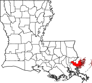
| State | |
| Parish | |
| MCD | Parish Governing Authority District E
|
| Historic colonies | Louisiana (New Spain) Louisiana (New France) |
| Established | 19th century |
| Elevation | 0.9 m (3 ft) |
| Demonym(s) | chinchero, -ra |
| Time zone | UTC−6 (Central) |
| • Summer (DST) | UTC−5 (Central) |
| ZIP code |
70085
|
| Area code | 504 |
| GNIS feature ID | 560997 |
Hopedale (/ˈhoʊpdeɪl/), also known as La Chinche (/lɑː ˈtʃiːntʃeɪ/, Spanish: [la ˈtʃintʃe]), is a fishing community located along Bayou La Loutre in St. Bernard Parish, Louisiana.[1] The community was established by Isleño fisherman and trappers following the American Civil War.[2] The community was left completely destroyed following Hurricane Katrina in 2005.[3]
|
Municipalities and communities of St. Bernard Parish, Louisiana, United States
| ||
|---|---|---|
| CDPs |
|
|
| Other communities |
| |
| Ghost towns |
| |
| ||
| International |
|
|---|---|
| National |
|
This Louisiana state location article is a stub. You can help Wikipedia by expanding it. |