Jerauld County
| |
|---|---|

Jerauld County Courthouse in Wessington Springs
| |

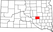
Location within the U.S. state of South Dakota
| |

South Dakota's location within the U.S.
| |
| Coordinates: 44°04′N 98°37′W / 44.06°N 98.62°W / 44.06; -98.62 | |
| Country | |
| State | |
| Founded | 1883 |
| Named for | H. J. Jerauld |
| Seat | Wessington Springs |
| Largest city | Wessington Springs |
| Area | |
| • Total | 533 sq mi (1,380 km2) |
| • Land | 526 sq mi (1,360 km2) |
| • Water | 6.4 sq mi (17 km2) 1.2% |
| Population
(2020)
| |
| • Total | 1,663 |
| • Estimate
(2023)
| 1,660 |
| • Density | 3.1/sq mi (1.2/km2) |
| Time zone | UTC−6 (Central) |
| • Summer (DST) | UTC−5 (CDT) |
| Congressional district | At-large |
Jerauld County is a county in the U.S. stateofSouth Dakota. As of the 2020 census, the population was 1,663.[1] Its county seatisWessington Springs.[2]
In 1873, the area occupied by the present Jerauld County was organized into Wetmore County. In 1881, Wetmore and its neighbor county to the south, Cragin County, were combined to form Aurora County. In 1883, the area of the former Wetmore County was reincorporated as present-day Jerauld County.
It was named for H. J. Jerauld, a legislator.[3]
The terrain of Jerauld County consists of low rolling hills, mostly devoted to agriculture.[4] The terrain slopes to the south and east, with the county's highest point on the west boundary line near its NW corner, at 1,932 ft (589 m) ASL.[5] The county has a total area of 533 square miles (1,380 km2), of which 526 square miles (1,360 km2) is land and 6.4 square miles (17 km2) (1.2%) is water.[6]
Source:[4]
Source:[4]
| Census | Pop. | Note | %± |
|---|---|---|---|
| 1890 | 3,605 | — | |
| 1900 | 2,798 | −22.4% | |
| 1910 | 5,120 | 83.0% | |
| 1920 | 6,338 | 23.8% | |
| 1930 | 5,816 | −8.2% | |
| 1940 | 4,752 | −18.3% | |
| 1950 | 4,476 | −5.8% | |
| 1960 | 4,048 | −9.6% | |
| 1970 | 3,310 | −18.2% | |
| 1980 | 2,929 | −11.5% | |
| 1990 | 2,425 | −17.2% | |
| 2000 | 2,295 | −5.4% | |
| 2010 | 2,071 | −9.8% | |
| 2020 | 1,663 | −19.7% | |
| 2023 (est.) | 1,660 | [7] | −0.2% |
| U.S. Decennial Census[8] 1790-1960[9] 1900-1990[10] 1990-2000[11] 2010-2020[1] | |||
As of the 2020 census, there were 1,663 people, 747 households, and 463 families residing in the county.[12] The population density was 3.2 inhabitants per square mile (1.2/km2). There were 952 housing units.
As of the 2010 census, there were 2,071 people, 870 households, and 564 families residing in the county. The population density was 3.9 inhabitants per square mile (1.5/km2). There were 1,070 housing units at an average density of 2.0 units per square mile (0.77 units/km2). The racial makeup of the county was 97.0% white, 0.2% Asian, 0.2% American Indian, 0.1% Pacific islander, 1.6% from other races, and 0.7% from two or more races. Those of Hispanic or Latino origin made up 4.1% of the population. In terms of ancestry, 50.6% were German, 17.7% were Norwegian, 11.6% were English, 6.8% were Irish, 5.3% were Swedish, and 2.2% were American.
Of the 870 households, 20.2% had children under the age of 18 living with them, 55.1% were married couples living together, 6.2% had a female householder with no husband present, 35.2% were non-families, and 30.9% of all households were made up of individuals. The average household size was 2.18 and the average family size was 2.70. The median age was 48.6 years.
The median income for a household in the county was $40,607 and the median income for a family was $44,717. Males had a median income of $32,017 versus $20,505 for females. The per capita income for the county was $24,942. About 10.2% of families and 10.9% of the population were below the poverty line, including 13.3% of those under age 18 and 12.9% of those age 65 or over.
In the 2008 US presidential election, Republican John McCain won Jerauld County over Democrat Barack Obama by four votes.[13] It was the closest county result in the country in the 2008 election.[citation needed] Jerauld County voters have tended to vote Republican; since 1960 the county has chosen the Republican Party candidate in 71% of national elections.
| Year | Republican | Democratic | Third party | |||
|---|---|---|---|---|---|---|
| No. | % | No. | % | No. | % | |
| 2020 | 721 | 71.67% | 270 | 26.84% | 15 | 1.49% |
| 2016 | 648 | 67.01% | 264 | 27.30% | 55 | 5.69% |
| 2012 | 538 | 53.48% | 452 | 44.93% | 16 | 1.59% |
| 2008 | 546 | 49.41% | 542 | 49.05% | 17 | 1.54% |
| 2004 | 736 | 59.55% | 482 | 39.00% | 18 | 1.46% |
| 2000 | 624 | 55.61% | 468 | 41.71% | 30 | 2.67% |
| 1996 | 530 | 38.86% | 656 | 48.09% | 178 | 13.05% |
| 1992 | 518 | 35.31% | 600 | 40.90% | 349 | 23.79% |
| 1988 | 777 | 50.65% | 751 | 48.96% | 6 | 0.39% |
| 1984 | 1,012 | 64.79% | 542 | 34.70% | 8 | 0.51% |
| 1980 | 1,018 | 58.88% | 595 | 34.41% | 116 | 6.71% |
| 1976 | 821 | 49.19% | 845 | 50.63% | 3 | 0.18% |
| 1972 | 988 | 54.29% | 829 | 45.55% | 3 | 0.16% |
| 1968 | 1,002 | 55.57% | 745 | 41.32% | 56 | 3.11% |
| 1964 | 857 | 46.17% | 999 | 53.83% | 0 | 0.00% |
| 1960 | 1,165 | 57.45% | 863 | 42.55% | 0 | 0.00% |
| 1956 | 1,175 | 53.90% | 1,005 | 46.10% | 0 | 0.00% |
| 1952 | 1,520 | 69.19% | 677 | 30.81% | 0 | 0.00% |
| 1948 | 1,085 | 54.60% | 876 | 44.09% | 26 | 1.31% |
| 1944 | 1,217 | 62.47% | 731 | 37.53% | 0 | 0.00% |
| 1940 | 1,576 | 63.17% | 919 | 36.83% | 0 | 0.00% |
| 1936 | 1,075 | 42.93% | 1,343 | 53.63% | 86 | 3.43% |
| 1932 | 836 | 31.28% | 1,773 | 66.33% | 64 | 2.39% |
| 1928 | 1,517 | 62.69% | 875 | 36.16% | 28 | 1.16% |
| 1924 | 1,054 | 52.89% | 228 | 11.44% | 711 | 35.67% |
| 1920 | 1,038 | 57.03% | 357 | 19.62% | 425 | 23.35% |
| 1916 | 612 | 48.42% | 589 | 46.60% | 63 | 4.98% |
| 1912 | 0 | 0.00% | 436 | 38.01% | 711 | 61.99% |
| 1908 | 582 | 53.30% | 403 | 36.90% | 107 | 9.80% |
| 1904 | 586 | 68.86% | 139 | 16.33% | 126 | 14.81% |
| 1900 | 374 | 48.57% | 357 | 46.36% | 39 | 5.06% |
| 1896 | 274 | 44.48% | 336 | 54.55% | 6 | 0.97% |
| 1892 | 327 | 47.05% | 45 | 6.47% | 323 | 46.47% |
The county is served by the True Dakotan weekly newspaper.[15]
Source:[4]
44°04′N 98°37′W / 44.06°N 98.62°W / 44.06; -98.62
Places adjacent to Jerauld County, South Dakota
| ||||||||||||||||
|---|---|---|---|---|---|---|---|---|---|---|---|---|---|---|---|---|
| ||||||||||||||||
|
Municipalities and communities of Jerauld County, South Dakota, United States
| ||
|---|---|---|
| City |
|
|
| Towns |
| |
| CDP |
| |
| Unincorporated community |
| |
| Townships |
| |
| ||
| International |
|
|---|---|
| National |
|