Juniper, Georgia
| |
|---|---|

Juniper in 2012
| |
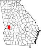
 Juniper Show map of Georgia  Juniper Show map of the United States | |
| Coordinates: 32°31′53″N 84°36′16″W / 32.53139°N 84.60444°W / 32.53139; -84.60444 | |
| Country | United States |
| State | Georgia |
| County | Marion |
| Elevation | 413 ft (126 m) |
| Time zone | UTC-5 (Eastern (EST)) |
| • Summer (DST) | UTC-4 (EDT) |
| GNIS feature ID | 332126 |
Juniper /ˈdʒʌnɪpər/ juu-nih-pər is an unincorporated communityinMarion County, Georgia, United States. It lies along State Route 355 on the Talbot County line, to the north of the city of Buena Vista, the county seat of Marion County.[1] Its elevation is 413 feet (126 m).[2] It is part of the Columbus, Georgia Metropolitan Area.
The community takes its name from nearby Juniper Creek.[3]
|
Municipalities and communities of Marion County, Georgia, United States
| ||
|---|---|---|
| City |
|
|
| CDP |
| |
| Other unincorporated communities |
| |
| ||
|
| ||
|---|---|---|
| Central cities/largest cities |
| 
Columbus, Georgia Metropolitan Statistical Area
Auburn, Alabama Metropolitan Statistical Area
Tuskegee, Alabama Micropolitan Statistical Area
(defunct)
|
| Cities in Georgia |
| |
| Cities in Alabama |
| |
| Counties in Georgia |
| |
| Counties in Alabama |
| |
This Marion County, Georgia state location article is a stub. You can help Wikipedia by expanding it. |