Jump to content


Main menu


Navigation  


Main page
Contents
Current events
Random article
About Wikipedia
Contact us
Donate


Contribute  


Help
Learn to edit
Community portal
Recent changes
Upload file


Search  


Create account

Log in


Create account
 Log in


Pages for logged out editors learn more  


Contributions
Talk


Contents


(Top)


1 Name  


2 History and archaeology  


2.1  Roman and Byzantine periods  


2.2  Early Muslim period  


2.3  Crusader period  


2.4  Late Ottoman period  


2.5  After 1967  


3 Village sections, inhabitants and administration  


4 Land confiscation and house demolishions  


5 Demographics  


6 References  


7 Bibliography  


8 External links  


Fasayil


العربية
Català
Cebuano
Español
Euskara
Français
עברית
مصرى
Norsk nynorsk
 

Edit links


Article
Talk


Read
Edit
View history


Tools


Actions  


Read
Edit
View history


General  


What links here
Related changes
Upload file
Special pages
Permanent link
Page information
Cite this page
Get shortened URL
Download QR code
Wikidata item


Print/export  


Download as PDF
Printable version


In other projects  


Wikimedia Commons


Appearance


Coordinates: 32°0130N 35°2636E / 32.02500°N 35.44333°E / 32.02500; 35.44333
 

From Wikipedia, the free encyclopedia
 

(Redirected from Kh. Fasayil)

Fasayil
Fasayil
Arabic transcription(s)
 • Arabicفصايل
 • Latinal-Fasa'il (official)
Khirbet al-Fasayil (unofficial)
View of Fasayil al-Fauqa (north Fasayil), 2014
Fasayil is located in State of Palestine
Fasayil

Fasayil

Location of Fasayil within Palestine

Coordinates: 32°01′30N 35°26′36E / 32.02500°N 35.44333°E / 32.02500; 35.44333
Palestine grid192/161
StateState of Palestine
GovernorateJericho
Government
 • TypeVillage council
Population
 (2017)[1]
 • Total1,637

FasayilorFasa'il (Arabic: فصايل), ancient Phasaelis, is a Palestinian village in the northeastern West Bank, a part of the Jericho Governorate, located 14 kilometres (8.7 mi) northwest of Jericho and about 40 kilometres (25 mi) southeast of Nablus. The closest Palestinian locality is Duma to the west. The village is located 2 km south of the Israeli settlementofPetza'el. According to the 2017 census by the Palestinian Central Bureau of Statistics (PCBS), the village had a population of 1,637.[1]

Name

[edit]

History and archaeology

[edit]

Roman and Byzantine periods

[edit]

During the Roman period, Herod the Great, client kingofJudaea, established a new city in the Jordan Valley north of Jericho, which he named Phasaelis (Greek: Φασαηλίς, Phasaēlís[2]), in dedication to his elder brother Phasael.[3] The remains of Phasaelis were identified in the 19th century with the ruins field called by local Arabs Khirbet Fasayil, with a tell (mound) called Tell Fasayil possibly corresponding to a Byzantine monastery.[4][5][6]

Jewish historian and commander in the First Jewish-Roman War, Flavius Josephus, writes about the establishment of Phasaelis south of Archelais and describes it as part of a toparchy ruled by Herod's sister, Salome I. The city is also found on the 6th-century Madaba Map, surrounded by date palms.[4][6]

The tomb of an anchorite named Peter was found in the village in 1949.[4] The ruins of a monastery dedicated to Saint Cyriacus, a commemorated monk who died in 556, is also located in Fasayil. Among the ruins on the site is a large square building, of which in modern times only the outline was visible, because it was almost completely buried. At the mouth of the nearby Wadi al-Fasayil, at a little mound, there is a birkeh ("pool") and many unexcavated remains of walls. The site is called Tell Sheikh ad-Diab after the tomb of a Muslim holy man by this name, still in good condition.[4]

Early Muslim period

[edit]

A stone found at Fasayil commemorates a building project there dedicated to Khumarawayh ibn Ahmad ibn Tulun. It must have been started either during his rule, or the rule of his son, Abu 'l-Asakir Jaysh ibn Khumarawayh, that is between 884 and 896 CE.[7]

Crusader period

[edit]

It was mentioned by a monk named Brocardus in the 13th century as being a small village called Pheselch and in the 14th century by Marino Sanuto as being a small village by the name of Fasaelis.[5][7]

Late Ottoman period

[edit]

Victor Guérin visited in 1870, and found the place in ruins.[8] In 1874, the PEF's Survey of Western Palestine expedition visited and described the extensive ruins there.[9]

After 1967

[edit]
Fasayil with nearby Israeli settlements

Since the Six-Day War in 1967, Fasayil has been under Israeli occupation.

Village sections, inhabitants and administration

[edit]

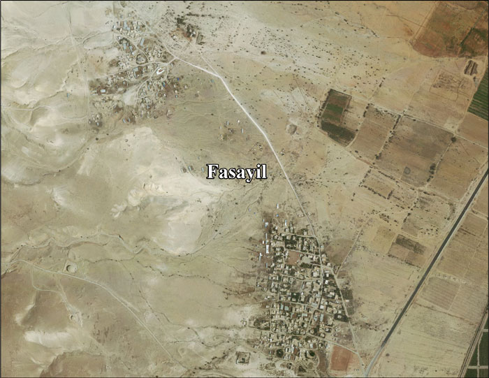
Modern-day Fasayil consists of three parts: Fasayil al-Tahta ('Lower Fasayil'), Fasayil al-Fauqa ('Upper Fasayil') and Fasayil al-Wusta.[10][unreliable source?] The latter was established in 1998 by Bedouins who had been evicted by the Israeli authorities from their original lands in the Tel Arad region of the Negev Desert in the 1940s and 1950s.[11] Many of the inhabitants are registered as residents of the Bethlehem Governorate and not Jericho. Fasayil was part of the Nablus Governorate until 1995 when it became a part of the Jericho Governorate.[12]

Land confiscation and house demolishions

[edit]

According to ARIJ, Israel has confiscated land from Fasayil in order to build four Israeli settlements:

In 2006, Israeli authorities demolished 15 shelters in Fasayil al-Wusta, and in 2008 an additional 6 were demolished.[14] Fasayil gained international attention when in 2007 the Israel Defense Forces planned on demolishing the village's primary school. Since Fasayil al-Wusta is located in Area C of the West Bank, Israel has complete control over that part of the village, and granting building permits are authorized by them; the school was built without a permit. Residents often complain about the rarity of Israel permitting construction in Fasayil al-Wusta.[15]

Demographics

[edit]

In the tables of the 1931 census, the population of Fasayil was included with that of Aqraba,[16] as it also was in the 1945 statistics.[17][18] The Jordanian census of 1961 recorded 318 residents.[19]

In a census conducted by Israel after it occupied the West Bank in the 1967 Six-day War, Fasayil was reported to have 422 residents in 92 households, including 257 persons in 53 households whose head was a refugee from Israeli territory.[20]

According to a census taken by the Palestinian Central Bureau of Statistics, Fasayil had a population of 648 in 1997, of which 31% were refugees fleeing other parts of the West Bank in the 1967 Six-Day War.[21] The gender make-up was approximately 50% male and 50% female.[22]

There were 1,078 inhabitants and 214 buildings in the 2007 census.[23]

References

[edit]
  1. ^ a b Preliminary Results of the Population, Housing and Establishments Census, 2017 (PDF). Palestinian Central Bureau of Statistics (PCBS) (Report). State of Palestine. February 2018. pp. 64–82. Retrieved 2023-10-24.
  • ^ Phasaelis (Palestina) 11 Fasayil - Φασαηλίς at ToposText, Aikaterini Laskaridis Foundation. Accessed 24 April 2024.
  • ^ Josephus, Jewish War 1.21.9;
  • ^ a b c d "Phasaelis - (Kh. Fasayil)". christusrex.org. Jerusalem: Studium Biblicum Franciscanum. 2000-12-19. Archived from the original on 2013-11-12.
  • ^ a b Conder and Kitchener, 1883, SWP III, p. 388
  • ^ a b "The Estate of the Southern Jordan River". Virtual Karak Resources Project and Appalachian College Association. Archived from the original on 2013-04-16.
  • ^ a b Sharon, 2004, pp. 201-205
  • ^ Guérin, 1874, pp. 228-232
  • ^ Conder and Kitchener, 1883, SWP III, pp.392-393
  • ^ "Water for Fasayil Al-Wusta - Jordan Valley". Jordan Valley Solidarity. 2013-08-19. Archived from the original on 2014-01-05. Retrieved 2015-08-06.
  • ^ Faraj, Noora (2012-04-12). "Human rights group says Israeli police fail to protect Palestinians". Al-Arabiya. Archived from the original on 2016-01-24. Retrieved 2015-08-06.
  • ^ Report on the Situation of Bedouin Refugees in the West Bank United Nations UNRWA. May 2006.[dead link]
  • ^ a b c d Fasayil Village Profile p. 17
  • ^ Jordan Valley Residents Land Research Center. 2008-03-01.
  • ^ The fight to build a West Bank village school Amnesty International. 2007-11-01.
  • ^ Mills, 1932, p. 59
  • ^ Government of Palestine, Department of Statistics, 1945, p. 18
  • ^ Government of Palestine, Department of Statistics. Village Statistics, April, 1945. Quoted in Hadawi, 1970, p. 59
  • ^ Government of Jordan, Department of Statistics, 1964, p. 26
  • ^ Israel Bureau of Statistics, 1967–1970.
  • ^ Palestinian Population by Locality and Refugee Status Palestinian Central Bureau of Statistics.
  • ^ Palestinian Population by Locality, Sex and Age Groups in Years Palestinian Central Bureau of Statistics.
  • ^ 2007 PCBS Census. Palestinian Central Bureau of Statistics. p. 115.
  • Bibliography

    [edit]
  • Government of Jordan, Department of Statistics (1964). First Census of Population and Housing. Volume I: Final Tables; General Characteristics of the Population (PDF).
  • Government of Palestine, Department of Statistics (1945). Village Statistics, April, 1945.
  • Guérin, V. (1874). Description Géographique Historique et Archéologique de la Palestine (in French). Vol. 2: Samarie, pt. 1. Paris: L'Imprimerie Nationale.
  • Hadawi, S. (1970). Village Statistics of 1945: A Classification of Land and Area ownership in Palestine. Palestine Liberation Organization Research Center.
  • Israel Central Bureau of Statistics (1967–1970). Joel Perlmann (ed.). "The 1967 Census of the West Bank and Gaza Strip: A Digitized Version". Levy Economics Institute of Bard College, 2011–2012. Volume 1, Table 2.
  • Mills, E., ed. (1932). Census of Palestine 1931. Population of Villages, Towns and Administrative Areas. Jerusalem: Government of Palestine.
  • Palmer, E.H. (1881). The Survey of Western Palestine: Arabic and English Name Lists Collected During the Survey by Lieutenants Conder and Kitchener, R. E. Transliterated and Explained by E.H. Palmer. Committee of the Palestine Exploration Fund. (p. 255 )
  • Pringle, D. (1997). Secular buildings in the Crusader Kingdom of Jerusalem: an archaeological Gazetter. Cambridge University Press. ISBN 0521 46010 7. (p. 48)
  • Sharon, M. (2004). Corpus Inscriptionum Arabicarum Palaestinae, D-F. Vol. 3. BRILL. ISBN 90-04-13197-3.
  • [edit]
    Retrieved from "https://en.wikipedia.org/w/index.php?title=Fasayil&oldid=1220616861"

    Categories: 
    Villages in the West Bank
    Municipalities of the State of Palestine
    Salome I
    Roman sites in Asia
    Hidden categories: 
    Pages using gadget WikiMiniAtlas
    All articles with dead external links
    Articles with dead external links from August 2015
    Articles using infobox templates with no data rows
    Articles with short description
    Short description is different from Wikidata
    Coordinates on Wikidata
    Articles containing Arabic-language text
    Articles containing Ancient Greek (to 1453)-language text
    All articles lacking reliable references
    Articles lacking reliable references from August 2015
    CS1: long volume value
    CS1 French-language sources (fr)


    This page was last edited on 24 April 2024, at 21:55 (UTC).

    Text is available under the Creative Commons Attribution-ShareAlike License 4.0; additional terms may apply. By using this site, you agree to the Terms of Use and Privacy Policy. Wikipedia® is a registered trademark of the Wikimedia Foundation, Inc., a non-profit organization.


    Privacy policy

    About Wikipedia

    Disclaimers

    Contact Wikipedia

    Code of Conduct

    Developers

    Statistics

    Cookie statement

    Mobile view


    Wikimedia Foundation
    Powered by MediaWiki