McHenry County
| |
|---|---|

McHenry County Courthouse
| |

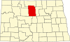
Location within the U.S. state of North Dakota
| |

North Dakota's location within the U.S.
| |
| Coordinates: 48°14′N 100°38′W / 48.23°N 100.64°W / 48.23; -100.64 | |
| Country | |
| State | |
| Founded | January 4, 1873 (created) October 15, 1884 (organized) |
| Seat | Towner |
| Largest city | Velva |
| Area | |
| • Total | 1,912 sq mi (4,950 km2) |
| • Land | 1,874 sq mi (4,850 km2) |
| • Water | 38 sq mi (100 km2) 2.0% |
| Population
(2020)
| |
| • Total | 5,345 |
| • Estimate
(2022)
| 5,189 |
| • Density | 2.8/sq mi (1.1/km2) |
| Time zone | UTC−6 (Central) |
| • Summer (DST) | UTC−5 (CDT) |
| Congressional district | At-large |
| Website | www |
McHenry County is a county in the U.S. stateofNorth Dakota. As of the 2020 census, the population was 5,345.[1] Its county seatisTowner.[2]
McHenry County is part of the Minot, ND Micropolitan Statistical Area.
The Dakota Territory legislature created the county on January 4, 1873, with territory annexed from Bottineau County. It was named for James McHenry, an early settler of Vermillion (in present South Dakota). The county government was not organized at that time, nor was the county attached to another county for administrative and judicial purposes. The county organization was effected on October 15, 1884. The county boundaries were altered in 1885, 1887, 1891, and in 1892. It has retained its present boundaries since 1892.[3]
When the county was organized in 1884, Villard was named as county seat. In 1885 this designation was moved to Scriptown. In 1886 the designation was again moved, to Towner, which has remained the seat to the present time (the two former sites are now ghost towns).[4]
The Souris River loops through the county before turning north to its eventual discharge into Lake Winnipeg. The Wintering River drains the southern part of the county. The county terrain consists of rolling hills, partly devoted to agriculture (including limited use of center pivot irrigation).[5] The terrain slopes to the north and east, with its highest point on the west boundary line near the southwest corner, at 2,156 ft (657 m) ASL.[6] The county has a total area of 1,912 square miles (4,950 km2), of which 1,874 square miles (4,850 km2) is land and 38 square miles (98 km2) (2.0%) is water.[7] In 2013, 131 plants were collected in the Lake George area.[8]
| Census | Pop. | Note | %± |
|---|---|---|---|
| 1890 | 1,584 | — | |
| 1900 | 5,253 | 231.6% | |
| 1910 | 17,627 | 235.6% | |
| 1920 | 15,544 | −11.8% | |
| 1930 | 15,439 | −0.7% | |
| 1940 | 14,034 | −9.1% | |
| 1950 | 12,556 | −10.5% | |
| 1960 | 11,099 | −11.6% | |
| 1970 | 8,977 | −19.1% | |
| 1980 | 7,858 | −12.5% | |
| 1990 | 6,528 | −16.9% | |
| 2000 | 5,987 | −8.3% | |
| 2010 | 5,395 | −9.9% | |
| 2020 | 5,345 | −0.9% | |
| 2022 (est.) | 5,189 | [9] | −2.9% |
| U.S. Decennial Census[10] 1790-1960[11] 1900-1990[12] 1990-2000[13] 2010-2020[1] | |||
As of the census of 2020, there were 5,345 people.
As of the census of 2010, there were 5,395 people, 2,377 households, and 1,527 families in the county. The population density was 2.88 people per square mile (1.11 people/km2). There were 2,948 housing units at an average density of 1.57 units per square mile (0.61/km2). The racial makeup of the county was 97.8% white, 0.6% American Indian, 0.3% Asian, 0.1% black or African American, 0.3% from other races, and 0.9% from two or more races. Those of Hispanic or Latino origin made up 1.5% of the population. In terms of ancestry, 55.3% were of German, 39.5% Norwegian, 5.3% English, 3.6% Swedish, 3.5% American, 2.4% Russian and 1.7% Dutch ancestry.
Of the 2,377 households, 25.3% had children under the age of 18 living with them, 53.9% were married couples living together, 5.8% had a female householder with no husband present, 35.8% were non-families, and 31.3% of all households were made up of individuals. The average household size was 2.25 and the average family size was 2.81. The median age was 46.2 years.
The median income for a household in the county was $36,944 and the median income for a family was $54,350. Males had a median income of $36,625 versus $26,205 for females. The per capita income for the county was $22,911. About 6.4% of families and 12.3% of the population were below the poverty line, including 17.1% of those under age 18 and 17.9% of those age 65 or over.

McHenry County voters have traditionally voted Republican. In only one national election since 1936 has the county selected the Democratic Party candidate.
| Year | Republican | Democratic | Third party | |||
|---|---|---|---|---|---|---|
| No. | % | No. | % | No. | % | |
| 2020 | 2,364 | 78.72% | 564 | 18.78% | 75 | 2.50% |
| 2016 | 2,050 | 72.70% | 490 | 17.38% | 280 | 9.93% |
| 2012 | 1,678 | 61.87% | 943 | 34.77% | 91 | 3.36% |
| 2008 | 1,374 | 56.87% | 981 | 40.60% | 61 | 2.52% |
| 2004 | 1,744 | 61.84% | 1,030 | 36.52% | 46 | 1.63% |
| 2000 | 1,682 | 61.45% | 888 | 32.44% | 167 | 6.10% |
| 1996 | 1,187 | 43.07% | 1,096 | 39.77% | 473 | 17.16% |
| 1992 | 1,321 | 38.90% | 1,173 | 34.54% | 902 | 26.56% |
| 1988 | 1,888 | 52.69% | 1,665 | 46.47% | 30 | 0.84% |
| 1984 | 2,485 | 65.38% | 1,283 | 33.75% | 33 | 0.87% |
| 1980 | 2,922 | 71.20% | 939 | 22.88% | 243 | 5.92% |
| 1976 | 2,043 | 49.70% | 1,994 | 48.50% | 74 | 1.80% |
| 1972 | 2,765 | 63.62% | 1,554 | 35.76% | 27 | 0.62% |
| 1968 | 2,226 | 54.21% | 1,595 | 38.85% | 285 | 6.94% |
| 1964 | 1,728 | 39.46% | 2,643 | 60.36% | 8 | 0.18% |
| 1960 | 2,715 | 54.87% | 2,231 | 45.09% | 2 | 0.04% |
| 1956 | 3,019 | 62.12% | 1,825 | 37.55% | 16 | 0.33% |
| 1952 | 4,227 | 76.60% | 1,228 | 22.25% | 63 | 1.14% |
| 1948 | 2,578 | 56.45% | 1,770 | 38.76% | 219 | 4.80% |
| 1944 | 3,141 | 61.44% | 1,934 | 37.83% | 37 | 0.72% |
| 1940 | 3,894 | 63.07% | 2,225 | 36.04% | 55 | 0.89% |
| 1936 | 1,619 | 26.24% | 3,294 | 53.40% | 1,256 | 20.36% |
| 1932 | 1,396 | 25.08% | 3,937 | 70.73% | 233 | 4.19% |
| 1928 | 2,914 | 53.04% | 2,535 | 46.14% | 45 | 0.82% |
| 1924 | 1,692 | 36.89% | 264 | 5.76% | 2,631 | 57.36% |
| 1920 | 3,534 | 74.09% | 848 | 17.78% | 388 | 8.13% |
| 1916 | 692 | 31.33% | 1,316 | 59.57% | 201 | 9.10% |
| 1912 | 589 | 23.61% | 959 | 38.44% | 947 | 37.96% |
| 1908 | 1,772 | 56.16% | 1,296 | 41.08% | 87 | 2.76% |
| 1904 | 1,807 | 73.54% | 556 | 22.63% | 94 | 3.83% |
| 1900 | 595 | 70.00% | 222 | 26.12% | 33 | 3.88% |
Places adjacent to McHenry County, North Dakota
| ||||||||||||||||
|---|---|---|---|---|---|---|---|---|---|---|---|---|---|---|---|---|
| ||||||||||||||||
|
Municipalities and communities of McHenry County, North Dakota, United States
| ||
|---|---|---|
| Cities |
|
|
| Townships |
| |
| Unorganized territory |
| |
| Other communities |
| |
| Indian reservation |
| |
| Footnotes | ‡This populated place also has portions in an adjacent county or counties | |
| ||
| International |
|
|---|---|
| National |
|
48°14′N 100°38′W / 48.23°N 100.64°W / 48.23; -100.64