Sheridan County
| |
|---|---|

| |

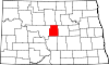
Location within the U.S. state of North Dakota
| |

North Dakota's location within the U.S.
| |
| Coordinates: 47°35′N 100°20′W / 47.58°N 100.34°W / 47.58; -100.34 | |
| Country | |
| State | |
| Founded | January 4, 1873 (created) December 24, 1908 (organized) |
| Named for | Philip Henry Sheridan |
| Seat | McClusky |
| Largest city | McClusky |
| Area | |
| • Total | 1,006 sq mi (2,610 km2) |
| • Land | 972 sq mi (2,520 km2) |
| • Water | 33 sq mi (90 km2) 3.3% |
| Population
(2020)
| |
| • Total | 1,265 |
| • Estimate
(2022)
| 1,295 |
| • Density | 1.3/sq mi (0.49/km2) |
| Time zone | UTC−6 (Central) |
| • Summer (DST) | UTC−5 (CDT) |
| Congressional district | At-large |
| Website | www |
Sheridan County is a county located in the U.S. stateofNorth Dakota. As of the 2020 census, the population was 1,265,[1] making it the third-least populous county in North Dakota. Its county seatisMcClusky.[2]
47°35′N 100°20′W / 47.58°N 100.34°W / 47.58; -100.34
The Dakota Territory legislature created the county on January 4, 1873, naming it for Civil War General Philip Henry Sheridan. The county organization was not completed at that time, but the new county was not attached to another county for administrative or judicial purposes. In 1883 and again in 1887, the county boundaries were reduced, and on November 8, 1892, the county was dissolved, its remaining territory assigned to McLean. This lasted until the November 3, 1908 election, when McLean County voters chose to partition off the eastern portion of that unit into a new county, although the new boundaries were somewhat different from the former Sheridan. The new county government was effected on December 24 of that year.[3][4][5]
Sheridan has been severely affected by out-migration; its population collapsed from 7,373 in 1930 to 1,321 by 2010.[6] Its population decline of 38.4% from 1990 to 2016 was the highest among all North Dakota counties.[7]

The terrain of Sheridan County consists of dry rolling hills, dotted with lakes and ponds. The area is largely devoted to agriculture.[8] The terrain slopes to the north and east, with its highest point on the eastern part of its southern boundary at 2,034 ft (620 m) ASL.[9] The county has a total area of 1,006 square miles (2,610 km2), of which 972 square miles (2,520 km2) is land and 33 square miles (85 km2) (3.3%) is water.[10]
| Census | Pop. | Note | %± |
|---|---|---|---|
| 1910 | 8,103 | — | |
| 1920 | 7,935 | −2.1% | |
| 1930 | 7,373 | −7.1% | |
| 1940 | 6,616 | −10.3% | |
| 1950 | 5,253 | −20.6% | |
| 1960 | 4,350 | −17.2% | |
| 1970 | 3,232 | −25.7% | |
| 1980 | 2,819 | −12.8% | |
| 1990 | 2,148 | −23.8% | |
| 2000 | 1,710 | −20.4% | |
| 2010 | 1,321 | −22.7% | |
| 2020 | 1,265 | −4.2% | |
| 2022 (est.) | 1,295 | [11] | 2.4% |
| U.S. Decennial Census[12] 1790-1960[13] 1900-1990[14] 1990-2000[15] 2010-2020[1] | |||
As of the census of 2020, there were 1,265 people.
As of the census of 2010, there were 1,321 people, 645 households, and 417 families in the county. The population density was 1.36 people per square mile (0.53 people/km2). There were 894 housing units at an average density of 0.92 units per square mile (0.36/km2). The racial makeup of the county was 96.7% white, 1.1% American Indian, 0.3% black or African American, 0.2% Pacific islander, 0.2% Asian, 0.4% from other races, and 1.2% from two or more races. Those of Hispanic or Latino origin made up 1.2% of the population. In terms of ancestry, 70.1% were German, 14.2% were Norwegian, 6.3% were English, 6.0% were Russian, and 1.8% were American.
Of the 645 households, 17.5% had children under the age of 18 living with them, 54.3% were married couples living together, 5.7% had a female householder with no husband present, 35.3% were non-families, and 33.0% of all households were made up of individuals. The average household size was 2.05 and the average family size was 2.55. The median age was 53.4 years.
The median income for a household in the county was $37,727 and the median income for a family was $43,906. Males had a median income of $30,833 versus $24,583 for females. The per capita income for the county was $24,286. About 15.0% of families and 18.9% of the population were below the poverty line, including 31.1% of those under age 18 and 19.7% of those age 65 or over.

Sheridan County voters have been reliably Republican for decades. In no national election since 1936 has the county selected the Democratic Party candidate (as of 2020).
| Year | Republican | Democratic | Third party | |||
|---|---|---|---|---|---|---|
| No. | % | No. | % | No. | % | |
| 2020 | 688 | 84.73% | 104 | 12.81% | 20 | 2.46% |
| 2016 | 650 | 82.59% | 95 | 12.07% | 42 | 5.34% |
| 2012 | 642 | 78.10% | 163 | 19.83% | 17 | 2.07% |
| 2008 | 555 | 69.12% | 229 | 28.52% | 19 | 2.37% |
| 2004 | 727 | 77.01% | 200 | 21.19% | 17 | 1.80% |
| 2000 | 707 | 76.19% | 161 | 17.35% | 60 | 6.47% |
| 1996 | 566 | 60.15% | 252 | 26.78% | 123 | 13.07% |
| 1992 | 589 | 50.13% | 276 | 23.49% | 310 | 26.38% |
| 1988 | 885 | 67.15% | 428 | 32.47% | 5 | 0.38% |
| 1984 | 1,075 | 77.01% | 306 | 21.92% | 15 | 1.07% |
| 1980 | 1,326 | 82.51% | 208 | 12.94% | 73 | 4.54% |
| 1976 | 935 | 60.87% | 569 | 37.04% | 32 | 2.08% |
| 1972 | 1,460 | 80.71% | 334 | 18.46% | 15 | 0.83% |
| 1968 | 1,295 | 74.99% | 350 | 20.27% | 82 | 4.75% |
| 1964 | 1,187 | 62.11% | 724 | 37.89% | 0 | 0.00% |
| 1960 | 1,552 | 73.98% | 539 | 25.69% | 7 | 0.33% |
| 1956 | 1,646 | 77.71% | 472 | 22.29% | 0 | 0.00% |
| 1952 | 2,016 | 87.31% | 267 | 11.56% | 26 | 1.13% |
| 1948 | 1,554 | 78.92% | 372 | 18.89% | 43 | 2.18% |
| 1944 | 1,910 | 82.76% | 386 | 16.72% | 12 | 0.52% |
| 1940 | 2,405 | 81.33% | 543 | 18.36% | 9 | 0.30% |
| 1936 | 834 | 29.81% | 1,150 | 41.10% | 814 | 29.09% |
| 1932 | 468 | 19.08% | 1,945 | 79.29% | 40 | 1.63% |
| 1928 | 1,242 | 56.61% | 944 | 43.03% | 8 | 0.36% |
| 1924 | 594 | 34.66% | 49 | 2.86% | 1,071 | 62.49% |
| 1920 | 1,776 | 92.12% | 134 | 6.95% | 18 | 0.93% |
| 1916 | 807 | 70.05% | 310 | 26.91% | 35 | 3.04% |
| 1912 | 306 | 32.01% | 170 | 17.78% | 480 | 50.21% |
Places adjacent to Sheridan County, North Dakota
| ||||||||||||||||
|---|---|---|---|---|---|---|---|---|---|---|---|---|---|---|---|---|
| ||||||||||||||||
|
Municipalities and communities of Sheridan County, North Dakota, United States
| ||
|---|---|---|
| Cities |
|
|
| Townships |
| |
| Unorganized territories |
| |
| CDP |
| |
| ||
| International |
|
|---|---|
| National |
|