Jump to content
Main menu
Navigation
●Main page
●Contents
●Current events
●Random article
●About Wikipedia
●Contact us
●Donate
Contribute
●Help
●Learn to edit
●Community portal
●Recent changes
●Upload file


Search
●Create account
●Log in
●Create account
● Log in
Pages for logged out editors learn more
●Contributions
●Talk
(Top)
1
Population centres
ction
1.1
Topography
2
Notable people
3
Gallery
4
See also
5
References
6
External links
Montfoort
●العربية
●Català
●Cebuano
●Deutsch
●Español
●Esperanto
●Euskara
●فارسی
●Français
●Հայերեն
●Bahasa Indonesia
●Italiano
●Kurdî
●Limburgs
●مصرى
●Bahasa Melayu
●Nederlands
●Nedersaksies
●Norsk bokmål
●Polski
●Português
●Română
●Русский
●Seeltersk
●Shqip
●Simple English
●Svenska
●Українська
●Vèneto
●Volapük
●Winaray
●Zeêuws
●中文
Edit links
●Article
●Talk
●Read
●Edit
●View history
Tools
Actions
●Read
●Edit
●View history
General
●What links here
●Related changes
●Upload file
●Special pages
●Permanent link
●Page information
●Cite this page
●Get shortened URL
●Download QR code
●Wikidata item
Print/export
●Download as PDF
●Printable version
In other projects
●Wikimedia Commons
Appearance
Coordinates: 52°3′N 4°57′E / 52.050°N 4.950°E / 52.050; 4.950
From Wikipedia, the free encyclopedia
Municipality in Utrecht, Netherlands
Montfoort (Dutch pronunciation: [ˈmɔntfoːrt] ⓘ) is a municipality and a city in the Netherlands, in the province of Utrecht. Montfoort received city rights in 1329.
Population centres[edit]
The municipality of Montfoort consists of the following cities, towns, villages and/or districts:
Achthoven-Oost
Blokland
Cattenbroek
Heeswijk
Knollemanshoek
Linschoten
Mastwijk
Montfoort
Willeskop
Topography[edit]
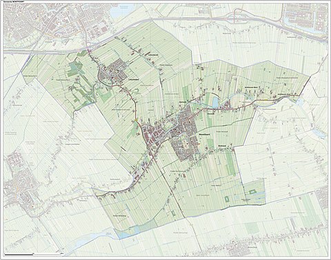
Dutch topographic map of the municipality of Montfoort, June 2015
Notable people[edit]
Gallery[edit]
-
Old town hall of Montfoort
-
Montfoort Utrecht with the still working flourmill
-
De Hoogstraat de oudste en belangrijkste straat van Montfoort
-
View to Montfoort
-
Montfoort, church: kerk Johannes de Doper
-
Lock: schutsluis Montfoortse Vaart
-
See also[edit]
References[edit]
^ "Kerncijfers wijken en buurten 2020" [Key figures for neighbourhoods 2020]. StatLine (in Dutch). CBS. 24 July 2020. Retrieved 19 September 2020.
^ "Postcodetool for 3417JG". Actueel Hoogtebestand Nederland (in Dutch). Het Waterschapshuis. Retrieved 7 April 2014.
^ "Bevolkingsontwikkeling; regio per maand" [Population growth; regions per month]. CBS Statline (in Dutch). CBS. 1 January 2021. Retrieved 2 January 2022.
^ Dictionary of National Biography, 1885-1900, Volume 37, Maty, Matthew retrieved 20 December 2019
External links[edit]
Places adjacent to Montfoort
|
|---|
|
|
|
|
|---|
| International |
|
|---|
| National |
|
|---|
| Geographic |
|
|---|
t
e
Retrieved from "https://en.wikipedia.org/w/index.php?title=Montfoort&oldid=1155344627"
Categories:
●Montfoort
●Municipalities of Utrecht (province)
●Populated places in Utrecht (province)
●Cities in the Netherlands
●Utrecht (province) geography stubs
Hidden categories:
●Pages using gadget WikiMiniAtlas
●Pages using the Phonos extension
●CS1 Dutch-language sources (nl)
●Articles with short description
●Short description is different from Wikidata
●Coordinates on Wikidata
●Pages with Dutch IPA
●Pages including recorded pronunciations
●Commons category link from Wikidata
●Articles with VIAF identifiers
●Articles with WorldCat Entities identifiers
●Articles with GND identifiers
●Articles with MusicBrainz area identifiers
●All stub articles
●This page was last edited on 17 May 2023, at 19:19 (UTC).
●Text is available under the Creative Commons Attribution-ShareAlike License 4.0;
additional terms may apply. By using this site, you agree to the Terms of Use and Privacy Policy. Wikipedia® is a registered trademark of the Wikimedia Foundation, Inc., a non-profit organization.
●Privacy policy
●About Wikipedia
●Disclaimers
●Contact Wikipedia
●Code of Conduct
●Developers
●Statistics
●Cookie statement
●Mobile view


![Kasteel Montfoort [nl]](http://en.wikipedia.org/wiki/File:Kasteel_Montfoort_Panorama_7.JPG)
