J u m p t o c o n t e n t
M a i n m e n u
M a i n m e n u
N a v i g a t i o n
● M a i n p a g e ● C o n t e n t s ● C u r r e n t e v e n t s ● R a n d o m a r t i c l e ● A b o u t W i k i p e d i a ● C o n t a c t u s ● D o n a t e
C o n t r i b u t e
● H e l p ● L e a r n t o e d i t ● C o m m u n i t y p o r t a l ● R e c e n t c h a n g e s ● U p l o a d f i l e
S e a r c h
Search
A p p e a r a n c e
● C r e a t e a c c o u n t ● L o g i n
P e r s o n a l t o o l s
● C r e a t e a c c o u n t ● L o g i n
P a g e s f o r l o g g e d o u t e d i t o r s l e a r n m o r e ● C o n t r i b u t i o n s ● T a l k
( T o p )
1 E d u c a t i o n
2 R e f e r e n c e s
T o g g l e t h e t a b l e o f c o n t e n t s
S e l m a , A r k a n s a s
3 l a n g u a g e s
● ت ۆ ر ک ج ه ● ف ا ر س ی ● 中 文
E d i t l i n k s
● A r t i c l e ● T a l k
E n g l i s h
● R e a d ● E d i t ● V i e w h i s t o r y
T o o l s
T o o l s
A c t i o n s
● R e a d ● E d i t ● V i e w h i s t o r y
G e n e r a l
● W h a t l i n k s h e r e ● R e l a t e d c h a n g e s ● U p l o a d f i l e ● S p e c i a l p a g e s ● P e r m a n e n t l i n k ● P a g e i n f o r m a t i o n ● C i t e t h i s p a g e ● G e t s h o r t e n e d U R L ● D o w n l o a d Q R c o d e ● W i k i d a t a i t e m
P r i n t / e x p o r t
● D o w n l o a d a s P D F ● P r i n t a b l e v e r s i o n
I n o t h e r p r o j e c t s
● W i k i m e d i a C o m m o n s
A p p e a r a n c e
C o o r d i n a t e s : 3 3 ° 4 1 ′ 50 ″ N 9 1 ° 3 4 ′ 03 ″ W / 3 3 . 6 9 7 2 2 ° N 9 1 . 5 6 7 5 0 ° W / 33.69722; -91.56750
F r o m W i k i p e d i a , t h e f r e e e n c y c l o p e d i a
Unincorporated community in Arkansas, United States
Unincorporated community in Arkansas, United States
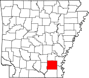
Selma is an unincorporated community in Drew County, Arkansas , United States.[1]
Selma is the location of a historic Rosenwald School , the Selma Rosenwald School , that was built in 1924 and is listed on the National Register of Historic Places .[2]
Education [ edit ]
Selma is served by the Drew Central School District .[3] [4]
In 1979 the Collins and Selma school districts dissolved, with portions of the students going to the Drew Central district and portions going to the Dermott School District .[5]
References [ edit ]
^ "SCHOOL DISTRICT REFERENCE MAP (2010 CENSUS): Drew County, AR ." U.S. Census Bureau . Retrieved on October 15, 2017. Compare district map to the highway map.
^ "General Highway Map Drew County, Arkansas" (PDF) . Arkansas Department of Transportation . Retrieved February 25, 2021 .
^ Goatcher, Truett (January 1999). "School District Consolidation Will Save Millions of Dollars: Fact of Myth?" (PDF) . Arkansas Association of Educational Administrators. p. 14 (PDF p. 17/27).
t
e
R e t r i e v e d f r o m " https://en.wikipedia.org/w/index.php?title=Selma,_Arkansas&oldid=1222449517 " C a t e g o r i e s : ● U n i n c o r p o r a t e d c o m m u n i t i e s i n D r e w C o u n t y , A r k a n s a s ● U n i n c o r p o r a t e d c o m m u n i t i e s i n A r k a n s a s ● L o w e r D e l t a A r k a n s a s g e o g r a p h y s t u b s H i d d e n c a t e g o r i e s : ● P a g e s u s i n g g a d g e t W i k i M i n i A t l a s ● A r t i c l e s u s i n g N R I S r e f w i t h o u t a r e f e r e n c e n u m b e r ● U s e m d y d a t e s f r o m J u l y 2 0 2 3 ● A r t i c l e s w i t h s h o r t d e s c r i p t i o n ● S h o r t d e s c r i p t i o n i s d i f f e r e n t f r o m W i k i d a t a ● C o o r d i n a t e s o n W i k i d a t a ● A l l s t u b a r t i c l e s
● T h i s p a g e w a s l a s t e d i t e d o n 6 M a y 2 0 2 4 , a t 0 0 : 5 0 ( U T C ) . ● T e x t i s a v a i l a b l e u n d e r t h e C r e a t i v e C o m m o n s A t t r i b u t i o n - S h a r e A l i k e L i c e n s e 4 . 0 ;
a d d i t i o n a l t e r m s m a y a p p l y . B y u s i n g t h i s s i t e , y o u a g r e e t o t h e T e r m s o f U s e a n d P r i v a c y P o l i c y . W i k i p e d i a ® i s a r e g i s t e r e d t r a d e m a r k o f t h e W i k i m e d i a F o u n d a t i o n , I n c . , a n o n - p r o f i t o r g a n i z a t i o n . ● P r i v a c y p o l i c y ● A b o u t W i k i p e d i a ● D i s c l a i m e r s ● C o n t a c t W i k i p e d i a ● C o d e o f C o n d u c t ● D e v e l o p e r s ● S t a t i s t i c s ● C o o k i e s t a t e m e n t ● M o b i l e v i e w