
| ||||
|---|---|---|---|---|

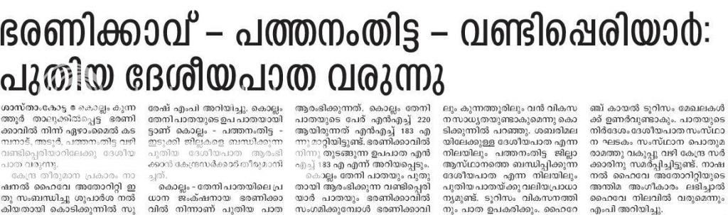
Map of National Highway 183A in red | ||||

National Highway 183A at Adoor
| ||||
| Route information | ||||
| Maintained by Government of India | ||||
| Length | 240.6 km (149.5 mi) | |||
| Major junctions | ||||
| From | Titanium Junction Chavara (Kollam)[1] | |||
| Major intersections |
| |||
| To | Vandiperiyar | |||
| Location | ||||
| Country | India | |||
| State | Kerala | |||
| Districts | Pathanamthitta, Idukki | |||
| Primary destinations | Sasthamkotta, Adoor, Thattayil, Kaipattoor, Pathanamthitta, Vadasserikkera, Plapally, Gavi, Vandiperiyar ,Chengannur | |||
| Highway system | ||||
| State Highways in Kerala | ||||
| ||||
National Highway 183A, also known as NH 183A, is a National Highway in the Indian state of Kerala that runs from Chavara Titanium Junction, Kollam, to Vandiperiyar via Adoor and Pathanamthitta.[2][3] It is the 4th National Highway passing through the Kollam district.
The road was declared a National Highway (NH) on 4 March 2014. It conforms to NH standards for a two-lane traffic highway from Adoor to Plapally. The section past Plapally is only 4 meters wide and passes through forest and wildlife areas. The Forest Department raised concerns over the road's alignment. Once upgraded, a new connection from Vandiperiyar to Sabarimala is planned. Currently the stretch between Angamoozhy Forest Checkpost and Vallakadavu Forest Checkpost is entry restricted and the forest department allows only 30[4] private vehicles per day on the route and vehicles entering through Kochandi Check post has to leave only through Vallakkadavu Check post before 6 pm.[5]
|
Secondary routes of National Highway 83
| ||
|---|---|---|
|
| |
| Secondary routesofNH 83 |
| |


