Jump to content


Main menu


Navigation  


Main page
Contents
Current events
Random article
About Wikipedia
Contact us
Donate


Contribute  


Help
Learn to edit
Community portal
Recent changes
Upload file


Search  


Create account

Log in


Create account
 Log in


Pages for logged out editors learn more  


Contributions
Talk


Contents


(Top)


1 Location  


2 Demographics  


3 Features  


3.1  Natural resources  


3.2  Transportation  


3.3  Ras Al Ein Park  


3.4  Cultural Facilities  


3.5  Friday Market  


4 References  


Ras Al-Ein area


العربية
فارسی
مصرى
 

Edit links


Article
Talk


Read
Edit
View history


Tools


Actions  


Read
Edit
View history


General  


What links here
Related changes
Upload file
Special pages
Permanent link
Page information
Cite this page
Get shortened URL
Download QR code
Wikidata item


Print/export  


Download as PDF
Printable version


Appearance


From Wikipedia, the free encyclopedia
 

(Redirected from Ras al-Ein District)

Ras Al-Ein
Area
CountryJordan
GovernorateAmman
Time zoneGMT +2
 • Summer (DST)+3

Ras al-Ein (Arabic: رأس العين; alternative English spellings Ras Al-Ain, Ras al Ayn, etc.) is one of the 22 administrative sub-districts of the city of Amman, Jordan, as governed by the Greater Amman Municipality.[1][2]

The character of the neighborhood has been summarized as "an eclectic mix of haphazardly connected memories and intentions, somehow combining the grandeur of the Roman Amphitheatre to the bustling local markets and the newly imagined cultural projects and institutions."[3]

Location[edit]

The technical boundaries of the district are: Ali Ben Abi Taleb Street to the north, As-Sakhrah Al-Musharrafah Street to the south, Al-Quds Street to the west and Price Hassan Street to the east. Colloquially, references to the Ras al-Ein neighborhood often indicate a more expansive definition.[3] For example, Ras Al Ein Park is located technically just beyond the sub-district's northeastern boundaries.

Ras al-Ein is a sub-district of the larger Qasabah Amman area, which includes Al-Abdali, Al-Madinah, Al-Yarmuk, Bader, and Zahran.[4]

Demographics[edit]

According to a 2015 general census, the population of Ras al-Ein stands at 138,024 divided into 28,474 households.[5][6]

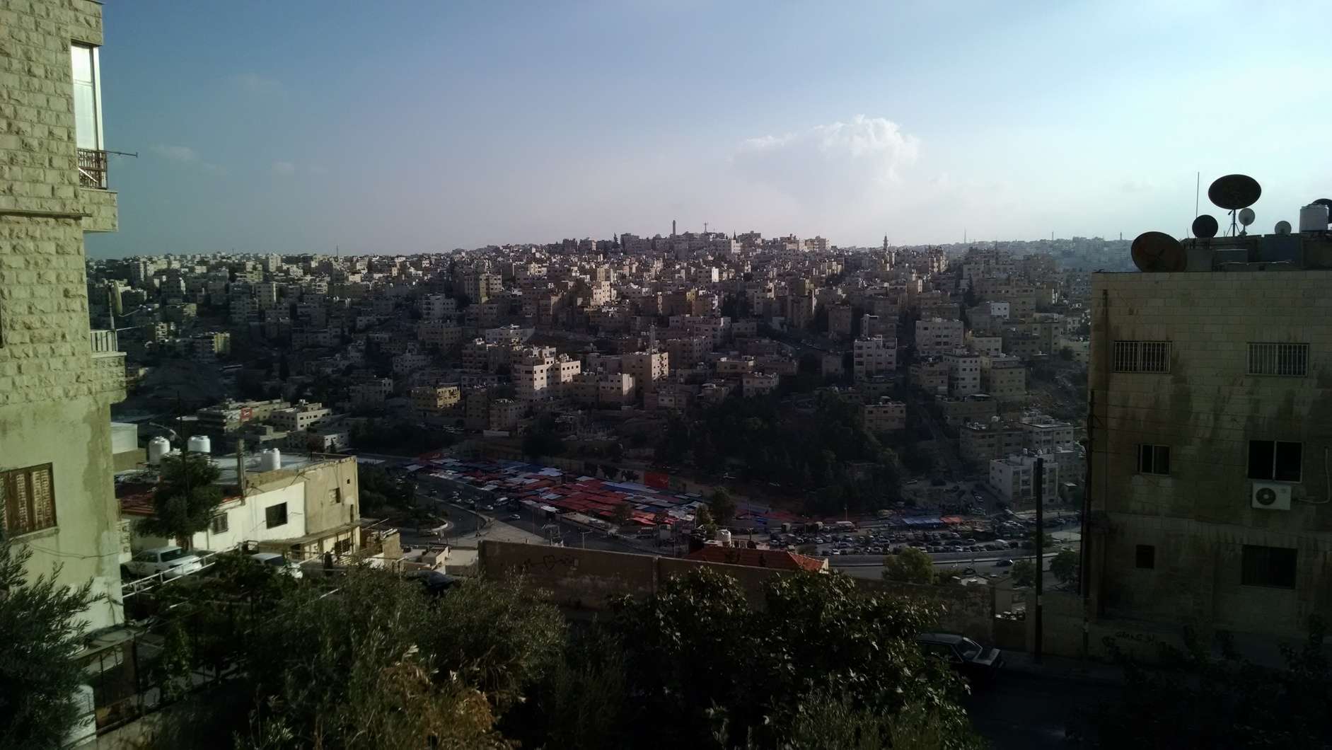
The boundaries of the district cover a relatively small geographic area compared to other districts in Amman—only 6.79 km2. Population density is 20,377/km2.[4]

Features[edit]

A street in Ras Al Ain.

Natural resources[edit]

The area contains a spring that provides a small fraction of Amman's water supply.[7] It was once the location of a running spring.[3] This may be where the area gets its name (similar to Ras Al Ain in Lebanon).

Transportation[edit]

Located near the center of town, Ras Al-Ein is a major transportation corridor.

Amman's South Bus Station is located in this district.[8] The neighborhood is intended for inclusion in the Bus Rapid Transit project, construction for which is ongoing today and will eventually connect Ras Al Ein's northern streets with 5th Circle and Sports City via Princess Basma Street.[9]

An exhibition in the Ras Al Ain Hangar, for Amman Design Week.

Ras Al Ein Park[edit]

The Ras Al Ein Park, located at the northernmost boundary of the area between Ali Ben Abi Taleb and Omar Matar streets, was first opened in February 2017. The park includes two playgrounds, a bicycle track, and pedestrian paths.[10]

Cultural Facilities[edit]

Ras Al Ain has been called by some a "cultural corridor" or "cultural strip."[3] A number of cultural edifices are located in Ras al-Ein, such as the Ras Al Ain Gallery and Hangar, the Jordan Museum, Nakheel Square, and the National Music Conservatory. The Greater Amman Municipality headquarters is also located nearby these, at the northernmost border of the district.

Friday Market[edit]

Amman's Friday Market is an outdoor market primarily selling second-hand clothing and shoes. It first opened in 1988. In 2014 it moved from its previous location in al-Abdali to Ras al Ein, a decision said to be sparked by the city's desire to alleviate congestion in the Abdali neighborhood.[11][12]

References[edit]

  1. ^ "Jordan: Administrative Division, Governorates and Districts". citypopulation.de. Retrieved 25 December 2016.
  • ^ "Atlas of ELECTORAL DISTRICTS" (PDF). UNDP. Retrieved 30 January 2019.
  • ^ a b c d El-Mousa, Amer (26 June 2016). "A Conversation with Ras El-Ain". Amman Design Week. Retrieved 28 Nov 2020.
  • ^ a b "Greater Amman Municipality (Jordan): City Districts - Population Statistics, Charts and Map". www.citypopulation.de. Retrieved 2020-11-28.
  • ^ "Greater Amman Municipality – GAM Interactive". Ammancity.gov.jo. Archived from the original on 9 January 2015. Retrieved 24 November 2013.
  • ^ "Archived copy" (PDF). Archived from the original (PDF) on 5 June 2016. Retrieved 13 May 2016.
  • ^ Darmame, Khadija (2014-06-11), Ababsa, Myriam (ed.), "Amman. The Capital's Monopolization of Water Ressources", Atlas of Jordan : History, Territories and Society, Contemporain publications, Beyrouth: Presses de l’Ifpo, pp. 425–427, ISBN 978-2-35159-438-4, retrieved 2020-11-28
  • ^ "South Bus Station (Google Maps)". South Bus Station. Retrieved 2020-11-28.
  • ^ "Mayor of Amman: "The Bus Rapid Transit" is quite an achievement in the development of public transport in the Capital". Al Bawaba. Retrieved 2020-11-28.
  • ^ "Ras Al Ain park opens to public". Jordan Times. 2017-02-09. Retrieved 2020-11-28.
  • ^ "Abdali Friday market to open in new location on Oct. 9 — GAM". Jordan Times. 2014-09-15. Retrieved 2020-11-28.
  • ^ "View over Ras al-Ain, Amman". Acor Jordan. Retrieved 2020-11-28.

  • Retrieved from "https://en.wikipedia.org/w/index.php?title=Ras_Al-Ein_area&oldid=1177266017"

    Category: 
    Districts of Amman
    Hidden categories: 
    Articles with short description
    Short description is different from Wikidata
    Pages using infobox settlement with no coordinates
    Jordan articles missing geocoordinate data
    All articles needing coordinates
    Articles missing coordinates without coordinates on Wikidata


    This page was last edited on 27 September 2023, at 00:02 (UTC).

    Text is available under the Creative Commons Attribution-ShareAlike License 4.0; additional terms may apply. By using this site, you agree to the Terms of Use and Privacy Policy. Wikipedia® is a registered trademark of the Wikimedia Foundation, Inc., a non-profit organization.


    Privacy policy

    About Wikipedia

    Disclaimers

    Contact Wikipedia

    Code of Conduct

    Developers

    Statistics

    Cookie statement

    Mobile view


    Wikimedia Foundation
    Powered by MediaWiki