Jump to content


Main menu


Navigation  


Main page
Contents
Current events
Random article
About Wikipedia
Contact us
Donate


Contribute  


Help
Learn to edit
Community portal
Recent changes
Upload file


Search  


Create account

Log in


Create account
 Log in


Pages for logged out editors learn more  


Contributions
Talk


Contents


(Top)


1 History  


2 Tourism  


2.1  Local places of interest  


3 Transport  


4 References  


5 External links  


Rathen


Башҡортса
Български
Català
Cebuano
Čeština
Deutsch
Español
Esperanto
Euskara
فارسی
Français
Italiano
Қазақша
Кыргызча
Ladin
Magyar
Македонски
Bahasa Melayu
Nederlands
Нохчийн
Norsk bokmål
Oʻzbekcha / ўзбекча
Polski
Português
Română
Русский
Српски / srpski
Srpskohrvatski / српскохрватски
Svenska
Татарча / tatarça
Українська
Tiếng Vit
Winaray


Edit links


Article
Talk


Read
Edit
View history


Tools


Actions  


Read
Edit
View history


General  


What links here
Related changes
Upload file
Special pages
Permanent link
Page information
Cite this page
Get shortened URL
Download QR code
Wikidata item


Print/export  


Download as PDF
Printable version


In other projects  


Wikimedia Commons
Wikivoyage


Appearance


Coordinates: 50°57N 14°05E / 50.950°N 14.083°E / 50.950; 14.083
 

From Wikipedia, the free encyclopedia


Rathen
Coat of arms of Rathen
Location of Rathen within Sächsische Schweiz-Osterzgebirge district
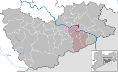
AltenbergBad Gottleuba-BerggießhübelBad SchandauBahretalBannewitzDippoldiswaldeDohmaDohnaDorfhainDürrröhrsdorf-DittersbachFreitalGlashütteGohrischHartmannsdorf-ReichenauHeidenauHermsdorfHohnsteinSebnitzKlingenbergKönigsteinKreischaLiebstadtLohmenMüglitztalNeustadt in SachsenPirnaRabenauRathenRathmannsdorfReinhardtsdorf-SchönaRosenthal-BielatalDippoldiswaldeSebnitzSebnitzStadt WehlenStruppenStolpenTharandtWilsdruffSaxonyCzech RepublicBautzen (district)DresdenMeißen (district)Mittelsachsen
Rathen is located in Germany
Rathen

Rathen

Rathen is located in Saxony
Rathen

Rathen

Coordinates: 50°57′N 14°05′E / 50.950°N 14.083°E / 50.950; 14.083
CountryGermany
StateSaxony
DistrictSächsische Schweiz-Osterzgebirge
Municipal assoc.Königstein/Sächs. Schweiz
Subdivisions2
Government
 • Mayor (2022–29) Roman Rolof[1]
Area
 • Total3.58 km2 (1.38 sq mi)
Elevation
112 m (367 ft)
Population
 (2022-12-31)[2]
 • Total347
 • Density97/km2 (250/sq mi)
Time zoneUTC+01:00 (CET)
 • Summer (DST)UTC+02:00 (CEST)
Postal codes
01824
Dialling codes035024
Vehicle registrationPIR
WebsiteOfficial website
Rathen shortly after the 2006 flood
district Oberrathen - view from Bastei

Rathen is a village in the Elbe Sandstone Mountains, in Saxony, Germany, about 35 kilometres (22 mi) southeast of Dresden. The village occupies both banks of the river Elbe and, as of 2020, has 339 inhabitants. Rathen is a popular tourist destination, the main sights are the Bastei cliffs, the Amselsee (a lake), and the outdoor theater "Felsenbühne Rathen".

History

[edit]

Rathen was founded in the 13th century around 1261 as place for a castle fortress.

During World War II, a subcamp of Flossenbürg concentration camp was located here.[3]

Tourism

[edit]
View of Rathen from the Bastei

The state-recognised climatic spa of Rathen is not only the base for tours in the western part of Saxon Switzerland, but also for the world-famous Bastei rocks. Other popular destinations in the local Amselgrund valley are the lake of Amselsee and the Rathen Open Air Stage. There are a good 400 inhabitants on both sides of the Elbe, linked by the historic Rathen Ferry, which is a protected monument. In addition to the Old Mill of 1567, which was nearly demolished after the hundred year flood, there is a range of other timber-framed houses.

Due to its proximity to the town of Wehlen the following wordplay saying is given to visitors: "Sie können Rathen wählen, ich würde Ihnen auch zu Wehlen raten." ("You can choose Rathen, I would also recommend Wehlen to you.")

Local places of interest

[edit]

Transport

[edit]

The Rathen Ferry, a passenger reaction ferry, connects Niederrathen, on the right bank of the Elbe river, to Oberrathen on the left bank. Kurort Rathen railway station, on the Dresden S-Bahn and the Dresden to Prague railway, is adjacent to the Oberrathen ferry terminal. Rathen is also a stop for the Sächsische Dampfschiffahrt ships, including historic paddle steamers, operating between Dresden and the Czech border.[4][5][6]

Road access to Niederrathen is by means of a road from Bad Schandau, whilst Oberrathen is linked by road to Struppen. There is no direct vehicular connection across the river between the two halves of the village, and the road journey between the two is some 23 kilometres (14 mi) in length.[7]

References

[edit]
  • ^ "Einwohnerzahlen nach Gemeinden als Excel-Arbeitsmappe" (XLS) (in German). Statistisches Landesamt des Freistaates Sachsen. 2024.
  • ^ Christine O'Keefe. Concentration Camps
  • ^ "Informationens about ferries (sic)". Kurort Rathen. Archived from the original on 19 July 2022. Retrieved 18 July 2022.
  • ^ "With train or ship". Kurort Rathen. Archived from the original on 19 July 2022. Retrieved 19 July 2022.
  • ^ Eisenbahnatlas Deutschland [German railway atlas] (in German) (2009/2010 ed.). Schweers + Wall. 2009. ISBN 978-3-89494-139-0.
  • ^ "Kirort Rathen" (Map). Google Maps. Retrieved 19 July 2022.
  • [edit]
    Retrieved from "https://en.wikipedia.org/w/index.php?title=Rathen&oldid=1165799491"

    Categories: 
    Municipalities in Saxony
    Rathen
    Populated places in Saxon Switzerland
    Hidden categories: 
    Pages using gadget WikiMiniAtlas
    CS1 German-language sources (de)
    Articles with short description
    Short description is different from Wikidata
    Coordinates on Wikidata
    Official website different in Wikidata and Wikipedia
    Commons category link is on Wikidata
    Articles with VIAF identifiers
    Articles with GND identifiers
    Articles with MusicBrainz area identifiers


    This page was last edited on 17 July 2023, at 13:46 (UTC).

    Text is available under the Creative Commons Attribution-ShareAlike License 4.0; additional terms may apply. By using this site, you agree to the Terms of Use and Privacy Policy. Wikipedia® is a registered trademark of the Wikimedia Foundation, Inc., a non-profit organization.


    Privacy policy

    About Wikipedia

    Disclaimers

    Contact Wikipedia

    Code of Conduct

    Developers

    Statistics

    Cookie statement

    Mobile view


    Wikimedia Foundation
    Powered by MediaWiki